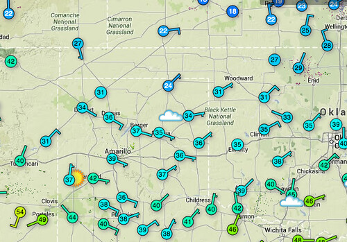
Update (12:05pm): It looks like the warm downsloping winds are eroding away at the cold air in some of the western and southwestern counties.
Original Text (9:35am): Cold air doesn’t play any games. Or rather, perhaps it does? If it does play games, though, it rarely follows any rules. It just makes them up as it goes.
And it often ‘goes’ south.
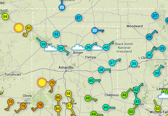
This morning, if you’re waking up across the southern high plains you are probably waking up to fog, freezing fog, or at the very least, freezing (or close to it) temperatures.
The cold air that was slated to be held to the north – by a pretty stiff westerly wind aloft and here at the surface – has oozed into the area. Most places across Kansas, Oklahoma, and Texas are sitting in the 20s and 30s.
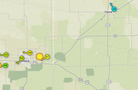
As of this writing, the leading edge of the cold air sits between Friona, Texas and Clovis, New Mexico and on a line southeast toward Abernathy, Texas and then east to Paducah, Texas and then back northeast toward Fredrick, Oklahoma.
As the day progresses the models are unsure about just how far south this cold air remains. Though, if history tells us anything, it will likely only be nudged back north a short distance and that will most likely occur further west in places like Hereford, Texas, Dalhart, Texas and Boise City, Oklahoma.
Though, confidence in that happening is quite low.
With the shallow pool of cold air in place, attention turns to the next area of low pressure, and the associated moisture.
The latest from the computer weather models tends to suggest the southern high plains will begin to see a mix of rain, freezing rain, and sleet as early as Saturday afternoon and early evening. As the cold air deepens, the precip type will transition to snow.
The transition to snow is tough to predict because a “dendritic growth zone” needs to develop. And it needs to do so with no “warm nose” or air below it.
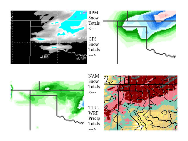
Right now, A fair prediction for snow totals looks to be between 1″ and 3″ across the area with higher amounts northeast where the dendritic growth zone will develop earlier and there won’t be a warm nose or air beneath it. Those totals are echoed by the QPF output from a few of the computer weather models.
This situation will be monitered closely, please check back for updates.


