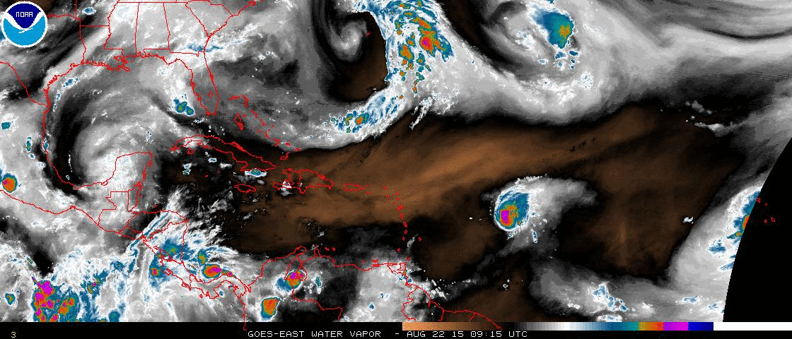
Hurricane Danny continues to weaken out in the open Atlantic. This is all apart of the forecast. Wind shear and dry air are doing a number on the once-Category 3 storm. At the same time another patch of cloud cover may start to get it’s act together farther east.
Latest on Danny
Danny is currently a Category 1 hurricane. Sustained winds estimated at 90mph. Pressure at 984mb.
It is also still quite the tiny hurricane. Latest estimates put hurricane wind speeds out to 10-15 miles from the center. Making it a very compact storm. there have been some rumblings that this may have been the smallest Category 3 hurricane on record.
8/22/15 2PM UPDATE:
2:00 PM AST Sat Aug 22
Location: 15.5°N 52.4°W
Moving: WNW at 12 mph
Min pressure: 985 mb
Max sustained: 85 mph
Here is a look at the official forecast from the National Hurricane Center:
The next mess
East of Danny, and following roughly the same track, is another cluster of storms. If you live in south Mississippi and catch me on TV you likely heard me talking about this the other day.
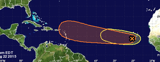
This next batch of storms is looking at a “medium” chance for development in the next five days. Since it is following the same path as Danny, we can assume that things are favorable for short-term development. Most models suggest the same. But that patch of storms may eventually encounter the same dry air and wind shear as Danny.
There is some thought that Danny will “pave the way” for this next cluster of storms to develop, and hold together as it travels west. So far none of the models – that have done so well tracking and forecasting for Danny – have picked up on that scenario yet.
Here is a look at what the Euro suggests for 10 days out, Monday afternoon, August 31st:
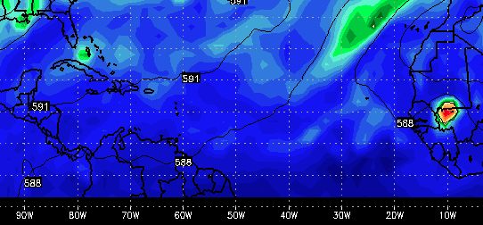
For comparison of “strength” the brighter yellows, oranges, reds and purples would indicate more energy and a stronger system (like the little patch over Africa. The blues, and light greens, indicate less energy and a weaker system.
That little patch of teal off the coast of Florida is what the Euro thinks this next batch of storms will look like on August 31st. Not much there. Some rain, some wind, but no worse than any other Florida storms.
It is something that bears watching, though, and we will keep a very close eye on it.


