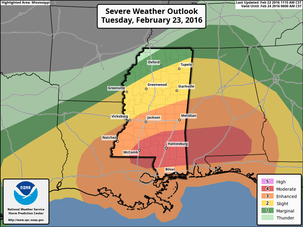
EDITOR’S NOTE: The SPC upgraded sections of the south to a Moderate Risk. Details here!
Good morning, everyone. Just a quick update after the overnight and early morning data was processed.
The Numbers
It looks like there is still a very real threat for severe weather. Here is a look at the Severe Weather Worksheet.
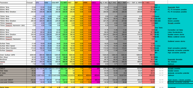
The “Big 4 AVG” is the average of the GFS, NAM, NAM-4KM and SREF. It often does a decent job at cleaning out the riff raff from one bad model run. Also the “Big 5 AVG” includes the previous models and the TTU-WRF run, too. Again, this tends to do a decent job at balancing things out if one model comes in super high or super low.
Right now, both the Big 4 and Big 5 show a SWEAT above 400, Total Totals above 51 and a K-index (different from the Karrie Index) around 33 with a BRN in the teens. All of these are in the window needed for creating severe weather in south Mississippi. Even the Low-Level SWEAT and Low-Level K-Index look favorable.
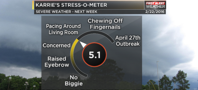
The Karrie Index is at a 5.10 for the Big 4. And a 4.99 for the Big 6.
Notice though, the NAM and GFS are sticking out in each direction. The NAM is at a 7.24 with the GFS at a 3.66. To validate our concern, the Karrie Index can be converted from a one-to-ten scale back to the SPC one-to-five scale, you get 2.55 or a 2.49. That is between a Slight Risk and Enhanced Risk. Right now, the area is officially under an Enhanced Risk, so it appears our concern is valid.
The Timeline
Still looks like an afternoon through overnight event as of now. Perhaps late evening being the peak. Storms will begin between 2pm and 4pm. Storms will linger through midnight.
The RPM model usually handles reflectivity pretty well. Here is a look at what it thinks the radar will look like at 8pm, 10pm and midnight.
That is the best we can do for now. More information on timing will be available as we get closer.
The Bottom Line
Have a severe weather plan. Know how you are going to get warnings from the National Weather Service. Make sure your NOAA Weather Radio is functioning and programmed correctly. If you choose to use an app for alerts, download a second app, too, for redundancy. Also know where you will go if a tornado warning is issued for your area. Fo you have a safe place to shelter? Can you get underground? All things you need to think about now, rather than during the event.


