Alright, it looks like a video breakdown won’t be in the cards today, so a written summation will have to suffice.
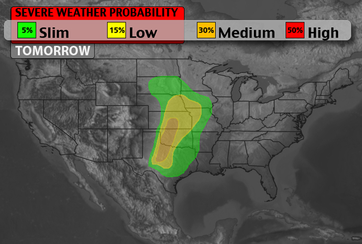
As I covered earlier, there is the threat for severe weather across sections of Texas, Oklahoma, and Kansas Saturday. If you are watching the skies closely and trying to decided to play a round of golf or have that afternoon barbecue, hopefully this will help you come to a decision.
Location
Sections of the Midwest and South Plains will be fair game for severe weather development.
Timing & Concerns
Storm initiation will occur along or close to the dryline in eastern sections of the Texas panhandle, western Oklahoma and south central Kansas around 6pm after sufficient daytime heating can overcome a cap of warm air aloft.
Right now, some models have the first storms initiating south of Childress and Vernon, Texas. These first storms will develop and push northeast quickly. Other storms will develop along the dryline to the north as the hours continue.
The biggest concern is whether or not there will be ‘umph’ for storms to overcome the cap of warm air aloft. The models are split right now. Some say yes others say no. I tend to lean toward yes given a few different factors.
The 12z NAM shows the cap isn’t that strong everywhere across the area. In late April, all a parcel of air needs is a weakness in the cap to get things started. Beyond that, CAPE Values will be at or above 2,ooo J/kg so once parcels start going – they’ll be cruisin’!
Also, it is late April. Climatologically speaking, this is the time of year for severe weather in the area.
Lastly, surface dewpoints will be around 60F. That is plenty of juice for afternoon thunderstorms.
That said, it’ll be close. Either way. If the cap holds, temperatures will glide into the 80s and 90s, dewpoints will climb into the 60s and it will feel like the atmosphere is going to pop – but it won’t. It has happened before. It will happen again.
By the late evening and overnight hours, though, the storms that didn’t have a chance to erupt during the day will begin to fire across the same area. Increased lift and better dynamics for storm initiation will commence.
Severe Weather Threats
The main threat for afternoon thunderstorms will be damaging winds in excess of 60 mph and hail stones in excess of two inches. As afternoon turns to evening and the atmosphere moistens up closer to the ground, the chance for a short-lived tornado isn’t out of the question. Although, right now, the threat for long-track, EF2 or greater tornadoes isn’t elevated.
After dark, the main threats will be high wind and hail – though both will be lower than the storms during the afternoon.
In a Nutshell
This time around changing plans shouldn’t be necessary, but having a plan if severe weather strikes is. Keep those barbecue briquettes handy, and make sure your 5-iron is feeling good.
Just also make sure you have an weather app that offers severe weather alerts on your phone and a NOAA Weather Radio handy.


