Meteorologist are combing through the newest forecast data every six hours, while the latest cluster of storms plowing across the Atlantic Ocean continues to try to organize.
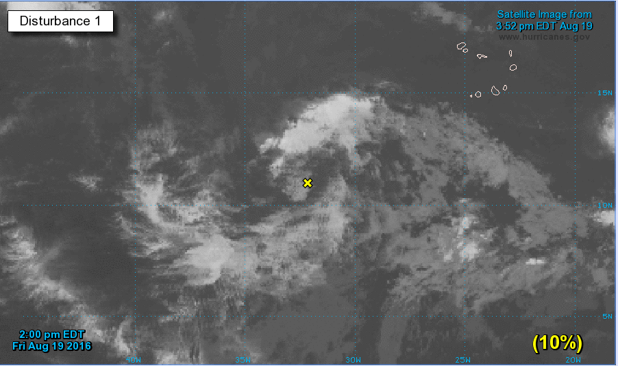
Right now, the National Hurricane Center gives Invest 99-L a 10-percent chance of development during the next 48 hours and a 40-percent chance of development during the next five days. This may seem counter-intuitive, but the longer it takes to develop, the worse it might be.
The NHC issued this statement at 2 p.m. eastern today:
“A tropical wave located about 600 miles southwest of the Cabo Verde Islands is producing a disorganized area of cloudiness and shower activity. Development, if any, during the next couple of days should be slow to occur as the system encounters a dry and stable air mass. After that time, environmental conditions are expected to become more conducive for development, and a tropical depression could form early next week while the system moves westward at about 15 mph across the tropical Atlantic Ocean.”
This year, the Saharan dust has played a big role in suppressing the strength and development of systems as they move across the Atlantic. But, lately, the dust has slowed.
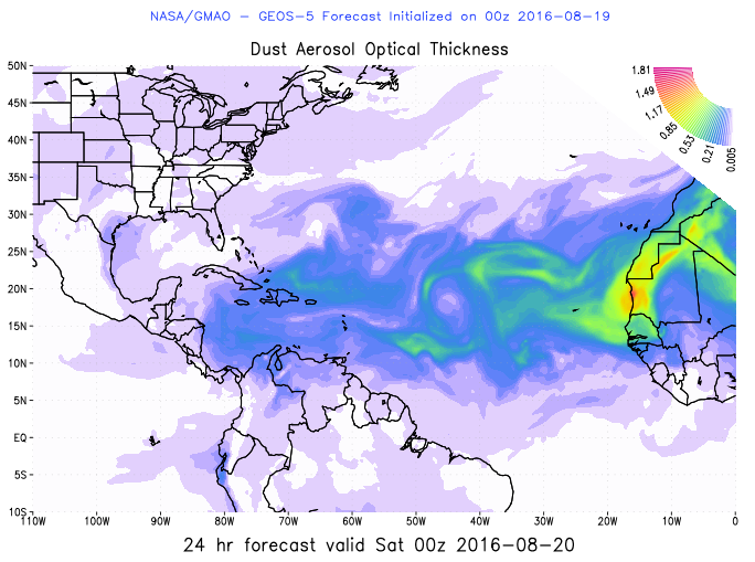
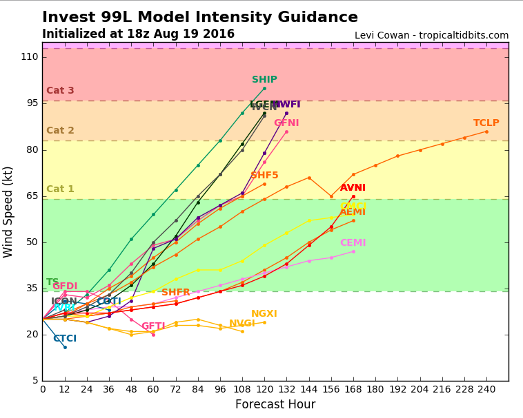
So, things are opening up a bit more to allow development to occur. And right now, most of the models indicate the storm will intensify and organize through the next 48 hours. A handful of models show the Invest strengthening into a low-grade Tropical Storm. Levi Cowan’s Tropical Tidbits page shows a great illustration of this:
If the Invest is to develop into a Tropical Storm, it would be named Gaston (Find more info on the last storm named Gaston, here).
Understanding that forecasting specifics on storms strength is not necessarily reliable, the general trend of a strengthening system is something that is giving meteorologists something to watch carefully.
But, why is it worse for the storm to take longer to develop?
It is all about the mid-level and upper-level winds. Where they are going. And how strong they are.
Tropical Storm Fiona developed quickly and got caught up in the mid-level and upper-level steering flow winds. Those winds pulled more north than west. That means it should remain out to sea.
Often, the more disorganized a storm remains, the less likely it is to be caught up in the mid-level and upper-level steering flow winds. Think of it like a kite. The bigger the kite, the more likely it is to be influence by the wind above you. If it is small, it might have a tough time getting caught up in the wind.
Tropical systems are the same way. The bigger the storm, the more of the wind it can get caught up in. And right now, that mid-level and upper-level steering flow is pulling storms (that are big enough) back north.
So, if this storm continues to remain disorganized as an Invest through the next 48 hours, it may slide far enough west to get into an area where it won’t be as influenced by that ‘pull’ to the north.
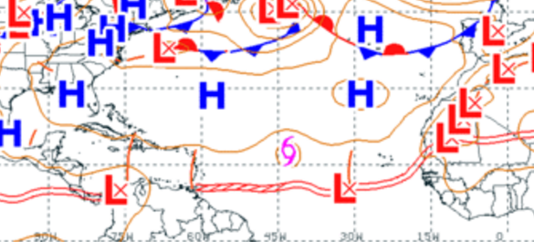
And that is the current trend shown by the models.
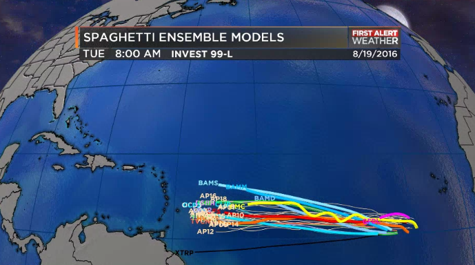
Notice that nearly every single model keeps Invest 99-L moving – mainly – west toward the Greater and Lesser Antilles. Beyond that, things get a little more inconsistent. So Invest 99-L will need to be monitored closely next week by folks living along the Gulf Coast, in the Southeast and along the East Coast, too.


