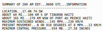
 The latest on Hurricane Matthew as of this posting is in from the National Hurricane Center.
This is still a very powerful Category Four storm with winds at 145mph and a central pressure of 934mb.
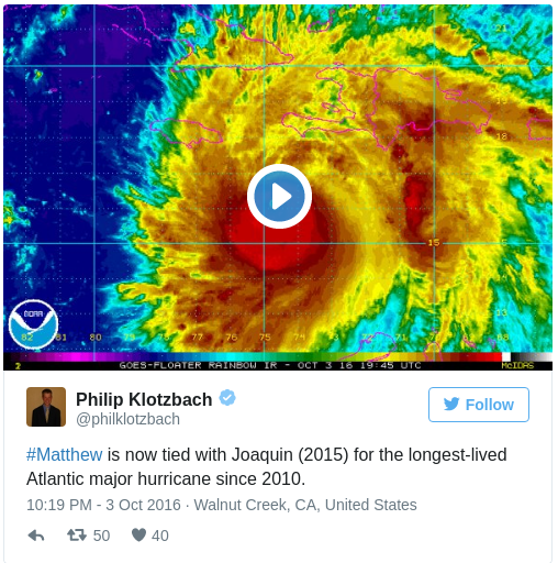
Looking to set the new record for longest “major” hurricane since 2010, Hurricane Matthew is set to pass Hurricane Joaquin if it keeps chugging along as a Category Three or higher.
As noted by Philip Klotzbach first…
Where is it going?
Matthew, though, records aside is set to cause catastrophic damage to Haiti, Jamaica and Cuba. And eventually the Bahamas.
Haiti is in a particular bad situation with a majority of the people there living in poverty. Some living in tin homes or shacks. Some only feet away from the ocean. And most of the people there with no where to go. And no means to travel even if they could leave.
The coming 36 hours will be a very deadly time for Haiti. And sadly, that is not a dramatization.
As the storm continues north, Cuba and then the Bahamas will be next in the path. The countries will likely see storm surge, strong wind and plenty of rain. But the overall scope of peril should be generally lower.
Eventually, Matthew may threaten the United States.
When does it get there
I could write out a timeline, but a picture is worth 1,000 words.

The image above should automatically update, but as of this writing, the storm is projected to move north across Haiti during the day on Tuesday, move across Cuba Tuesday night and into Wednesday morning, then across the Bahamas on Wednesday and Thursday.
All the while, maintaining Category Three – or higher – status.
How strong will it be when it hits my house?
Depends on where you live. The National Hurricane Center produces this great graphic showing the percent-chance of experiencing Tropical Storm force winds during the next five days (through Saturday at 8PM)
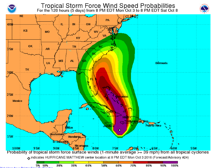
The best bet to see hurricane force winds will be in Haiti and Cuba during the next 36 hours. The Bahamas after that.
Then between Thursday AM and Saturday PM from Miami, Florida up the coast to Jacksonville to Savannah, Georgia. Continuing to Cape Hatteras all have a chance of seeing – at least – tropical storm force wind.
Is there any good news?
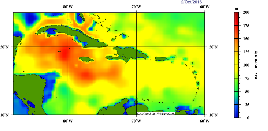
Sort of. As Matthew drifts north it will eventually encounter waters that are not as warm below the surface. Given the slow movement of the storm, there is a chance that it rains itself out of being a major hurricane and is only a Category Two.
But even still, a Category Two storm is not one to mess with.
Notice in the graphic the deeper red colors are where Matthew is now and where it has been during the last 48 hours during the period of identification
As it moves north of Cuba it will work over waters where the 26 degree isotherm isn’t running as deep. That means, intensification may not be as easy to come by.
But, the good news is only ‘sort of’ good news because farther north between the islands of the Bahamas, notice the isotherm does run a bit deeper.
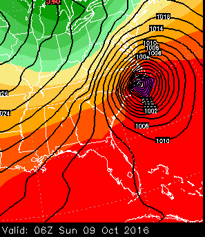
The models show that it is going to hit my house seven days from now! What about me? You didn’t mention me!
I know folks in the Northeast are worried. You guys have been through a lot in the last few years with hurricanes and tropical storms that climb the ladder north. I have friends and family – a lot of them – who live up there.
I know this is hard, but try to not look out past about five or six days when it comes to tropical systems. Often times the models aren’t the best at forecasting track beyond that point. And they are really limited when trying to forecast intensity. I try not to look past about 48 hours for intensity.
Try not to get too hung up on what one model might suggest. Or what another model might show.
Models are forecast guidance, not Gospel. In fact, I rarely see – if ever – a forecast model get it right with 100-percent accuracy on a storm track more than 24 hours out. And even then, it’s close, but not perfect.
At 120 hours (five days) out? good, but not great. Beyond that? Sometimes good, rarely ever great.
The best forecast you are going to get is from a meteorologist trained to read the models for what they are, guidance. That meteorologist will interpret more than just the storms track kicked out by one model. Instead the meteorologist will look at 500mb geopotential heights, 200mb winds, 830mb winds, water vapor imagery, sea-surface height anomalies, and a host of other parameters to make a forecast.
That is why the National Hurricane Center folks are so good. Be wary of those who post one picture of a model as a forecast.


