(NOTE: THIS POST WILL BE CONTINUALLY UPDATED FOR THE NEXT FEW HOURS WITH NEW DATA AS IT IS AVAILABLE)
12:33a CST UPDATE: Mesoscale Analysis details
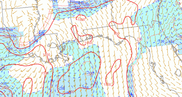
Latest model data shows a nose of Mixed-Layer CAPE values around 1000 J/Kg around 4am for the SE counties of MS and SW of Alabama
11:52 CST UPDATE: Mesoscale Analysis details
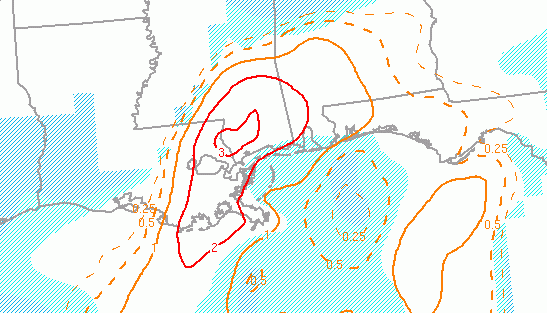
The latest details from the SPC’s Mesoscale Analysis page show a tornadic environment developing across south Mississippi by 3am.
More details to come…
UPDATE: A TORNADO WATCH HAS BEEN ISSUED
The SPC is concerned about more than just a few tornadoes, too. The Tornado Watch includes the threat for 10 – or more – severe wind events (58mph or stronger) and hail bigger than quarters.
This Tornado Watch is in effect until 7am.
The latest model trends from the HRRR model suggest that the warm front may life a bit farther north than originally anticipated, leading to storms to ride a little farther north, too.
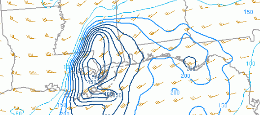
Here is a look at the 3hr updraft helicity values from Pivotal Weather.
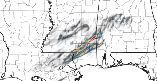
If this happens, the risk for the stronger, EF-2 or greater, tornadoes may lift north with it.

The latest from the Storm Prediction Center is out. The latest Mesoscale Discussion is for Louisiana and southern Mississippi.
From the SPC:
SUMMARY…Threat for a few tornadoes, damaging wind and large hail
will gradually expand east into southeast LA and southern MS through
the early morning hours. A tornado watch will be issued by around
05Z.DISCUSSION…Late this evening a warm front extends from near the
Gulf Coast through southern LA. This boundary will move slowly north
through the early morning as the low-level jet strengthens in
response to a northeastward-ejecting shortwave trough. Northward
advection of richer low-level moisture and eastward expansion of
elevated mixed layer plume will destabilize the atmosphere
downstream from storms currently developing from southwest through
south-central LA. The destabilization process, increasing low-level
hodograph size and strong effective bulk shear will promote
supercells and bowing segments as storms continue east. Greatest
tornado threat may be as storms interact with warm front. Otherwise,
large hail and damaging wind will also be likely.
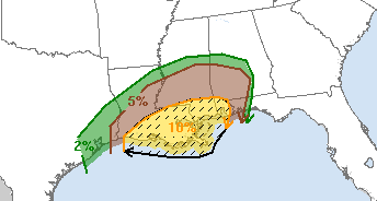
Right now, the SPC and local NWS offices are most concerned that the strongest tornadoes will be in areas south of Highway 98 in Louisiana, Mississippi and Alabama.


