I’m really not great at eye-catching titles. Like, to the guy who wrote that Irma was going to be a “Category 6” storm: You suck. My examples of “MAJOR HURRICANE EYES GULF STATE” and “CATEGORY FIVE STORM EXPECTED IN NEW ORLEANS” or “ERMIGHERD!! ITS KERMIN THIS WEYR!!!” were child’s play compared to your load a horse manure.
If you haven’t seen it yet, here is the cleaned up version of it.
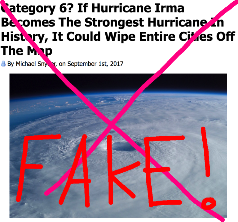
Instead of hype, sensationalism or – as shown above – flat lies, here is an objective look – in plain English – at the storm and what you need to know about it. Because we are all on pins and needles after Harvey, the last thing we need is hyperbole. So here is a #nofilter look at everything Irma. Borrowing a line from former United States Secretary of Defense Donald Rumsfeld, we are going to look at the known knowns. The known unknowns. And the unknown unknowns.
Known knowns
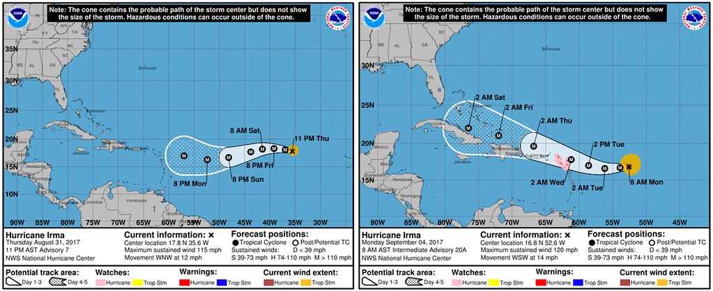
The National Hurricane Center is pretty good. And they are doing a great job forecasting this storm. For comparison, here is the forecast from August 31st vs. where the storm is, and the forecast from today.
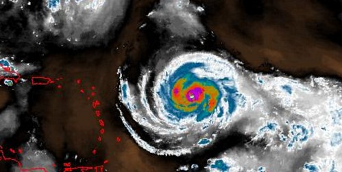
Hurricane Irma is located at 16.8N, 52.6W or roughly 600 miles east of the Leeward Islands. It is a Category 3 storm with wind speeds up to 120mph. It is moving WSW at 14mph with a central pressure of 947mb. And, according to information gathered by the Hurricane Hunters this morning, it is getting stronger.
Dropsonde into #Irma‘s eye measured a pressure of 946mb with an 18kt surface wind, so perhaps ~944-945mb. Still falling. Irma strengthening. pic.twitter.com/3zeUUGbQ7H
— Levi Cowan (@TropicalTidbits) September 4, 2017
Here is the latest forecast from the National Hurricane Center:
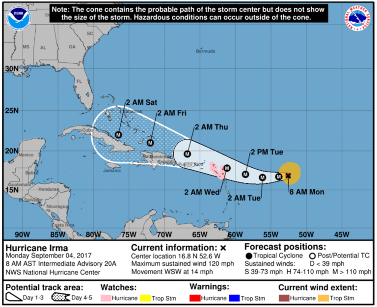
The strongest wind is still pretty compact. That said, hurricane-force winds extend outward up to 30 miles from the center, and tropical-storm-force winds extend outward up to 140 miles. So while the strongest wind may be only within a handful of miles to the center, the tropical-storm force wind field may be as large as Hurricane Harvey’s.
This storm has gone through repeated eye wall replacement cycles. This isn’t a good or a bad thing, necessarily. It just is. An open eye wall can make it tougher for the storm to continuously strengthen. But, a lack of a cohesive eye wall doesn’t keep it from strengthening, either. In fact, the National Hurricane Center says:
All environmental factors suggest that Irma will at least maintain its intensity for the entire 5-day forecast period, if not strengthen gradually. Oceanic heat content values increase along Irma’s forecast path, mid-level moisture will be more abundant, and vertical shear appears to be generally low. As a result, the NHC intensity forecast continues to call for gradual intensification through at least 72 hours, with a possibility for some slight weakening by days 4 and 5 (but still as a major hurricane).
he sea surface temperatures are warm in the open Atlantic. Currently temps are sitting in the Top 3 warmest during last 20 years trailing only 1998 and 2005. The atmospheric environment ahead of the storm is sufficient for sustaining or the continued strengthening of Irma.
Known unknowns
We know that we don’t know what is going to happen with Irma beyond five days (as of this writing, that would be beyond Friday, September 8th). That goes for the forecast track, the intensity of the storm, and who will be affected. We know that we don’t know because there are some big factors that go into Irma’s path that we can’t know yet and the models have struggled to figure out:
1. Placement of ridge of High Pressure in the Atlantic
2. Strength of ridge of High Pressure in the Atlantic
3. Placement of the trough in the eastern 2/3 of the US
4. Influence of Typhoon Sanvu on the jet stream
Because of that, there are still, hundreds of possibilities.
While ANYTHING is still possible, latest models trend westward. Most show abrupt right turn, but where key to impacts to east coast. #scwx pic.twitter.com/ATSIlaPMKF
— Ed Piotrowski (@EdPiotrowski) September 4, 2017
#HurricaneIrma #SpaghettiPlot Most models have Irma impacting FL this wknd, then pushing NE, AWAY from Texas. pic.twitter.com/mjFCOjmjAf
— Allison Miller (@AllisonMillerTV) September 4, 2017
There are other differences between the American (GFS) and European (ECMWF) models. And then differences between those and the shorter-term models like the HWRK, HMON and TABS, TABM, TABD models. Some have struggled with outcomes, too. When the models show things that aren’t probable, it becomes more difficult to predict further into the future.
Furthermore, the Hurricane Hunters started taking readings and collecting data during the last few days. That added data is helping those above-mentioned models create better forecasts. What those better forecasts look like are also something that we know that we don’t know.
Unknown unknowns
Because it is the atmosphere, there are going to be things that are going to happen that we cannot foresee at this time. That is why it is important to be prepared for all possible outcomes. Live along the East Coast? Or along the Gulf Coast? Check your Hurricane Preparedness Kit. Don’t have one? Buy one! Here is a great link for that. There is no need to do much else yet. Check your plan, make sure your kit is ready to go and wait for the meteorological world to figure out what will happen with Irma.
Being prepared today means when it is time to act, you’ll be ready to go!
In a nutshell
We know it is going in a westerly direction. We know it is moving toward the United States. But we are still trying to figure out is where Irma will turn north. And when it does turn, does it turn out to sea or into the USA? And, if it does turn into the USA, where it will be when it does? What we do know is that it is too far out to tell for certain. Anyone who suggests otherwise, is lying.


