Tropical Depression 16 forecast track

NHC official forecast track for TD 16

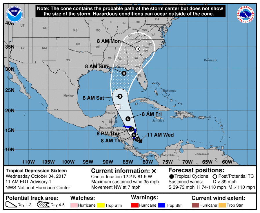
Now that we have a localized center, the models can start to really get a handle on where Tropical Depression 16 – and eventually Nate – will go.

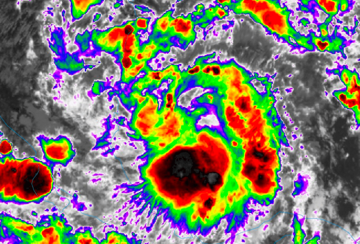
Here is a look at the storm on Infrared Satellite.

GOES-16 Infrared Imagery // Courtesy: College of DuPage Meteorology

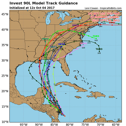
The 12z model guidance shows the storm moving north toward the Gulf of Mexico in the coming days.

Forecast spaghetti model tracks // Courtesy: Tropical Tidbits


Author of the article:


Nick Lilja

Nick is former television meteorologist with stints in Amarillo and Hattiesburg. During his time in Hattiesburg, he was also an adjunct professor at the University of Southern Mississippi. He is a graduate of both Oregon State and Syracuse University that now calls Houston home. Now that he is retired from TV, he maintains this blog in his spare time.