There is the threat for thunderstorms this evening for South Mississippi, but – in general – the severity of the storms will be quite limited.
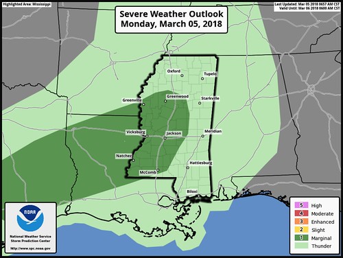
The main risk area will be west of the area.
The Breakdown
Storms will develop to the west and swing through South Mississippi between 8pm and 4am.
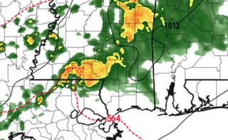
Some of these storms will be supercells that will be falling apart. Look for heavy rain, frequent lightning, gusty wind, and small hail. The tornado threat is quite low, but not zero.
The SPC spelled it out best, saying: “Effective bulk shear averaging 40 kt will be sufficient for organized storms including supercells with predominantly mid-level rotation, posing a risk for severe wind gusts and large hail. The tendency for veering low-level flow ahead of the cold front will result in generally weak low-level shear which should temper any tornado potential. Thunderstorm intensity will diminish into the late evening hours as instability wanes in the presence of nocturnal cooling.”
As the storms begin to fall apart, they will still be capable of producing heavy rain, gusty wind and small hail. But the severity of the rain, wind and hail, should be limited across the area to below-severe-limits.
What could change
A few things…
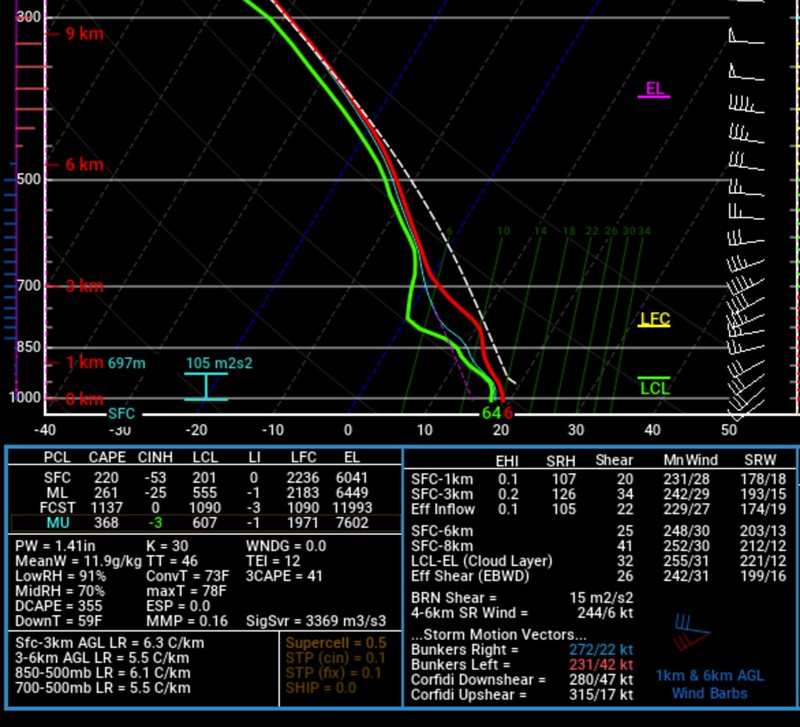
1. We’ll have to see where / if / how much the low-level jet comes into play tonight. So far, I haven’t sen much to indicated it will be pumping the atmosphere full of extra energy.
2. For South Mississippi, there is plenty of sunshine this morning helping temperatures climb quickly. The morning drizzle passed through and cleared out quickly. This may play with the amount of afternoon storms that develop (we weren’t, and still don’t anticipate any). If we can get enough instability, there may be enough energy to break the cap.
3. Storms are going to be oriented in a different way than they usually are for this area. They will be traveling west to east, and at times even west-northwest to east-southeast. Historically this has increase our hail threat, even in non-severe storms.


