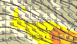
During a few of the forecast write-ups I’ve touched on the “cap of warm air aloft” as something that hinders thunderstorm development. But what is it? How did it get there? How does it stop thunderstorms from forming?
Well, it’s very cool stuff. There are a few – quite common – ways for a “cap” to inhibit thunderstorm development. The most common across the plains is what meteorologists call “horizontal warm air advection.”
In other words, a warm breeze.
The weather in the northern hemisphere moves – generally – from west to east. Because of the proximity to the Rocky Mountains the plains can get “capped” easier than other places.

Think about Pikes Peak in Colorado in the late spring. At 14,000-feet it might get up to 65 degrees with a dewpoint of 15. Warm and dry. Well, that warm air will be continuously pushed away by the Jet Stream. As warm air is pushed away – from west to east – from the Rockies it glides over the plains at the same altitude.
Suppose the waind was blowing from northwest to southeast that day.
Now, in Oklahoma City, at 65 degrees, even if surface CAPE values are high, the warm air cannot rise, cool and condense, because the air isn’t warmer than the air at 14,000ft. In fact, because of thermodynamics, once that air does rise to 14,000ft its cooler than 65 degrees and won’t be able to rise any further.
That leads to the next reason we see a “cap of warm air” aloft. Sinking air.

Sinking air is stable. Very stable. A stable air mass is one where warm air is above cold air. Just like in the previous example. This situation usually occurs when high pressure is in the area. High pressure is – generally speaking – sinking air. That is why the air “pressure” is “high” because it is exuding a higher force of pressure on that area.
Another way to “cap” an atmosphere is to cool down the surface of the earth. That way it will be like the previous two examples: Cooler below, warmer above.
The easiest way to do that is to get rid of the sun. Overnight hours can create a “cap” of warm air aloft by cooling the air at the surface. Heat is transferred to the surface by the sun’s energy, while the upper-levels of the atmosphere transfer heat by wind. So overnight the upper-levels stay warmer, while the surface cools down.

