Last week at this time Amarillo was preparing for another round of snowflakes. Then thunderstorms. Now, Amarillo is waiting for thunderstorms and looking down the road at another bout with snow chances. It’s left a lot of people asking, “Is it November, again?”
Summary
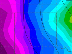
Amarillo faces thunderstorm possibilities under a weak ridge of high pressure ahead of a “cut-off low” set to move through the area. A few weak disturbances will move through between Thursday and Sunday before Tuesday the cut-off low finally strolls through te high plains.
Behind that cut-off low a chance for rain turning to a rain/snow mix and eventually – gulp – all snow is possible.
Quick Breakdown
The first round of showers and storms will arrive Thursday afternoon and will be quite isolated. Right now, it looks like a less than 10-percent chance that any one spot gets a shower or storm.
Low-level moisture will be limited as well and most of the rain will be falling as virga (rain that evaporates before it hits the ground). This may be a repeat performance of a few weeks back when storms moved through Amarillo and dropped .02″ of rain.
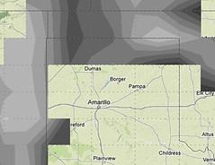
The next rounds will fire Friday afternoon. The dryline will set up between Keyes, Oklahoma and Bovina, Texas. Thunderstorm development will initiate along the dryline – and push east and southeast.
Some of these storms will have a chance to be strong or marginally severe because of the elevated dewpoint levels, CAPE values and projected bulk shear. The main threats will be high wind and hail. A tornado can’t be ruled out, but the chances are incredibly minimal.
Saturday is the toss-up. If storms develop on Friday the chances of another round firing on Saturday is markedly lower. Also, as it looks right now, the necessary atmospheric dynamics won’t be quite as robust Saturday. But the chance is there for another round of storms to fire along outflow boundaries and another weak front pushing through.
Sunday things calm down – mostly. There is still an outside shot for a storm in some of the eastern counties of the Texas panhandle. Monday, another front pushes through, and brings a shot of cold air.
Temperatures will nose dive through the day. Indications right now are for the 60s and 70s to turn to the 30s by late afternoon and evening.
The chance for storms turns to a chance for cold rain, a rain/snow mix and eventually snow. Latest computer weather models suggest light snow falling across the high plains by Tuesday night and into Wednesday morning.


