Well, that was odd. Sometimes, it takes an odd weather phenomena to break an equally “odd” weather pattern (read: drought). The normal pattern for storms to take is from southwest to northeast.
That didn’t happen this week. Instead, this week, we watched an area of low pressure sag from northeast to southwest.
Originally we were thinking that a few areas across the high plains could see as much as five to seven inches of slow soaking rain.
Things didn’t end up being <emthat goodl. But, so what it wasn’t perfect? It wasn’t four days of full-out soaking rain across the Texas and Oklahoma panhandles, sure, but it was three-and-a-half days of intermittent rain.
And between one, two and five inches of rain.
Okay, so a few spots made out pretty well in the past 92 hours. But now it’s all over.
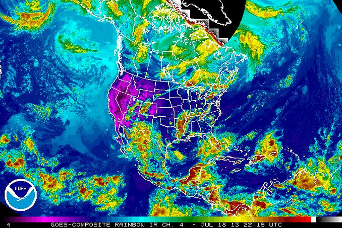
Yes, sadly right now, the storm that brought the high plains all of the beneficial rain continues to sag to the southwest. Eventually it will fall apart and a normal July pattern will resume.
That means July heat, sunny conditions and slim chances for rain.
But before we get back to the heat, let’s take a few minutes and reflect on the last few days.
Temperatures:
This weather sure has been cool! Literally! Afternoon high temperatures this week have been well below average. In fact, Amarillo set daily low-max temperatures on July 15th (75 degrees) and July 16th (72 degrees). Amarillo even set a record low temperature on July 16th (58 degrees), too. It wasn’t until July 17th that Amarillo started to slowly get back to average.
Climate data:
Date – H / L
July 15th – 75/56
July 16th – 72/58
July 17th – 79/64
If you take a three-day average of those temperatures (75 and 59) it looks more like early May than the middle of July.
Precipitation
This is what everyone really cares about – precip. While the high plains has been starved for rain the past few (okay, more than just a few) years, this storm didn’t bring as much rain as originally advertised, but it was still welcomed rain.
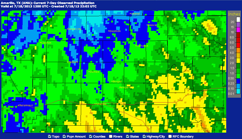
7/11/13 – 7/18/13
Most places across the high plains picked up between one-half of an inch and two inches of rain. Most of the rain falling south of Interstate 40. In fact, the most rain fell just to the west of Interstate 27 between Happy and Plainview.
The official total in Amarillo was 1.12 inches of rain through Wednesday night. That said, many weather stations in and around the city picked up between 1.20 and 2.25 inches of rain.
While the rain is great for sub-soil moisture levels it also does wonders for the soil temperatures.
Drought Impact
This is what everyone cares about. How much did all of this rain help the drought.
Unfortunately, I have bad news: Not much. In fact the high plains is in such a prolonged drought that even if places like Amarillo, Guymon and Dalhart received rain like down in Abilene (where up to 10 inches fell), it only put a dent in the drought.
Despite all of the rain, Lake Meredith is still at 26.54 feet deep. To the south, the Mackenzie Lake is still only at 54 feet deep.
In fact, the high plains would need a system like this to roll through every five to six days for about the next three-to-six months to get back on the right track.
That said, it was really nice to see the rain across the area and here’s hoping that with an ENSO-Neutral setup, the chances for rain will be at or above normal.


