Well, not really. But it’s not like The Weather Channel has anything else to talk about, right? And frankly, neither do we.
For the most part the Lower 48 is quite docile weatherwise. There is the risk of strong storms in the Northeast. It’s still hot across the Midwest. And temperatures are rising across the Pacific Northwest.
But, not much else is happening.
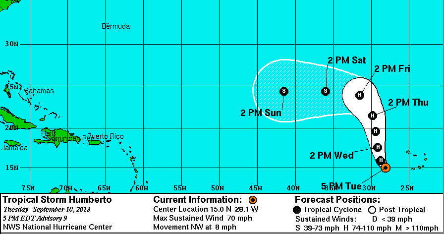
So all eyes turn to Tropical Storm Humberto. Spinning off the coast of Africa. Roughly 3,600 miles from Miami. And at 10 to 15mph, it is still at least 10 days away from the United States.
If it even comes close.
The latest on Humberto:
5PM EST Advisory:
Location: 15.0 N 28.1 W
Winds: 70 mph
Movement: NW 8 mph
The National Hurricane Center projects the storm will achieve hurricane status by tomorrow. That would mean there will be two named storms in the tropical Atlantic. Not uncommon, but it might feel more uncommon given the particularly quiet summer.
How active can it get? On September 25, 1998, there were four hurricanes at once. Georges, Ivan, Jeanne and Karl hung around until September 27th as hurricanes. But that’s not the most “active” time. In 1971, from September 10th to the 12th there were five named tropical systems. Edith, Fern, Ginger, Heidi and Irene were all spinning around in the Atlantic as either hurricanes or tropical storms.

The first four storms, Edith, Fern, Ginger and Heidi all eventually made landfall in the United States. Irene missed the US, striking Nicaragua.
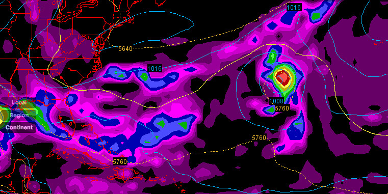
Of the five, Ginger was the most unique storm – as noted by the storm track on the left.
It is the second-longest lived named storm on record. It cruised around – in loops at times – in the Atlantic for over 27 days before finally falling apart!
Beyond that it was the final hurricane that was cloud-seeded by Project Stormfury.
Per Wikipedia:
While over the western Atlantic Ocean, Ginger became the last target of Project Stormfury, which sought to weaken hurricanes by depositing silver iodide into tropical cyclone rainbands. The plane dropped silver iodide into the center of Ginger, although there was no effect due to Ginger’s large eye and diffuse nature; Ginger was the last seeding done by the project
Speaking of unique hurricanes. Humberto might sound familiar to some storm geeks. During the 1995 hurricane season, then-soon-to-be-Hurricane Humberto spun-up in close proximity to then-soon-to-be-Hurricane Iris. Some thought the two storms might merge, known as the Fujiwhara Effect, but they didn’t. Instead, Iris eventually merged with Tropical Storm Karen.
But, back to the Humberto of today. During the next 72 hours, models suggest the northerly track will continue. After that point, a more westerly track will begin. It will be interesting to see what the models do with the storm after the next 120 hours.
Right now, the latest GFS shows it weakening slightly as it moves west before strengthening again as it turns back to the north and eventually the northeast.


