A Severe Thunderstorm watch is likely across the northeastern United States.
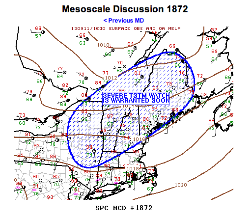 According to the National Weather Service Storm Prediction Center, the cumulus field is deepening over higher terrain of upstate New York where surface temperatures have warmed into the upper 80s.
Destabilization will continue over the next few hours leading to the potential for severe thunderstorms from Albany, New York northeast to Portland, Maine.
Per the Discussion:
Cu field will likely continue to expand as boundary layer heats over the next few hours. Temperatures downstream across vt/nh are quite warm with readings now approaching 90f…Roughly convective temperature based on early morning soundings. Rapid warming/destabilization is expected across the remainder of nrn new england prior to tstm development.
Over the last hour or so mid level convection has gradually deepened across sern qb along the st. Lawrence valley and lightning is now observed with deeper updrafts roughly 70mi north of the vt border. This activity is moving quickly east in excess of 40kt and should spread into extreme nrn me over the next few hours.
Gradual intensification is likely during the next few hours with the main threats being damaging winds. This area is also under a 5-percent tornado risk.


