After a relatively dry spring and summer, winter has started early. For most of the state of Oregon it has been a very wet September. In fact, the wettest ever.
Recap
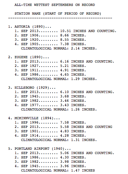
And after the latest storm moved through, most of the Pacific Northwest is looking at the record books – and adding a new Number One. A rare major september storm system brought heavy rain and strong winds. It was a double-decker system. The first brought rain and wind, the second – a remnant of Typhoon Paduk – brought more rain and more wind. In all, more than three inches of rain fell across almost everywhere west of the Cascades.
As of now, the streets and streams are starting to drain and – slowly – things are returning to “normal” as far as Pacific Northwest weather is concerned. Today, most of Oregon can expect intermittent rain showers, perhaps a peek of sun and temperatures in the 50s and 60s.
That’s good for the crews set out to clean up after the rain and wind combined for power outages, down trees and flooded neighborhoods.
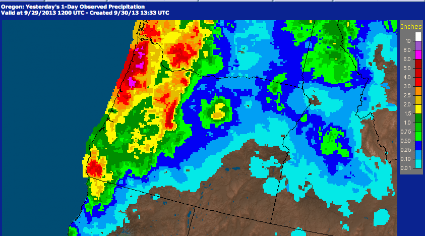
Visually Speaking
Take a look at the seven-day satellite radar estimates from the National Weather Service. The pink indicates over eight inches of rain in sections of the Oregon coast range!