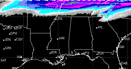
Due to the lack of cooling through the column and a very high (about 15,000 feet) dendritic growth zone, snow still doesn’t look likely across the Gulf Coast. But the latest model data is coming back showing a shallow layer of cold air pushing south that may promote the development of sleet and freezing rain as far south as a line from Monroe, Louisiana and Andalusa, Alabama.
But first, there could be a few strong thunderstorms to handle.
Before the cold, comes the rain
Now that more of the shorter-range computer weather models have been able to sample the next storm system, there seems to be more agreement as to how things will play out.
As it looks right now…
The first wave of moisture will push across the south on Monday mid-day with a few elevated thunderstorms. The term “elevated” means that storms won’t be dependent on surface heating and likely will remain below severe limits. Usually “elevated” storms have heavy rains, gusty winds, thunder and lightning.
The 0z rendering of the RPM computer model suggests a stout line of thunderstorms, but again, other parameters show this to a line of stronger, but mainly non-severe, storms.
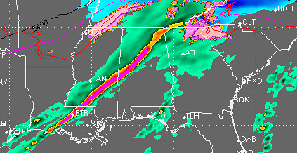
If a storm does turn severe it will likely be due to strong winds in excess of 58mph.
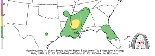
Our good friends at CIPS Analogs show a slight chance for a severe storm based on the top 8 analogs with about 25-percent of the top 15 analogs showing at least one severe weather report.
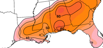
This first wave will also have a lot of rain. Estimates from the computer weather models suggest between .5″ and 2.5″ of rain from central Louisiana to central Alabama. The highest totals will be closer to the coast or in areas where the storms train over the same spots.
Again, the CIPS shows, historically, that this type of scenario creates a good soaking rain.
So be prepared to use the umbrella on Monday.
You’re getting coooolder
The second wave will move through late Monday and into Tuesday early morning. This will be mainly across the extreme southern sections of the Gulf Coast.
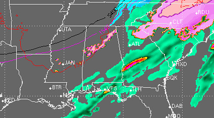
The second wave will be lighter precipitation. Most of this will fall as the air cools close to the front and we squeeze the rest of the available moisture out of the air. The RPM reflectivity doesn’t capture all of the precipitation, I expect the light precip to be a littl emore widespread.
At this point temperatures could be close to the freezing mark in some the spots on the northern edge of the precipitation. It is in these areas that there is the best chance for things like freezing rain or sleet to occur.
Take a look at the Monday afternoon Skew-T chart in Hattiesburg:
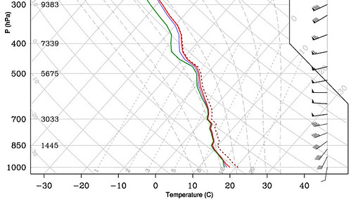
Notice that the lines (red, green and blue) are all very close together and that the slant from top left to bottom right. From this you can tell a couple things.
At this point the atmosphere is saturated and the area is above freezing up to about 700mb (9,000 feet). And the dendritic growth zone – the place where you can build snowflakes – starts at roughly 550mb (16,000 feet).
So, Monday afternoon any snow that is being built is being melted. And stays melted all the way to the surface.
By early Tuesday morning, that may change.
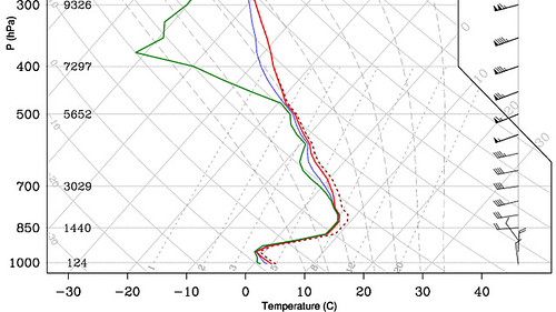
Here we see the same basic setup from 850mb (4,500 feet) up, but instead, below that there is a sharp change in temperature. The air cools to below the freezing mark about 1,000 feet above the ground.
This could mean that snowflakes are built, melt, then a few refreeze before making it to the surface.
The only time mom won’t get mad you’re looking at models
Looking at a bunch of the 21z and 0z data the chance for frozen precipitation isn’t overly impressive.
Take a look at some SREF Plume weather models for a few cities in Louisiana, Mississippi and Alabama. Each line represents the percent chance you see a certain kind of precipitation. The green line is rain, the blue line is snow, the pink line is sleet, the red line is freezing rain.
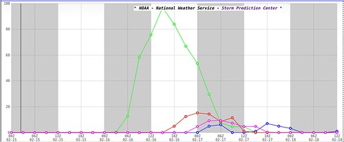
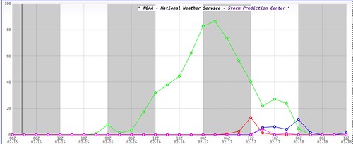
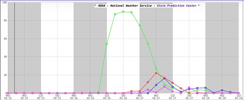
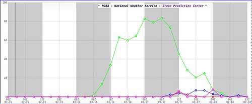
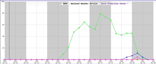
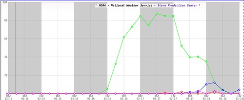
In a nutshell, it doesn’t look good for the snow lovers. According to this 21z SREF computer weather model, Jackson, Mississippi is looking at the best chance for snow and it is less than 20 percent.
For a look at the afternoon high temperatures for each city for each day, click here
And the SREF is much nicer than the RPM. Look at the suggested accumulated snow totals through the next 72 hours from the 0z RPM:
It doesn’t even show snow in Louisiana, Mississippi or Alabama.
And that seems to be the continuing trend. By the time cold enough air settles in across the area to get the snow that is up in the clouds, all the way down the surface, most of the precipitation will be gone.
Nick, dude, tl;dr – just gimmie a quick recap
Generally speaking there will be a line of storms that moves through Louisiana, Mississippi, and Alabama on Monday. Some storms could be strong, but very few – if any – look to be severe.
The storms will begin in Louisiana around noon, move into Mississippi around 3pm and fizzle out in Alabama around 8pm.
Behind those storms, some cold air looks to move into the area. But as it does so, the available precipitation will be leaving. This leaves a short window for the opportunity to see any kind of wintry weather across the region.
If you want to see anything wintry you’re best bet is now looking like late Monday night through mid-morning Tuesday or Tuesday night. But, given the available data, the chances are looking mighty slim. And any wintry precipitation that falls will be very light and shouldn’t cause any kind of problems.
Kids should expect to go to school and parents should anticipate going to work. Sorry.
For an extra look at the forecast graphics used to create this forecast, click here


