A shelf cloud is the leading edge of a gust front on a line of storms. It often has a lower area where the clouds cover very close to the ground, then a smoother region in the middle, then higher up, it looks like regular clouds you’d see any time of year.

The image above, taken a few years ago, is what we weather nerds call “the mothership.”
What is really happening, is a bunch of rain-cooled air in the distance is forcing a bunch of warm humid air closer to me, in the car, to surge upward very quickly. it gets to a point in the atmosphere where the temperature matches the dewpoint temperature and BAM! you start to squeeze out clouds.

The image above is from a typical summertime thunderstorm. And can spawn also have hanging clouds that almost look like tornadoes, but they aren’t. They may even appear to spin a bit, too! But don’t worry, they aren’t spinning in the right place for it to be worrisome.
That isn’t the only place you see shelf clouds, though.
Shelf clouds can also form from supercell thunderstorms. A supercell thunderstorm rotates counter-clockwise. The pancake-looking clouds you see are made by the very strong – and warm – winds flying into, and around, the storm. As they wrap around the leading edge, the gives the clouds a knuckle or pancake shape.
Here’s how it works…
In a thunderstorm, warm moist air is being lifted up, cooled and condensed into clouds. Eventually that cloud starts to precipitate. The rain that falls at the surface is cooler than the air around it.
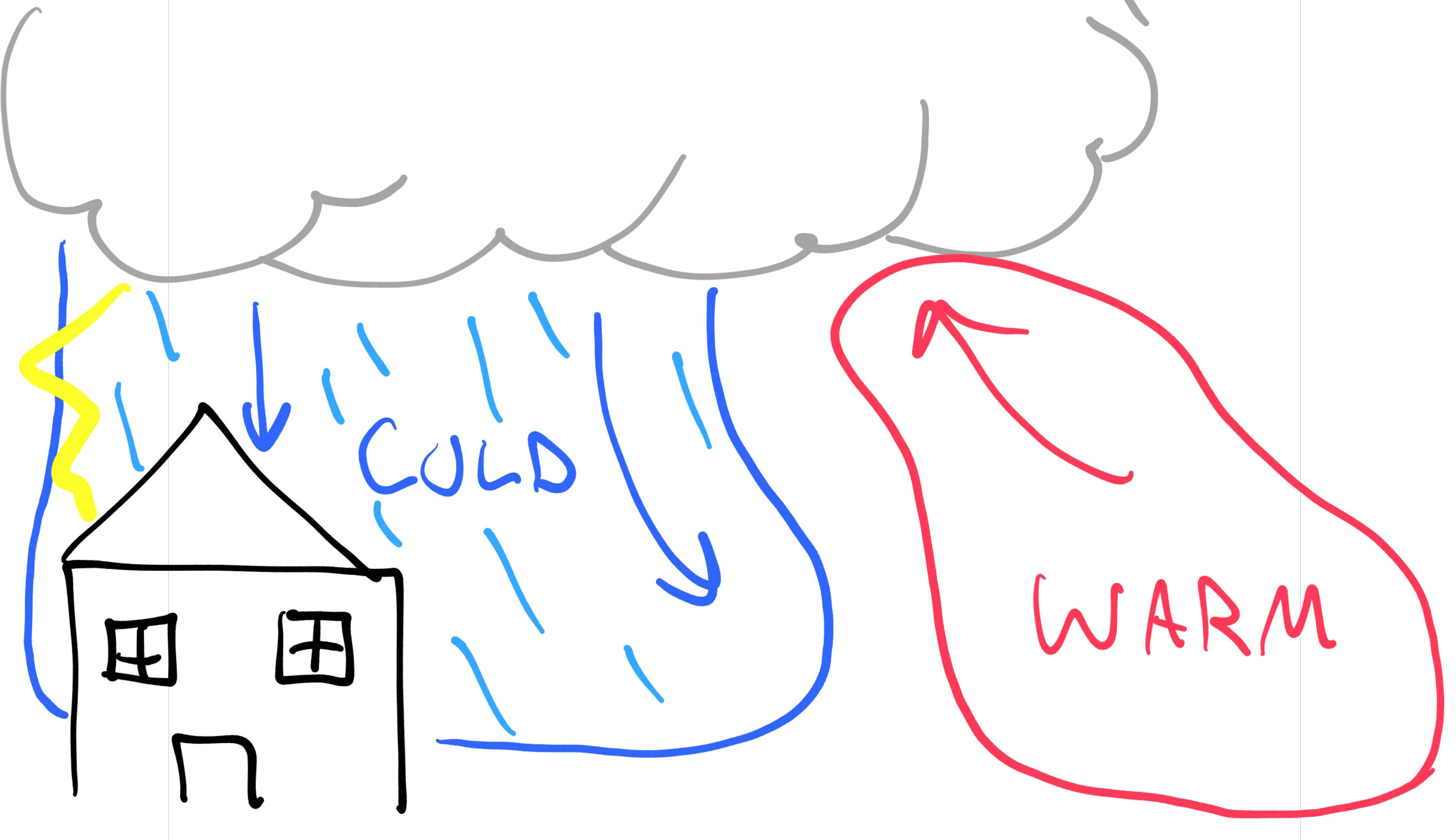
Since the air is cooler, and falling pretty quickly it hits the ground and starts to take off in every direction. Eventually undercutting the warm air that is being lifted into the storm.
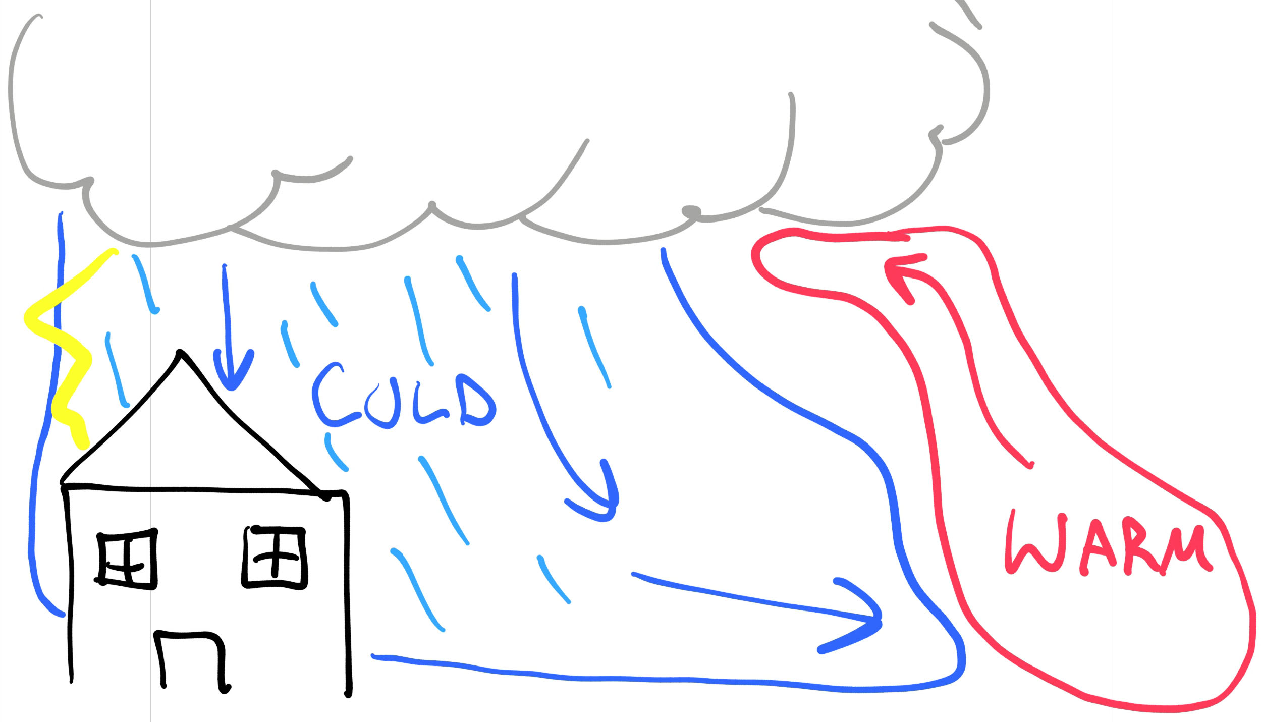
In the summer, due to the lack of winds aloft, when this happens it often kills the thunderstorm because it cuts off the warm moist air that is being sucked into the storm. In the fall, winter and spring, though, this isn’t often the case.
Instead, the warm air is lifted into the storm, while simultaneously it is swooped around the side of the storm by stronger winds aloft.
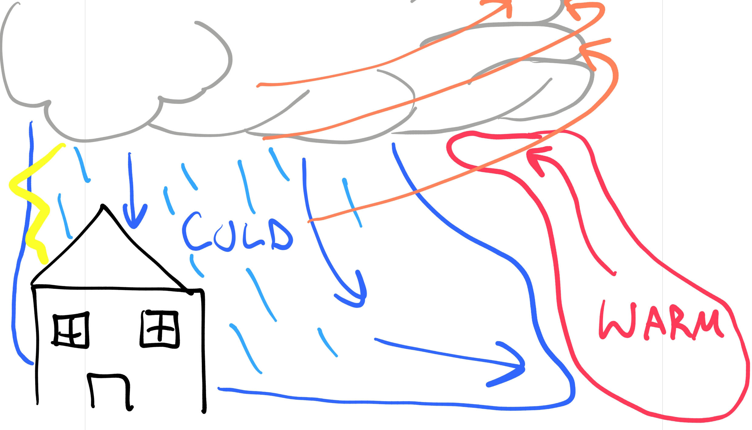
The swooping and the lifting are what gives the shelf cloud the very ominous look. Here is a great video (that I didn’t shoot) of a storm I was chasing with Chris Martin back in 2013. It was a beautiful storm with amazing structure.
There are often some pretty strong winds and/or heavy rain associated with storms like this. As well as the possibility of large hail and tornadoes.
But, man, they are gorgeous!


