South Mississippi Forecast Page
Hey guys, Nick Lilja here! Welcome to your new one-stop spot for South Mississippi weather data. This page will house the latest forecasts, radar data, SPC and NHC outlooks and more!
No need to download an app and clog your phone! Just bookmark this page and add it to your homescreen (for more info on how to do that, click here)!
Recent Forecasts
- New Changes to SPC Severe Weather Outlooks – 3/5/26
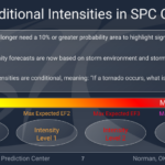 Hey everyone! As we head into severe weather season, I wanted to update you all on the new severe outlooks from the SPC, which include cleaner graphics and some changes to how storm intensity is…
Read more of New Changes to SPC Severe Weather Outlooks – 3/5/26
- Severe Thunderstorm Potential on Saturday: Southern MS/AL/LA Local Weather Forecast – 3/5/26
 Severe Outlooks Ahead It seems like each time there’s a severe weather event, it occurs on the weekend. Don’t feel left out, the same thing happens in Jersey, it only snows on the weekend! Just…
 - Warm Mid-Week Followed by Soggy Weekend – Weekend Forecast for South MS/LA/AL 3/4/26
 The good news is that the air quality has improved over the past couple of days! There still are some that may be affected by the current conditions, though. The next few days are going…
Read more of Warm Mid-Week Followed by Soggy Weekend – Weekend Forecast for South MS/LA/AL 3/4/26
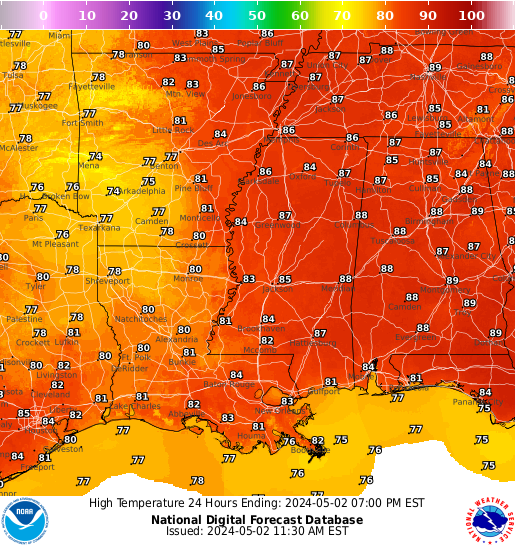
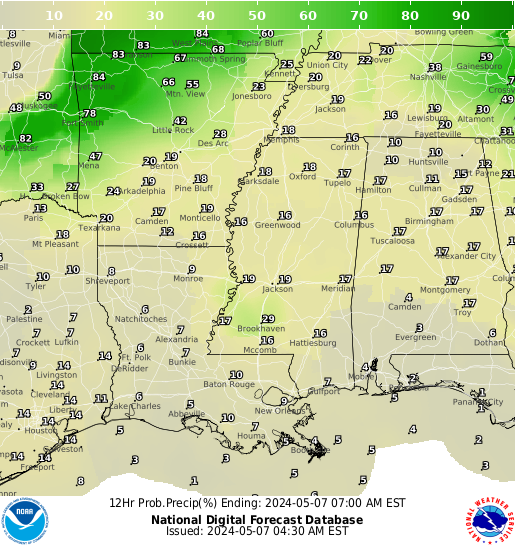
Regional Forecast Graphics
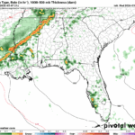
Local NWS Forecast Discussion
Here is a look at the local forecast from the local NWS:
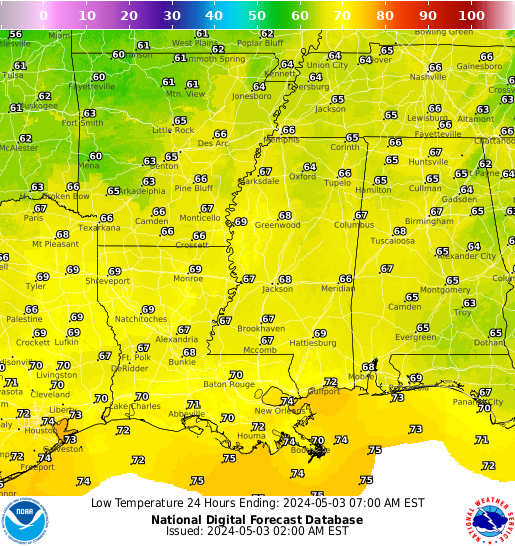
Interactive Radar
Here is a look at the local radar:
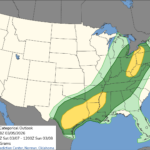
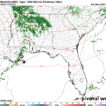
Storm Prediction Center Outlook


SPC Discussion:
National Hurricane Center Forecast

NHC Tropical Atlantic Discussion:
NHC Full Tropics Discussion:
Recent Tropical Weather Forecast Breakdowns
- Gusty Winds to Exit, Mixed Signals on Weekend Rain – Weekend Forecast for South MS/LA/AL 10/29/25
 It’s been a cool and blustery day out there with a strong cold front moving through much of Mississippi. Clouds still remained keeping conditions colder than usual and they will eventually move out by tomorrow. The low for tonight will fall into the upper 40s with windy conditions. By tomorrow afternoon, the clouds will move…
 - Severe weather in Louisiana this evening; Gusty winds throughout the region: Southern MS/AL/LA Local Weather Forecast – 10/28/25
 Overall Setup We’re watching the potential for some severe weather across central and western Louisiana this evening into tonight as a line of storms pushes through the region. A fast moving upper-level trough will dive south, helping to strengthen a surface low with a cold front extending southward from it. This setup will trigger a…
 - Rain Tomorrow Evening, Then a Crisp Halloween Night – Weekly Outlook for South MS/LA/AL 10/27/25
 Morning clouds finally gave way to some sunny skies later in the afternoon for a good ending to a more damp day after all the rain on Sunday. Highs reached the mid 70s today with north winds. This Halloween week will be a lot more fall-like with rain and cooler temperatures ahead. Let’s take a…

