- Dry Conditions Remain, Maybe, Just Maybe Rain by Next Weekend – Weekly Outlook for South MS/LA/AL 10/23/26
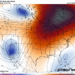 Similar to the late southern summer pattern we all know and loathe, we’re stuck in a dry pattern that budges for no one. Eventually, it will have to make way for incoming weather, and we’re almost there. For now, we’re stuck with dry and warmer than average weather for this time of year. It’s not very different from what…
 - Much of the Same For Now: Southern MS/AL/LA Local Weather Forecast – 10/22/26
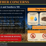 Current Conditions Most of the country is quiet this afternoon, though the Southwest is dealing with showers and storms, some of which have been severe. Here in the NickelBlock region, the dry stretch continues with a clear radar and temperatures in the mid to upper 70s around noon. Fire danger remains a concern, with a Special Weather Statement in…
Read more of Much of the Same For Now: Southern MS/AL/LA Local Weather Forecast – 10/22/26
- Warmer, More Fall-Like Weather For the Rest of the Week – Weekend Forecast for South MS/LA/AL 10/21/26
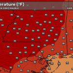 It’s been another beautiful day today with highs just reaching 80! The wind has been fairly light, but otherwise, it feels like Fall! It’ll continue to be that way for several days as well. Let’s take a look at the rest of our week! Today We’ve had a few upper level clouds in the sky today, but otherwise, clear…
 - Cool Mornings & Dry Warming Afternoons: Southern MS/AL/LA Local Weather Forecast – 10/20/26
 Current Conditions It’s a sunny, fall-like afternoon across the region, with dry air making it feel pretty comfortable outside. High pressure is keeping things quiet, with little cloud cover and no rain to worry about. A nice day to spend some time outdoors! The Setup High pressure is sticking around, so there’s still no rain in sight for the…
 - October’s Dry Spell Persists, Warm Weather Ahead – Week Ahead Forecast for South MS/LA/AL 10/19/26
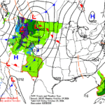 As we’re further into the Halloween season, we are in the self-fulfilling prophecy of dry October. Typically, this is the driest month of the year as the mid-latitudes begin to ramp up again and Gulf moisture is more dependent on incoming fronts. For now, we’re stuck in a dry pattern due to a large upper ridge that isn’t budging…
NickelBlock Forecasting uses the same tools and data as much larger organizations while tailoring the meteorological information to the specific needs of the most important person - You.

