Just like most of the summer has been and will continue to be, it has been pretty hot in the eastern half of the country thanks to a high-pressure system planted in the northeast. Along with the current heat, there are more severe weather threats expected to pop up through the end of the week. On top of all the craziness happening, the newly named Tropical Storm Alberto has been bashing Texas with rain and causing some flooding concerns. Lets jump into it!
EASTERN HEAT CONTINUES WELL INTO NEXT WEEK:
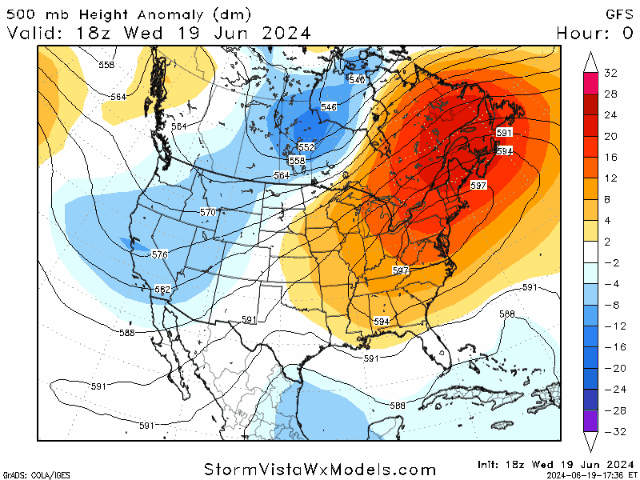
There is a ridge settled in the northeast US that is causing the lack of rain and high temperatures for the eastern half of the country. This high-pressure system is expected to stay put over the next week, which will keep the heat round for much longer.

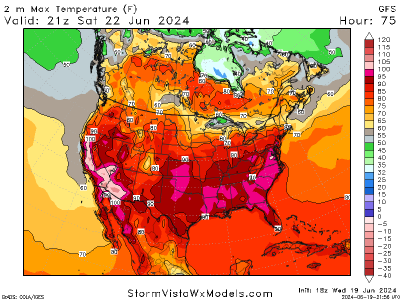
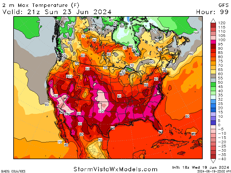
Temperatures are expected to stay in the 90s, with some areas getting above the 100s mark. Several records are expected to be broken across the region as we continue on into summer. While the southeast is accustomed to this kind of heat, the Mid-Atlantic/Northeast regions will face the worst of this heatwave. Take precautions to stay safe and healthy as we navigate the heat.
SPC SEVERE WEATHER OUTLOOK:
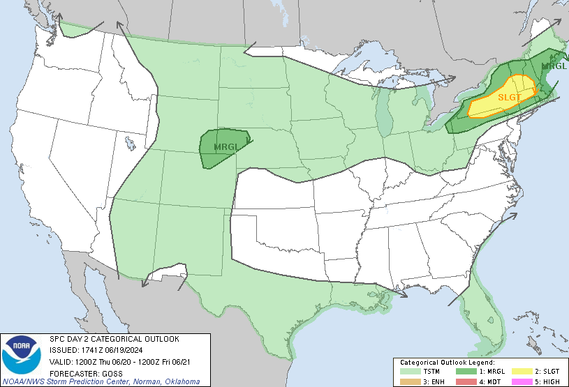
There is a slight risk (2 of 5) for severe weather in the northeast for tomorrow with a marginal risk (1 of 5) for part of the high central plains.
For the northeast, there is a cold front moving to the southeast across the region that is initiating storm development as temperatures rise in the afternoon. Scattered strong storms could bring damaging wind gusts and possibly hail. The risk for severe weather will lessen after sunset as temperatures cool down.
For the high central plains, a weak low-pressure system is expected to form and produce storms as temperatures increase. These isolated severe storms could bring strong wind gusts and some hail. As the evening progresses, storms may move eastward into Nebraska, but they are expected to weaken overnight.
TROPICAL IMPACTS:
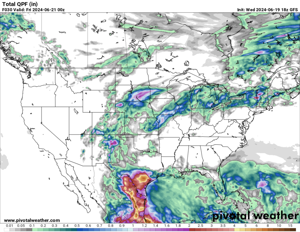
While Tropical Storm Alberto was not considered a ‘major’ tropical system, it did bring plenty of rain to Mexico and the southern Texas region. There have been tornado watches and warning issued, but the main concern will be the potential for flash flooding with the total rain amount.
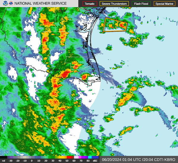
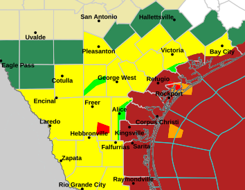
The image above depicts the hazards in place for the southern tip of Texas. The yellow means tornado watch, dark green means flood watch, dark red means tropical storm warning, and the bright red and green indicate tornado and flood warnings respectively. With all the hazards in place for the area, exercise caution and stay weather aware as Alberto passes through tonight!


