Last night we had a pretty stout system swing through the Pacific Northwest that produced wind gusts up to 60mph at times (not from thunderstorms, just the regular wind), and knocked down trees and power lines. WE had decent sized branch land on our roof from a very tall pine tree. Thankfully no visible damage.
That was just a piece of a much larger system that will be swinging across the Rockies and down into the southeast this weekend.
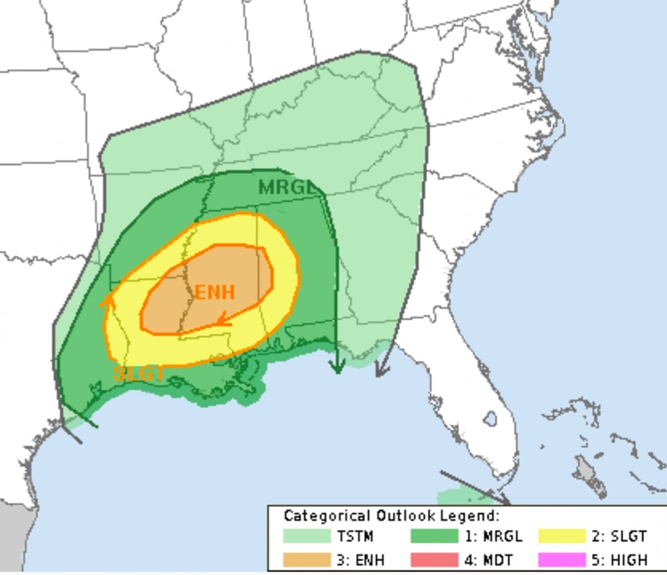
It looks like we will have another risk for severe weather as we move through the day on Saturday, into the evening and through parts of the overnight hours. The Storm Prediction Center has highlighted parts of the area with an Enhanced Risk for severe weather, a “3” on the 1-to-5 scale where “5” is the highest risk for the most significant severe weather.


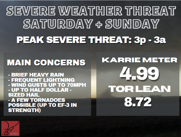
The Karrie Meter shows a 4.99 which on the 1-to-10 scale puts it in the same “ballpark” as the SPC risk. The “TOR LEAN” which gives an indication if tornadoes are more likely or less likely for a particular setup given historical parameter space shows an 8.72. The value of the “TOR LEAN” category is always relative to the Karrie Meter value. So, in this case, as it is much higher, it suggests tornadoes are more likely in this particular setup than would normally be expected.
As shown in the graphic, the timeline is pretty wide as of now — with a window from 3p through 3a. I think that window will get smaller as we get closer, but not much. I tend to think this may be a longer duration event. Not that tornadoes will be on the ground for hours on end, but rather the window for potential storm development may simply be longer.
A COUPLE NOTES
— Everyone sees some wind. I know this isn’t a “sexy” threat and most people tend to overlook it, but I think in this case, as the line of storms kicks through… everyone gets at least a few wind gusts up to 45mph at some point.
Sustained wind will be between 10 and 20mph ahead of the line of storms and within other isolated storms ahead of the line, we may see wind gusts up to 50mph at times and up to 70mph at other times. But not everyone will see that.
But everyone will see the line. And the line will have – at least – a few gusts of 45mph for everyone.
— The “sexy” threat that gets everyone’s attention is the tornado threat. For good reason. Tornadoes are incredibly destructive at times. And very, very dangerous.
Currently, I’ve got “up to EF3” for the top-end for tornadoes given the parameters shown on the model guidance and local history. But I think there is a chance that that changes during the next 24 hours and we may see a brief window for “up to EF4” tornadoes possible – especially closer to I-20 and northward.
We still need to wait and see how the short-term model guidance handles things once it starts to show projections tomorrow, but for now, I’ll hang with “up to EF3” for now.
— I will try to post a county-by-county forecast tomorrow as I think the timeline will change as you move from one point to another and I also think that certain areas are at a higher risk for tornadoes than other areas. But the specifics like that have to wait until we get our hands on some of the shorter-range data.

