Well, it looks to be yet another hot week for our area thanks to a high pressure system dominating most of the nation through the weekend. Rain chances will start to increase towards the start of next week with the ridge starting to shift eastward, making way for the trough in the west to settle and bring in moisture from the Gulf.
TEMPERATURES RISE THROUGH THE WEEKEND:
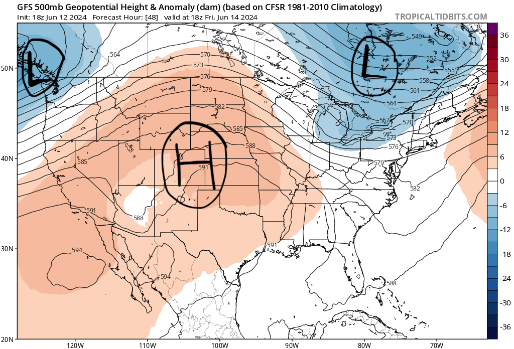
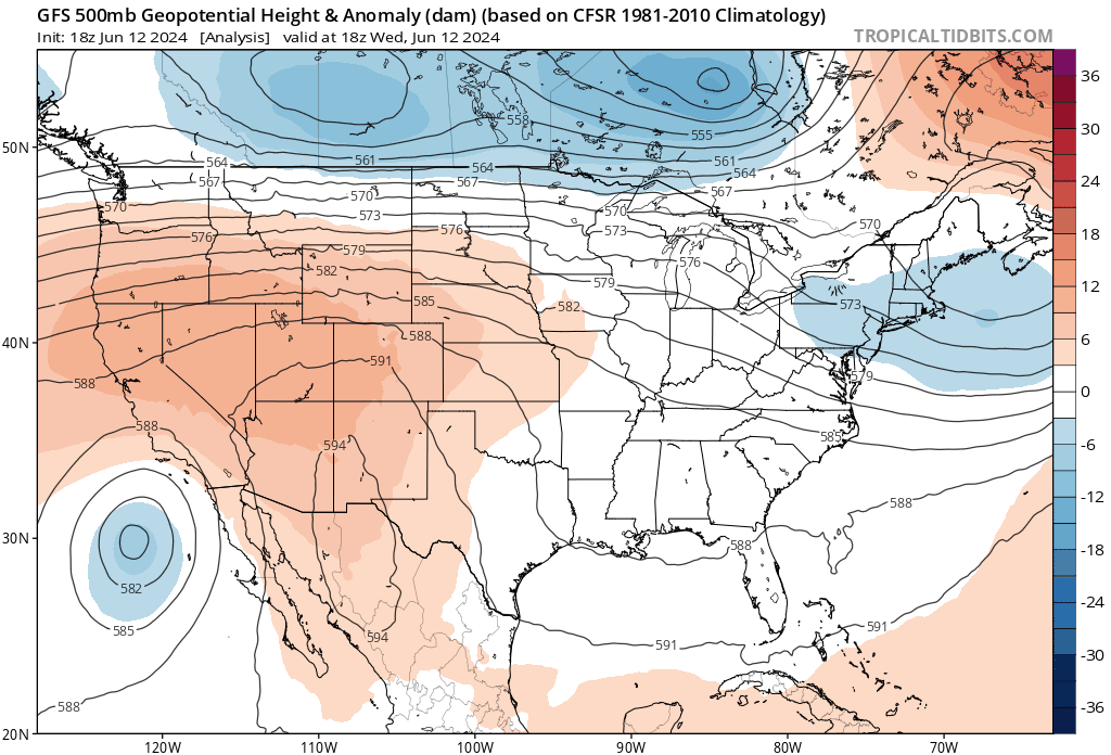
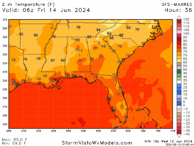
Above-average temperatures are expected for our area for the next couple of days. The high pressure ridge (as seen in the GIF above) is expected to move in just in time for the weekend and keep the region very hot, dry, and hot. The omega-pattern that the ridge is taking on (high pressure ridge with low pressure troughs on each side) is to blame for “never-ending heat” thanks to the stable atmosphere associated with these systems. Highs will range in the upper 90s, with several areas breaking into the 100s within the coverage zones. The lows are expected to be in the 70s.
While most of us are used to this heat, especially during the summer, it is very important to stay hydrated and keep from overheating. Heat advisories are likely to be issued as we progress into the week, so stay alert. Limiting outside work and taking several breaks is highly suggested to put one’s safety first.
This heat is expected to stay through the weekend until the ridge starts shifting to the east. This shift will allow for a trough to start deepening in the west, helping to bring some moisture in from the Gulf of Mexico to aid in thunderstorm development at the start of next week.
THUNDERSTORMS EXPECTED EARLY NEXT WEEK:
After the ridge moves out of the area, the trough on backside will deepen and allow an influx of moisture from the Gulf of Mexico. This will result in an increase in humidity and precipitation as the trough continues into the region. Rain chances will rise between Sunday to Tuesday, with the heaviest rainfall expected for Tuesday. Rain will be more likely during the afternoon hours due to daytime heating, but some overnight shower could occur as well. The chance for thunderstorms will remain through the rest of the week, decreasing as the week progresses.
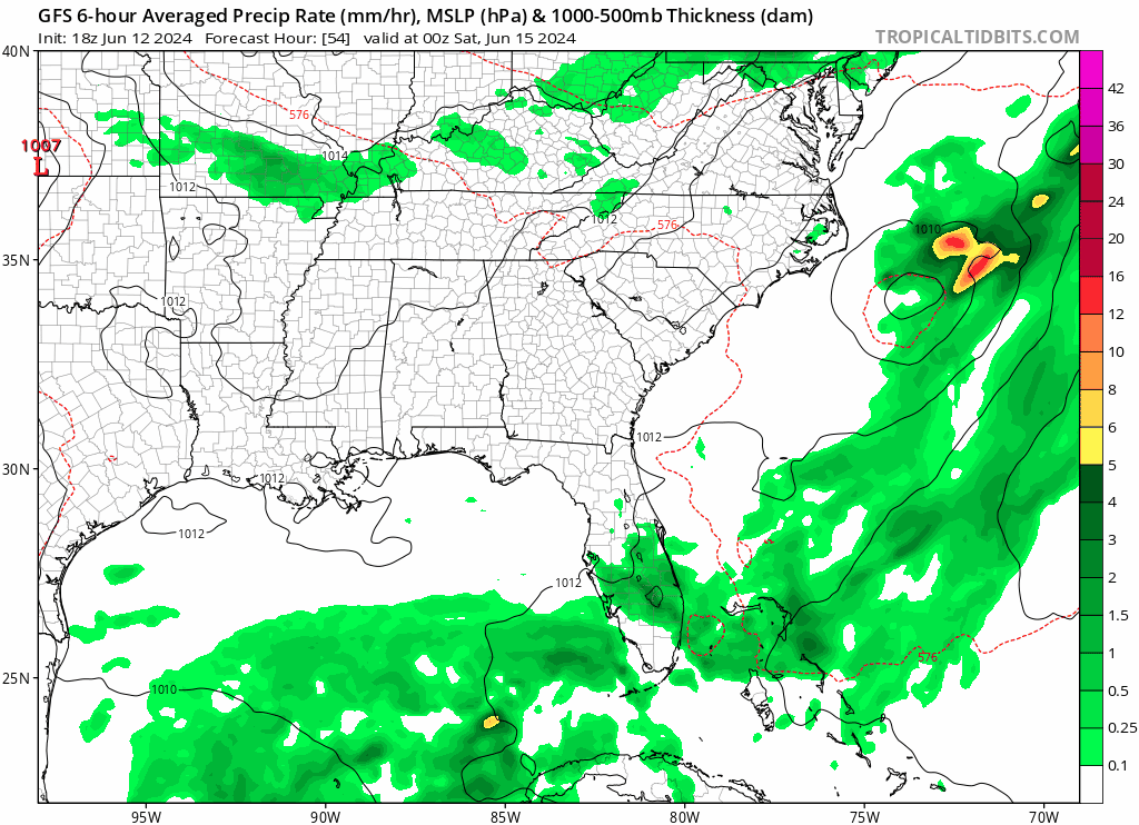
Along with humidity and precipitation, temperatures will slightly cool to highs in the lower 90s. With the increased humidity it will probably feel just as hot, but we will take what we can get. Moving towards the end of next week, another high pressure system will make its appearance and gradually rid of the instability in the atmosphere. Rain chances will decrease and it will be back to hot and dry conditions at the end of next week.
BRIEF TROPICAL UPDATE:
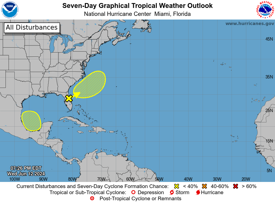
Taking a quick look at the tropics, there are two areas of concern highlighted by the National Hurricane Center. The area currently over the Florida Peninsula (Invest 90L) only has a 20% chance of tropical development but is pouring rain over the impacted area. The new area to watch, located in the Southwester Gulf of Mexico, is still very new but showing potential for some formation later next week.
We will continue to monitor these areas as they progress. If you want to get a more detailed discussion on these two tropical watch areas, view Mason’s Tropical Outlook from Today!


