Happy Thursday everyone! I hope that it has been a good week so far ignoring the heat we are experiencing. I wish I could say that its leaving, but we are out of luck. I want to discuss a couple of weather activities in the U.S. that will occur over the next couple of days. We have the extreme heating conditions, severe weather chances in the Great Plains and the northeast, and continued rainfall in the Florida Peninsula. Before getting into those topics, lets take a look at what is happening in the upper-levels.
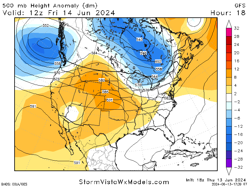
The upper-level systems at play are responsible for the weather trends that will be occurring over the next couple of days. A high-pressure ridge is dominating the central part of the country, resulting in the high temperatures and lack of precipitation many have experienced. The ridge is expected to stay relatively centered over the U.S. heading into this weekend, before shifting eastward and allowing the trough out west to ease its way in. This trough will bring back the rain chances and slightly cooler air (not much cooler, but cooler).
Looking to the eastern half, there is currently a low-pressure trough sitting over the Great Lakes region, which is helping to fuel our severe weather threat for tomorrow along with an upper-level jet. These two factors are aiding storm development that is impacting the Midwest today and will move to the east coast by tomorrow. A high-pressure system will move in once this trough pass through, giving the area a break from the severe weather threat.
VAST HEATING ACROSS THE NATION:
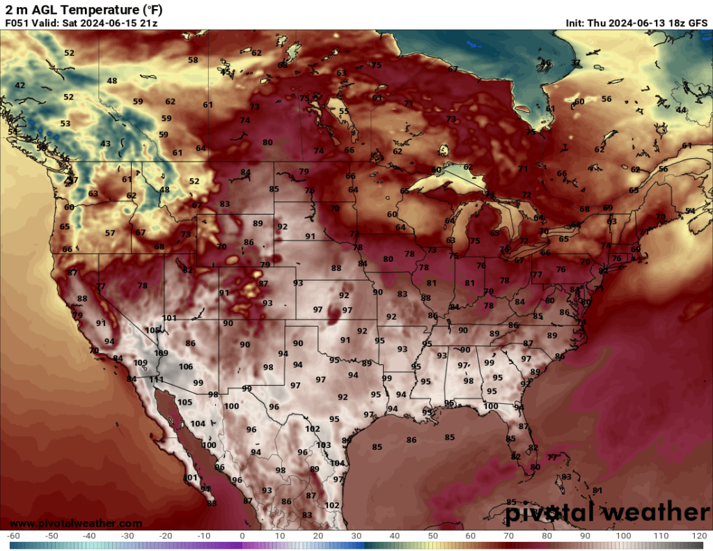
I am sure we all are already aware, but the ridge in place is causing temperatures increase across the central and southern parts of the nation. Majority of the country will be experiencing above-average temperatures as we move into the weekend, with Saturday being the hottest with a large amount of places hitting 100 degrees or greater!
The good news is that while it will not cool down significantly, the extreme heat will dial back as we head into the start of next week. This is a result of the upper-level trough in the Pacific Northwest moving in and shifting the ridge to the east.
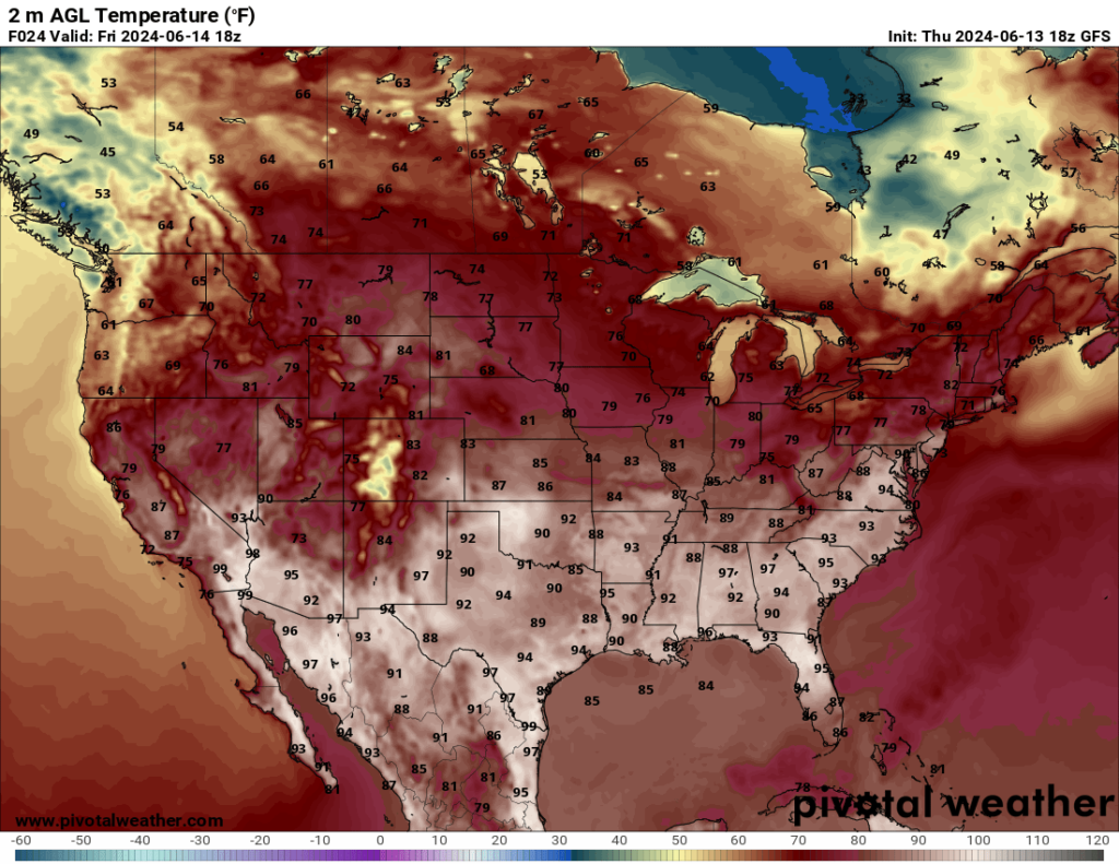
Heat advisories and warnings are expected to be issued as we progress through the day on both Friday and Saturday, so it is important to stay aware and alert. While it may not be as “exciting” as severe weather, extreme heat can be more dangerous (hence it’s nickname ‘the silent killer’). Please try to limit time outside in the sun, stay properly hydrated, and take plenty of breaks if work takes you outside.
SPC OUTLOOKS:
More severe weather is expected for tomorrow in the central Great Plains as well as in the Northeast. Both areas are under a slight risk (2 out of 5) with the timeline being in the afternoon to early evening. While there is a low chance for tornadoes, strong winds can be just as damaging.
For the central Great Plains, the biggest concerns will the the chance for large hail along with 60-80 mph wind gusts. It is expected to be a more widespread event with scattered thunderstorms rather than a large-scale system, but some storms may merge together and form clusters. This wil increase the chance for hail and wind as the system moves through.
For the northeast, a cold front will move into the area and initiate thunderstorm development ahead of said front. Strong winds and hail are the main risks associated with the scattered thunderstorms.
CONTINUED FLOODING IN FLORIDA:
Rain brought across the Florida Peninsula by Invest 90L is still present in the southern tip of the state with some scattered shower around the Tampa area. While most of the rain has passed through, flooding is still an issue for most of the area. For areas that have already received 10+ inches of rain, the slightest addition of rainfall is very dangerous. Heavy rainfall is expected to continue for the next few days as the system continues to move offshore.
With all the different factors coming into play, be sure to be weather aware and exercise safety with both severe weather and heat in the next few days.


