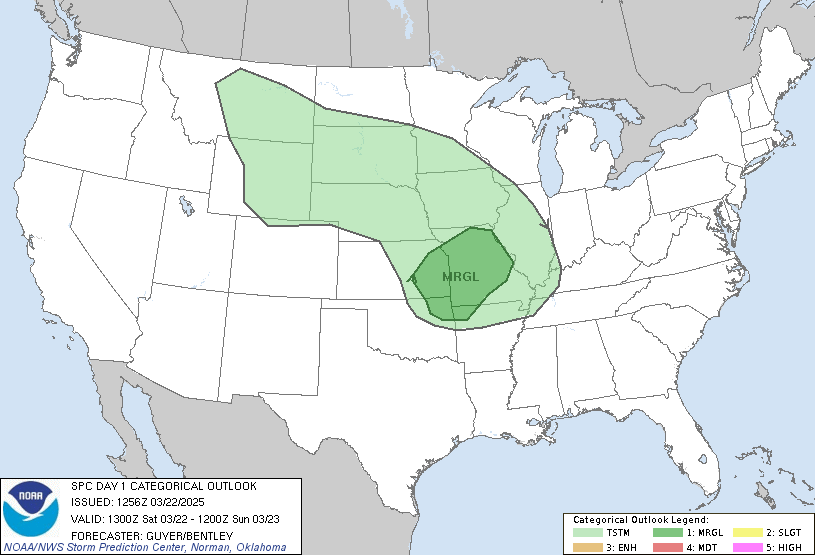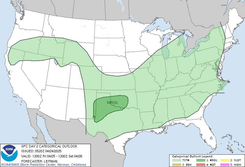
Much of the Central US is still going to be experiencing rain with the possibility of thunderstorms across the area for this weekend. As has been the story for the past week, general weather patterns are generally persisting with strong upper-level ridge remaining over South Central US. From this, excessive heat will remain in place for the South Central US and along the Gulf Coast with temperatures exceeding 95 degrees in most areas.


Oklahoma will be at the greatest risk of severe weather today with the Storm Prediction Center issuing an Enhanced Risk across the entire state. On Sunday, the main area of interest will shift towards Arkansas, Mississippi, and southern Arkansas with a Slight Risk. Tornado risk still remains very low with only a 2% chance of formation under the Enhanced Risk area. Some portions of Montana and the New England region will also be under a Slight Risk this weekend.

This shortwave trough coming off the Rockies Mountains will be the main exciting factor to spark much of the severe weather that is responsible for the Enhanced Risk today. Much of the severe weather will come in the form of intense thunderstorms, hail, and strong wind gusts. As the weekend continues, the shortwave trough will continue move ESE into the Louisiana, Mississippi by Sunday for some afternoon convection.

Upper-level winds are expected to shift this weekend as a strong jet begins to build along the Northwest region of the US. However. the upper-level ridging pattern along the South Central US will remain for the weekend but begin to weaken by the start of next week. But in the meantime, the subtropical jet will continue to fuel the Oklahoma, Louisiana, Mississippi area for the chance of thunderstorms and severe weather throughout the weekend. In areas under the Slight Risk, there is the possibility of 70 mph wind gusts and golfball-sized hail so always stay alert.
With the upper-level jet now stretching across the Pacific Northwest, we can expect to see some above above average precipitation stretch across the Central US. This will likely lead to some drier conditions further south while keeping those warm temperatures in place.
Travel Impacts for 6/17/23
The South Central US will likely be impacted by the severe weather with Oklahoma being the most impacted today. By Sunday, Arkansas, Louisiana, and Mississippi will also be under threat of severe weather that will impact travel. Especially along the Gulf Coast, flooding will likely occur due to the intense rainfall over the past couple days. Be careful when traveling through these affected areas. Across the rest of the United States, travel should be relatively unaffected.
Extended Outlook


Courtesy: Climate Predication Center
Warm and wet will continue to be the story for most of the Central US. By the start of next week and further ahead, the Midwest will is expected to be above average in temperature with the Central East and West Coast looking to be a bit cooler. Precipitation will also above average along the Pacific Northwest, Central Plains, and the South. That upper-level jet will be pulling in a lot of moisture that will be spilling out into the Plains region but this will not be expected to last long. The emerging EL Nino will tend to push the jet stream further south, especially as surface temperatures get warmer.
Conclusion
The overall threat of severe weather is expected to remain in place for the weekend as the subtropical jet pumps further moisture and heat from the Pacific across the South Central US with the main risk being in Oklahoma today. As the weekend continues, this severe weather risk will shift towards the AR, MS, AL following the shortwave trough. Temperatures exceeding 95 degrees will also be likely to continue throughout next week until the upper-level ridge begins to break down.

