Happy Tuesday, everyone! Here are the three main topics I will be focusing on today. First, Potential Tropical Cyclone One has developed over the southwest Gulf of Mexico and will bring flooding concerns to southern Texas. Second, widespread heat is likely for the eastern half of the country over the next couple of days. Finally, two additional areas in the tropics are being monitored by the National Hurricane Center for possible development.
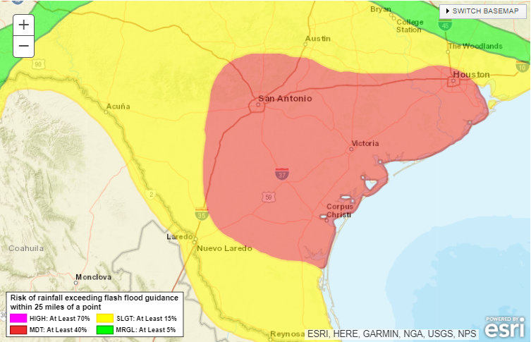
Texas Flooding Concerns
// Courtesy: wpc.ncep.noaa.gov
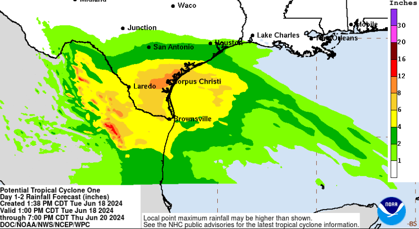
Potential Tropical Cyclone One has formed in the southwest Gulf and is forecasted to slowly move off to the west-northwest over the next 24-36 hours. Low-end tropical storm force winds are likely for Mexico and far southern Texas Wednesday afternoon.
The main concern with this system will be the heavy rain threat due to the slow forward speed and abundance of tropical moisture. Widespread 3-6″ of rainfall is likely for south Texas with some locations nearing 10″. Timing for the heaviest rain will be between Wednesday morning and Thursday afternoon.
The Heat Is On
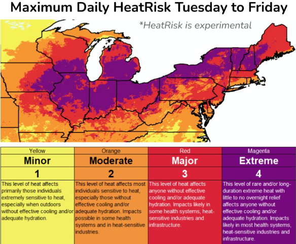
Extreme Heat This Week. // Courtesy: wpc.ncep.noaa.gov
Millions of people from the Midwest to the Northeast will experience days of dangerous heat as we approach the first day of summer on June 20th. High pressure is forecasted to build in across the Northeast, allowing some of us to set daily records with high temperatures climbing into the 90s and heat index values over 100 degrees.
Please drink plenty of water and wear sunscreen if you plan on going outside during peak hours. Find a way to cool down if you do not have access to reliable air conditioning as record warm overnight temperatures are forecasted for the rest of the week.
For this weekend, the most intense heat will be possible from New England to the Mid-Atlantic.
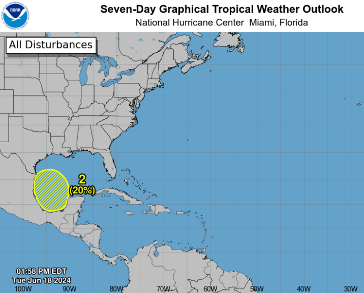
Two Additional Areas In the Tropics
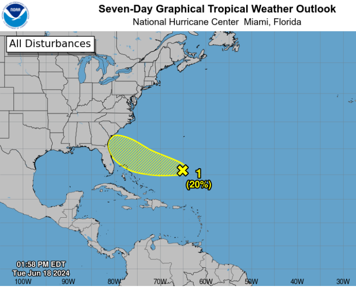
Area 1: A broad area of showers and thunderstorms well east of the Bahamas is forecasted to move towards the southeast coast this weekend. Dry air has been limiting the organization of this system and little to no development is likely over the next couple of days. 1-2″ of rain is possible this weekend for the Georgia and Florida coastlines.
Area 2: A new area of showers and thunderstorms will likely move into the same area as PTC1 late this weekend and into early next week. I’m not going to talk about this one much as we have plenty of time to monitor it. Could be another rainmaker as we head into next week.


