I hope everyone is having a great week so far! Here are the three main things I will be focusing on today. First, severe weather is possible on Thursday and Friday from the Great Plains to the Midwest. Second, above average temperatures are likely for most of the Southern Plains the rest of the week and into next week. Finally, we are watching two areas highlighted by the National Hurricane Center for possible development.
Severe Weather On Thursday & Friday
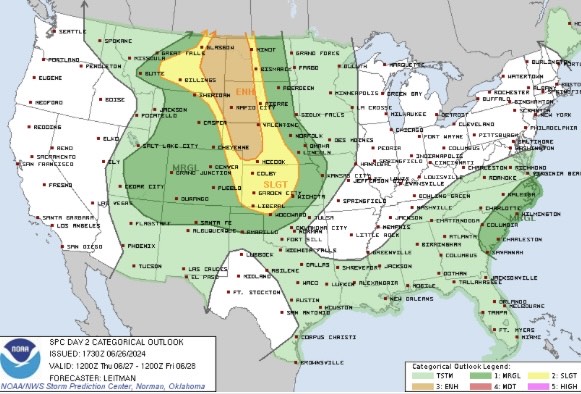
For Thursday, severe weather is likely from eastern Montana and the Dakotas to Kansas. A strong mid-level shortwave trough is forecasted to move across the northern Rockies on Thursday with a surface low expected to strengthen across Montana. This low will track off to the east-southeast throughout the day, advecting moisture northward into eastern Montana and the western Dakotas.
There is the potential for supercells Thursday afternoon due to the strong mid-level flow, so large hail, damaging winds, and a few tornadoes are possible during the late afternoon and evening hours.
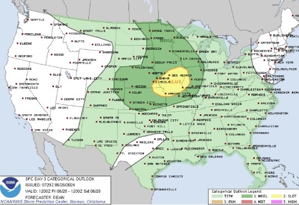
For Friday, the mid-level trough is forecasted to track eastward towards the upper Great Lakes region, leaving the possibility of strong thunderstorms across the mid/upper Mississippi Valley. Morning convection is likely Friday morning, so if that moves out sooner, then higher severe probabilities may need to be added later. Wind and hail are the main threats as of now.
Southern Heat
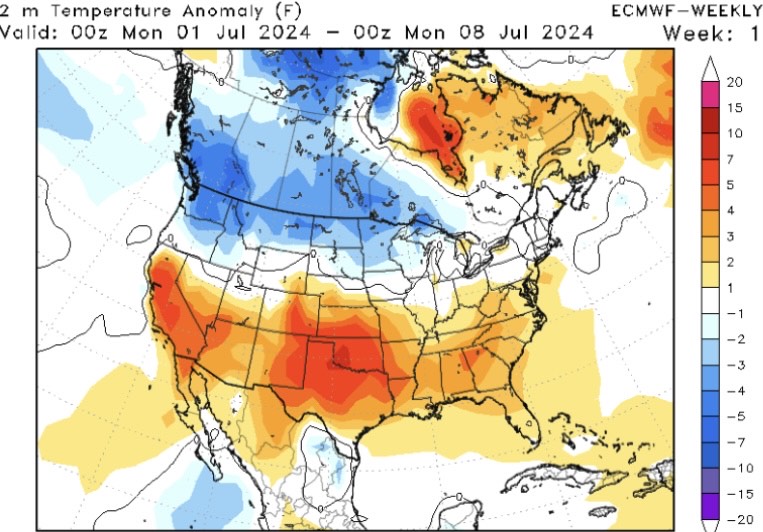
Upper level ridging is forecasted to build into the southern half of the country late this weekend into early next week with zonal flow across the northern United States. This simply means that warmer than average temperatures are likely for much of the south next week. Widespread 90+ degree days are likely in Texas, Oklahoma, Kansas, and much of the southern CONUS.
This pattern will begin to shift east late next week, so above average temperatures are likely for much of the southeast CONUS. Drink plenty of water and avoid staying outside for extended periods of time.
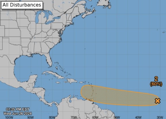
Two Areas In the Tropics
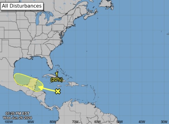
Area 1: A broad area of showers and thunderstorms over the central Caribbean Sea is forecasted to move towards the Bay of Campeche this weekend. Slow development is possible over the next couple of days. Eastern Mexico and southern Texas should monitor this for an increase in cloud cover and rainfall.
Area 2: A strong tropical wave off the Main Development Region (MDR) will track off to the west towards the Lesser Antilles late this weekend and into early next week. Confidence is increasing that a tropical depression or storm may form as the NHC has it a 60% chance over the next 7 days. Conditions usually aren’t too favorable this time of the year in the Caribbean, so we’ll see how the models handle it over the next few days.


