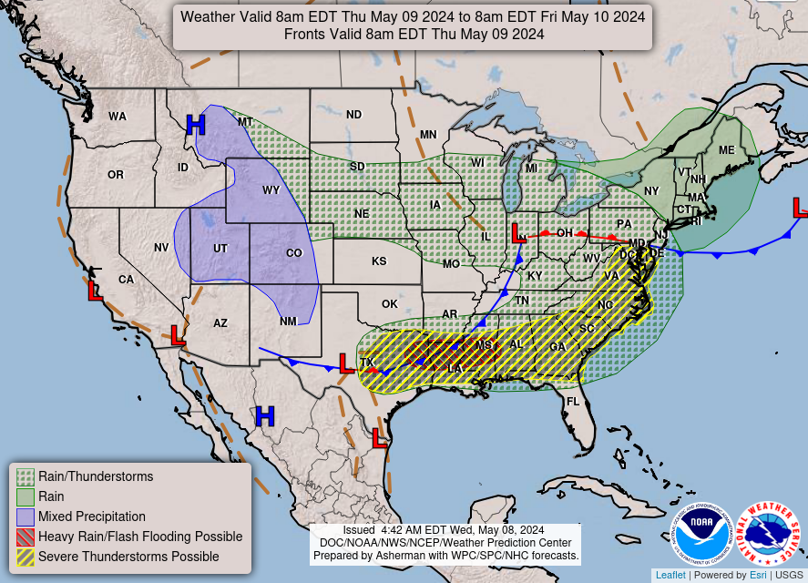
Our active weather pattern continues this week and looking into the long term it shows no signs of stopping. A low pressure system has brought rainfall to parts of the Northeast with flooding possible in some spots. In the South a ridge will build allowing heat to build in Texas with temperatures reaching into the 100s this week. Another chance for severe weather looks likely across the Southern Plains.
The South Continues to Roast!
Heat continues to be the story as the Texas Heatwave continues. Temperatures across the South will be in the upper 90s to low 100s with little relief across the region in terms of fronts, rain, or even cloud cover. While recent rainfall should keep drought development to a minimum, this heat will continue to cause problems for communities across the South, particularly in Texas. Residents affected by this heatwave should continue to exercise caution when approaching tasks outdoors. Continue to remain hydrated and aware of the heat and seek relief when needed.
Severe Weather Across the Southern Plains
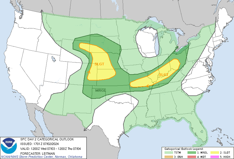
After last week’s severe weather chances in the High Plains, the Southern Plains seem set to return chances to the region. As highlighted alone the Oklahoma-Kansas border. Another Mesoscale Convective System (MCS) appears to be taking shape. Models have come to a consensus over the previous day that another impactful damaging wind and hail set up could take place within the highlighted region in the late afternoon to early evening timeframe. The MCS will first take shape in Southeast Colorado as a cluster of storms before growing upscale into the MCS and traveling eastward. How far south the MCS develops and how long it lasts remain open questions at this time, but general location and reasonable impacts can be deduced as the MCS will be capable of winds potentially up to 80 mph and hail the size of quarters looks likely. Within the first few hours the threat for wind driven hail looks higher then later as the system progresses Eastward. People within the highlighted regions should remain weather aware, especially in the late afternoon to early evening as the evolutions of these storms could shift who is impacted. As always listen to any and all weather warnings as they come in and be sure to take appropriate action to stay safe during severe weather!

Minor Flooding Across the Northeast and High Plains.
The upper level low that has plagued the south has finally found its way to the Northeast. Over the next day the low is expected to open into a wave allow for lift over a decent area. With southerly flow present across the region there will be plenty of moisture in the region to allow for showers and thunderstorms across the region. While these storms are largely expected to not be severe, a severe storm along the Mid-Atlantic cannot be ruled out.
Across the Northern Rockies, a trough will provide lift across the region promoting showers and thunderstorm develop across the Rockies. This trough will promote the develop of a low level jet across the region which won’t promote flooding across the region, but any storm that does get going will have the moisture and low level convergence to get some minor flooding going. These storms may also end up being severe with damaging winds and hail as the main threats, but the primary threats from these storms will be minor flooding.

Travel Concerns for 6/27/2023
Be aware if you are traveling across the plains that severe storms and potential flooding can cause travel issues on low laying roads. Have multiple ways of receiving weather information and any warnings or advisories and plan your trip accordingly if your route is expected to run into severe thunderstorms. For the South, make sure your car’s AC system is in good working order and be sure to keep your vehicle running if you can if you have to stop for an extended period of time. It does not take long for temperatures inside a vehicle to soar in conditions as hot as this and can make for potentially extremely hazardous situations.

Extend Outlook
Looking ahead, the general stormy pattern shall continue across the Southeast and East due to a series of lows and shortwaves proving lift across the region. While heat continues to expand across the South as our ridge builds and becomes more entrenched across the state of Texas. Out West, an overall stormy pattern will also continue with several troughs will provide lift across the region.

