The start of this hurricane season has been nothing short of active, with this trend continuing with two areas of interest in the Gulf of Mexico and the Caribbean. While it is still early to fully predict where these systems will end up, it’s important to keep an eye on these areas. Let’s talk about it!
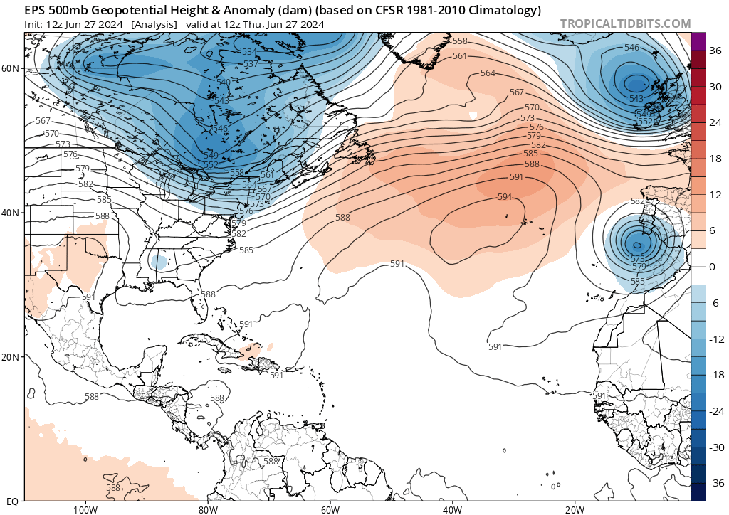
Looking at the synoptic setup above (red is higher heights, blue is lower heights), there is a strong ridge across the North Atlantic Ocean. This ridge will greatly contribute to the direction of Invest95L. If it stays where it is, the system should head west-northwest before curving out and avoiding landfall in the US.
However, if this ridge shifts west or strengthens beyond expectations, this system could be blocked from going north and start heading for the Caribbean. Either scenario is likely to occur but will become more clear as we move into next week.
INVEST 94L
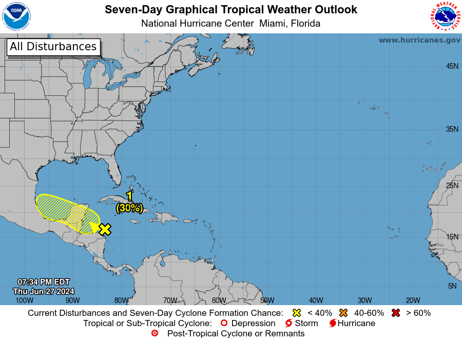
A broad area of low pressure in the western Caribbean Sea is moving west-northwest at about 15 mph. This system is creating lots of showers and thunderstorms, but they are not very organized yet. Over the next few days, there is a 30 percent chance that this system could develop further as it moves into the northwestern Caribbean Sea or the southwestern Gulf of Mexico. If this system does develop further, it will impact Mexico.
INVEST 95L
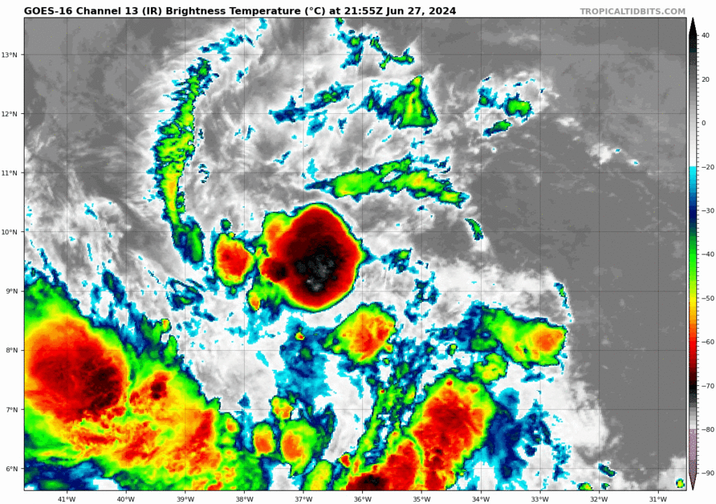
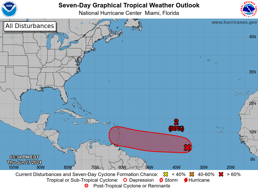
A tropical wave is currently located several hundred miles west-southwest of the Cabo Verde Islands and is showing signs of becoming more organized with showers and thunderstorms. The conditions in the environment are expected to remain favorable for this system to develop further. Over the next couple of days, it is likely to become a tropical depression or tropical storm as it moves westward at a speed of 15 to 20 mph toward the Windward Islands. People in the Lesser Antilles should keep an eye on this system as it progresses.
As for us, it is uncertain where this storm will end up. Models agree that it will move into the Caribbean, but are uncertain where it will head towards Mexico or curve to the Gulf Coast. We will have more insurance as we move into next week.
It is likely that this will be our second named storm of the season and will be given the name ‘Beryl’. As both of these storms continue to move and develop, we will continue monitoring them and update the forecasts as needed.


