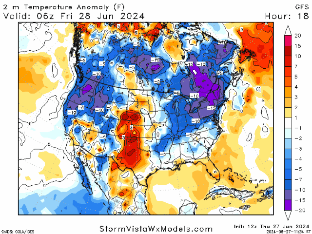
Happy Thursday! Summer has proved to be hotter than usual, and the severe weather threats continue to hit across the nation. Above-average temperatures continue for a vast majority of the nation, with an upper-level trough coming into the eastern half to slightly (keyword: slightly) cool down the area. This is also thanks to some rain that is expected in the midwest/northeast over the next two days.
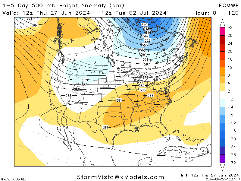
Looking synoptically over the next 5 days, there is a trough making its way from the west to the Great Plains, which is resulting in a severe weather risk for Friday. The high-pressure ridge that is dominating the east is bringing the high temperatures being experienced.
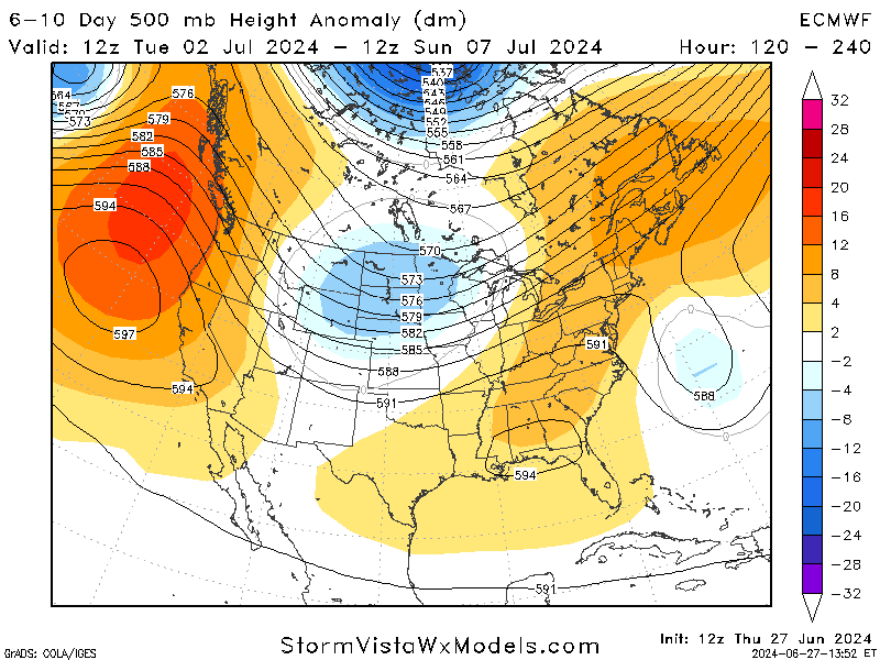
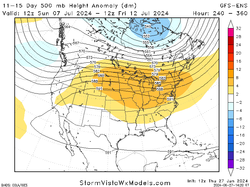
Focusing further out on days 6 to 10, models expect a trough to reside over the Central Plains with ridges preceding and following behind. These ridges will continue to keep the heat around, so do not expect it to go away anytime soon. Things could change since this is looking a little far out, but it is nice to have an idea of what is to come.
SPC FRIDAY OUTLOOK:
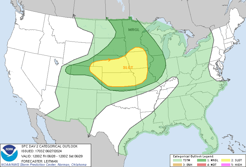
A slight risk (2 out of 5) for severe weather has been issued for the central Great Plains, with a marginal risk (1 out of 5) surrounding it. A significant weather system, including an upper trough, will move from the northern Rockies toward the Upper Midwest and Great Lakes, with an associated cold front that will bring strong thunderstorms to the area.
High moisture levels and strong heating will contribute to the development of severe weather, particularly in the central Plains. Morning storms in Missouri, Iowa, and Illinois may impact how the weather evolves later in the day, potentially limiting afternoon storm development in these areas if the atmosphere doesn’t recover quickly.
The main risks for this event include strong winds and hail, with Kansas and Nebraska having the chance for tornadoes. The timing for these storms remains closer to the afternoon/evening hours. Stay weather aware and keep an eye out for any updates to the forecast.
SUMMER HEATWAVE STILL AROUND


Here is a look at the CPC Temperature outlook for the next 2 weeks. As we can see, the majority of the country will experience normal to above-average temperatures moving into the first half of July. This is thanks to an upper-level ridge that forming over the central plains, bringing stability and trapping the heat in the area by acting as a ‘cap’
Pop-up storms are also a factor for the Southeast with the moisture made available by the Gulf of Mexico. Diurnal heating also plays a role in storm development by supplying rising warm air into the atmosphere. These pop-up storms contribute to the high temperatures by increasing the humidity, which makes a huge difference in the experienced temperature.
TWO WEEKS OUT?

I know what you are thinking, it is way too early to know if any of these predictions are remotely correct. While I do agree with the amount of uncertainty with models for 2 weeks out, I also argue that it is important to use these models to have an idea of what to expect as we move through the weeks.
Temperatures are still expected to be above-average on a national level, and that is backed up by the high-pressure ridge shown in the figure on the left. It is safe to say that while the models may not be the most accurate, they do agree that the heat is here to stay.


