Happy Tuesday! Thankfully, there is not a lot to discuss in both the Atlantic and East Pacific. Remember, it’s just the beginning of Hurricane season, so the atmosphere may need more time to adjust before we get our first system of the year.

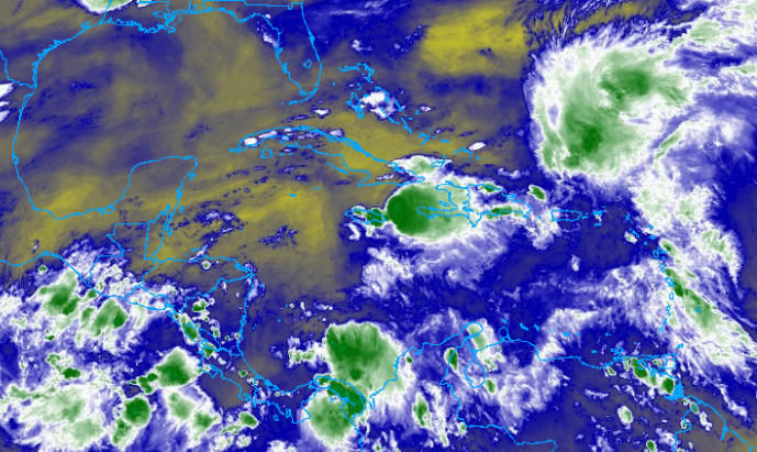
The Inter-Tropical Convergence Zone (ITCZ) continues to show multiple areas of showers and storms across the Tropical Atlantic, however, no tropical cyclone activity is expected over the next 7 days.
The main focus over the next couple of days will be a persistent upper-level trough over the western Caribbean that will bring multiple chances of heavy rain to Hispaniola, Jamaica, and eastern Cuba. Heavy downpours could lead to flash flooding and mudslides, especially in Hispaniola. Rainfall totals through Friday night will be between 2-4 inches with some areas exceeding 5 inches.

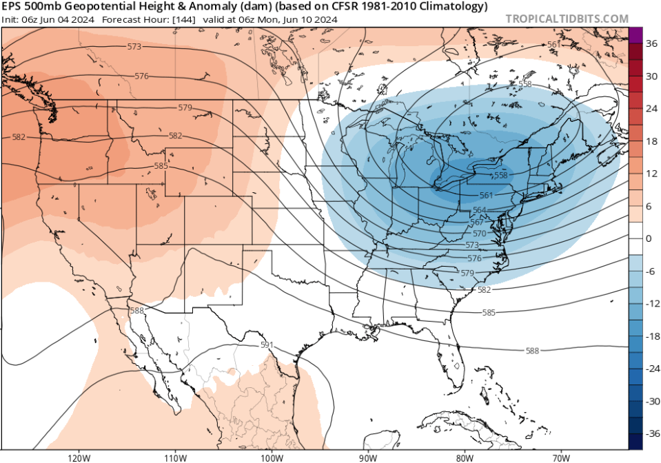
Above is an idea of what the European ensembles think the atmosphere will look like by Sunday night. A ridging pattern will continue for the western portion of the United States while places like the Midwest and Northeast deal with troughing.
If this pattern holds true, there isn’t much of a steering current if any areas of showers and thunderstorms organize in the tropics. This simply means that the direction will be dictated by more local atmospheric conditions than big-picture stuff. Expect this pattern to change as we get into next week

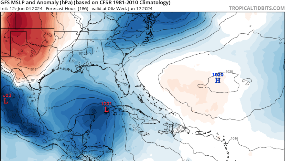
Mason, this is about 7 days out. Should we buy the hype? Not yet…
A couple of the models have hinted at the idea of developing a tropical wave in the northern Caribbean next week, but remember, we’re still over a week out and a lot can change. The track of this area of showers and thunderstorms will continue to change, so stay tuned for our tropical outlooks later this week.

