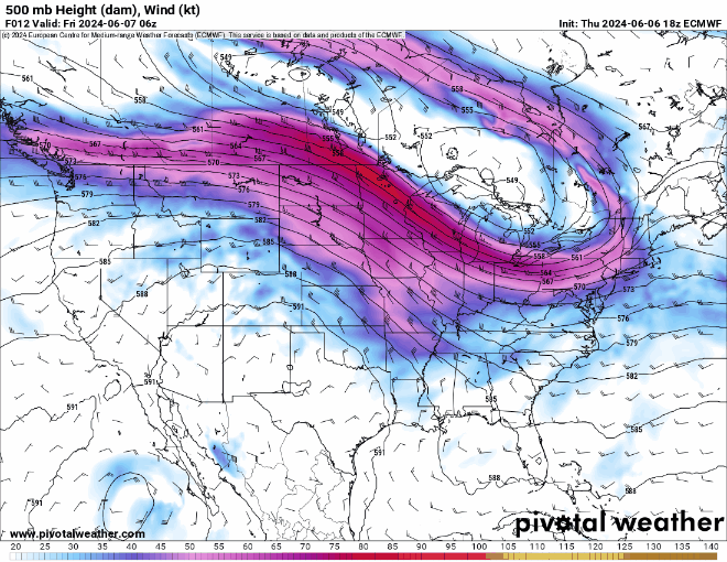
The big picture shows the ridge out west breaking down in the coming days. That will open the door for a pattern shift next week.
Before the pattern change, there is another threat of severe weather yet again, and this time its back in the central Great Plains area. This event is expected to be more localized thanks to the upper-levels systems at play. We are also still monitoring the extreme heat out west and seeing warming trends all across the nation.
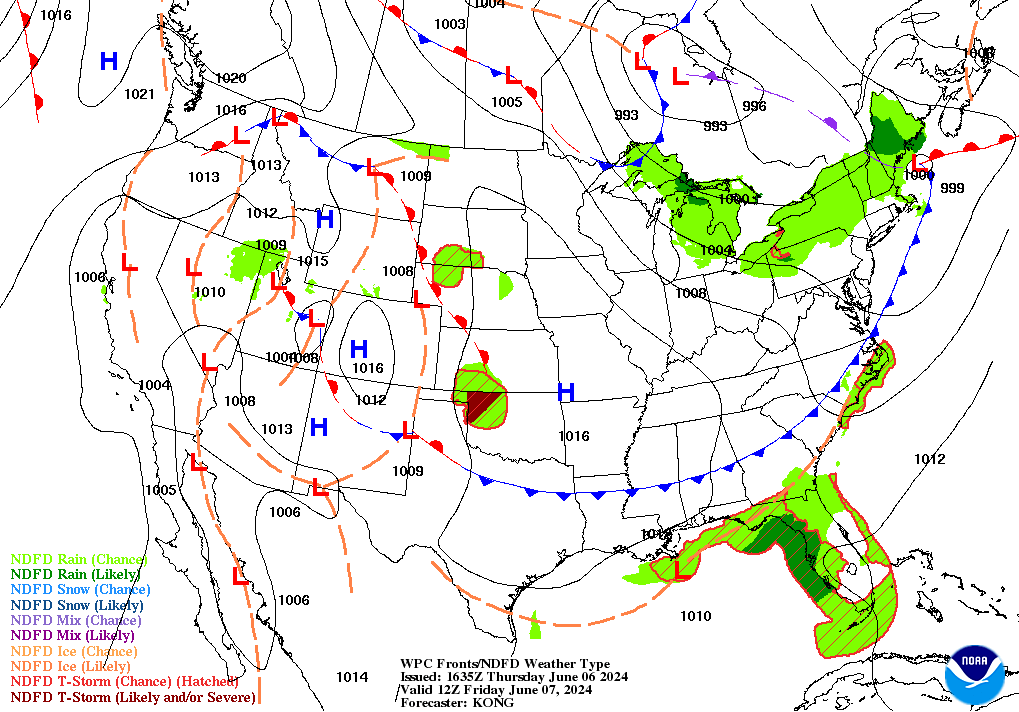
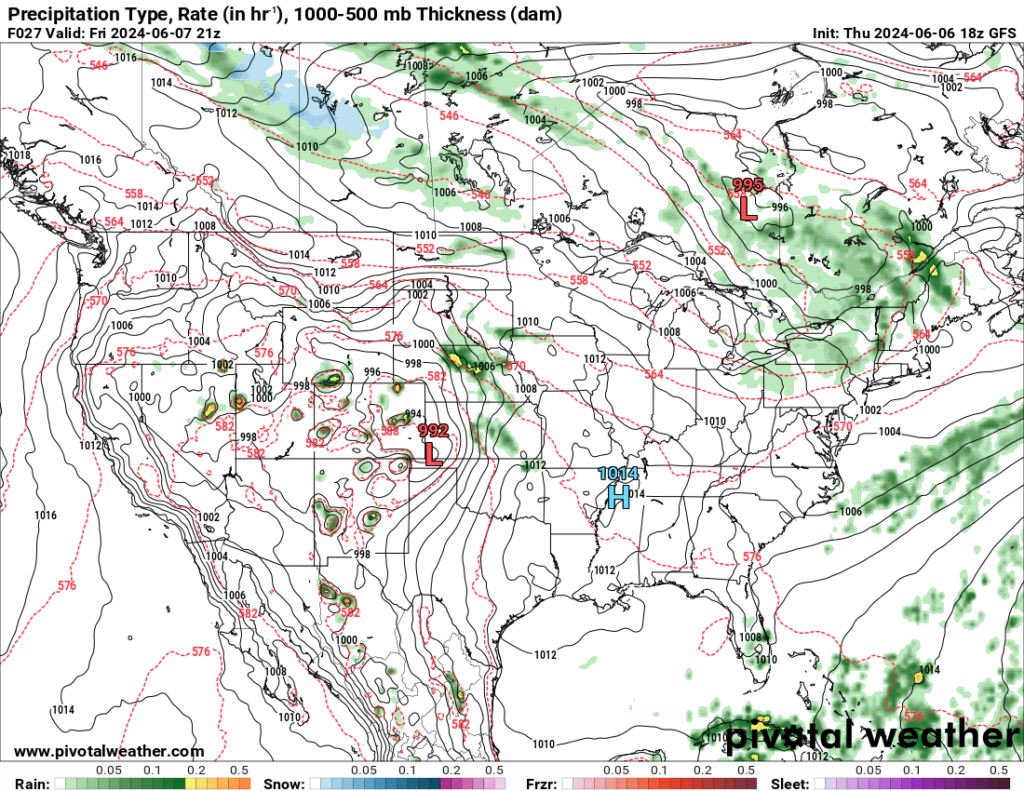
Synoptically, there will be a lee-side trough that develops across parts of Nebraska, Kansas and down into the Texas panhandle. Below, on the left, the surface maps shows the area of low pressure across the Oklahoma panhandle., with the storms firing to the north of that low across Nebraska and Kansas.
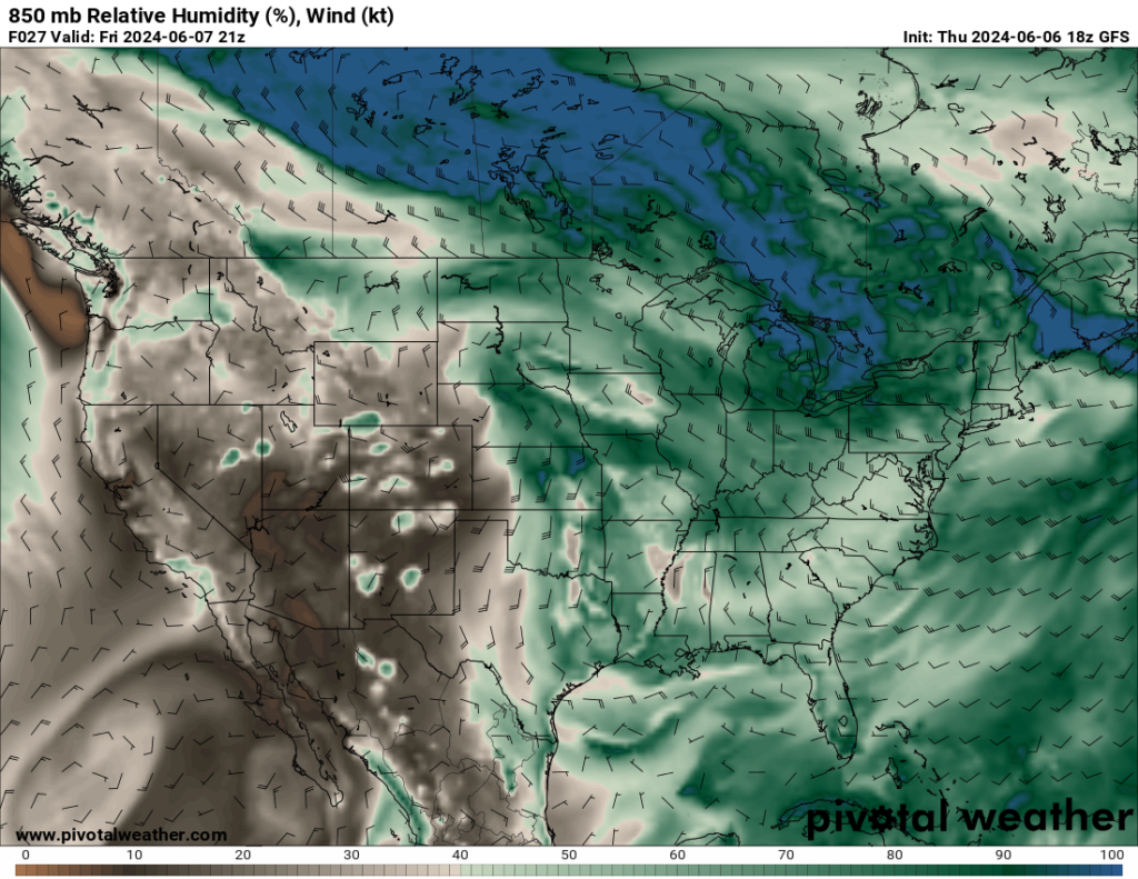
On the right, the 850mb humidity map shows the deep greens – showing robust humidity – pushing northward along the trough across central Kansas and Nebraska. Where the gradient is sharpest between the drier air to the west and the humid air to the east is where the storms will develop first.
Given the prevailing wind at 500mb moving from WNW to ESE, around the northern side of the ridge, these storms will likely be moving from NW to SE which should limit the tornado threat and increase the wind and hail threat. More on that below.
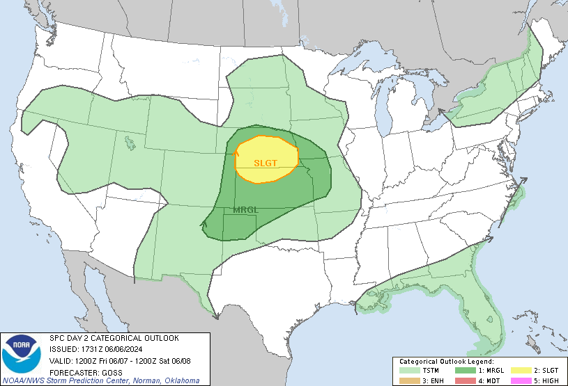
SPC Outlook for Friday:
The threat of severe weather for Friday is expected to impact areas in the Great Plains with the target time being Friday afternoon with potential for additional storms that evening.
The upper-level setup that is responsible for this risk consists of a trough (low pressure) in the eastern portion of the nation, while a ridge (high pressure) continues to build out in the west. A cold front that extends from the east coast to northeast Texas that will keep pushing storms into the southeast. However, there is a warm front expected to move to the north across Oklahoma and Kansas that will bring more moisture to help fuel the severe weather potential.
The central part of the plains will experience strong heating which allows thunderstorms to form. The main concerns will be damaging winds as the storms move east, slight chance for hail, and a tornado or two is possible. For the southern part, the same conditions are expected but with damaging winds being the main risk. More storms may form later in the evening due to warm-air advection and low level jet winds, bringing the risk for large hail and more damaging winds.
Remember that things can change very quickly with severe weather chances, so weather aware as we continue to monitor this system.
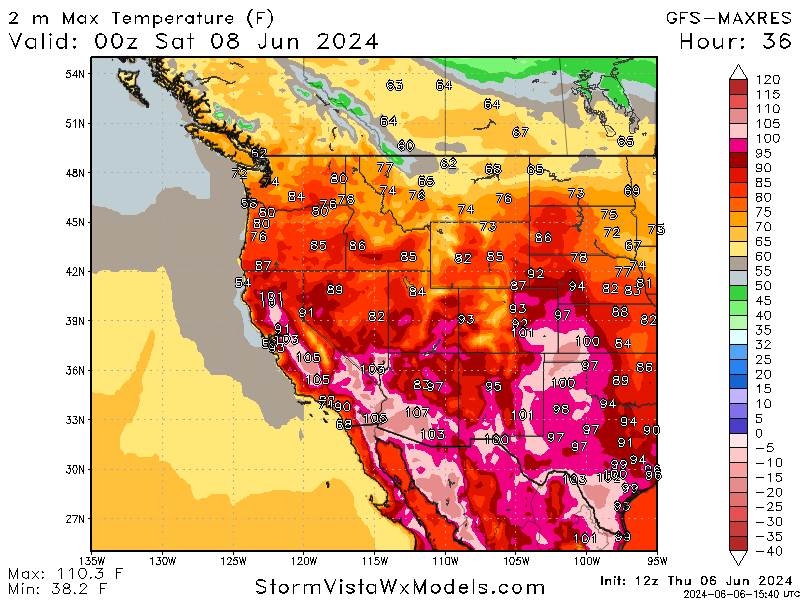
Extreme Heat Remains, but Shifts:
Shifting gears a little bit, majority of the desert southwest is still under excessive heat warnings thanks to the ridge still present to the north of the area. Parts of southern California, Nevada, and Arizona will reach highs around 110 between today and through the weekend. Continue exercising caution in outdoor activities and stay properly hydrate when working outside.
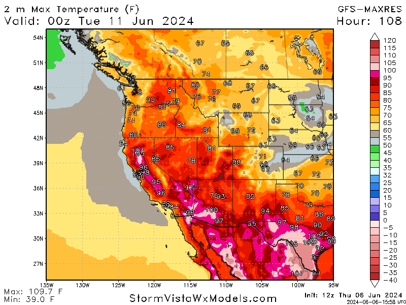
At the beginning of next week however, the extreme heat will start shifting into the southern part of Texas as the upper-level ridge is expected to start flattening out. This will also bring some more heat more towards the east as the upper level trough will start to weaken. While the worst of the heat is shifting, it will still be extremely hot in the southwest.