Good evening, everyone! Our time talking about Beryl is coming to an end (thankfully), but something that’ll continue to stick around for the next few weeks is the heat. Above-average temperatures are likely for much of the southern United States over the next couple of weeks. Also, heavy rain is possible for the Carolinas and Virginia this weekend due to a weaker system in the Atlantic.
Record Heat Out West
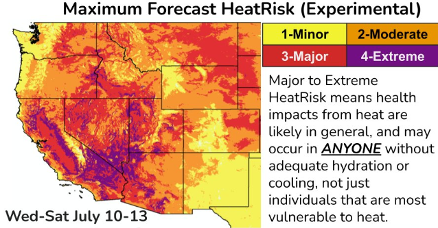
What has the weather been like away from Hurricane Beryl? HOT! Ridging has dominated the western U.S. this week, resulting in near-record warm temperatures. On Thursday, high temperatures will climb above 100F for cities like Boise, ID, Las Vegas, NV, and Phoenix, AZ. For Friday and Saturday, the heat expands as cities such as Bakersfield, CA, Rapid City, SD, and Denver, CO could experience record-high temperatures as well.
Rainfall chances will be limited the rest of the week, so drought conditions could worsen in places such as western Montana and southern New Mexico.
If you’re outside, be sure to pack a lot of water to stay hydrated and find shady areas to rest. Locations further north may return closer to average next week due to a cold front moving across the Plains.
Warm Temperatures Shift East
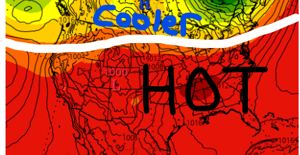
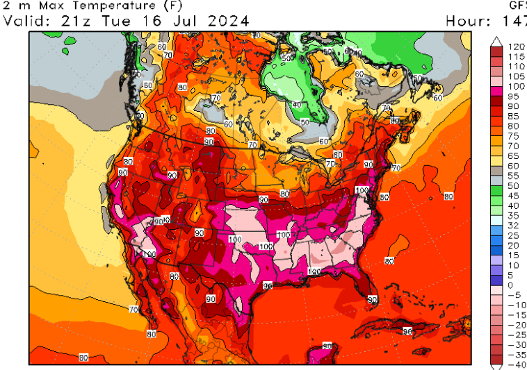
As we head towards next week, the heat is forecasted to shift further east towards the Southern Plains and southeast CONUS. Above average temperatures are likely for most of the south with high temperatures in the 90s and possibly in the triple digits! Heat indices will likely climb above 110F in some locations during the afternoon hours.
Locations that saw rainfall from Beryl will not have to worry about immediate drought concerns, but areas such as Kansas, Oklahoma, and western Texas could see increasing concerns in next week’s outlook.
Not only will it be hot in this part of the country, but rain chances should be low. The Upper-Midwest and southern Arizona are areas that are more likely to see rainfall next week.
Rainmaker for the Carolinas
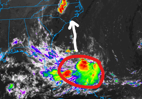
A broad area of low pressure is currently a couple hundred miles offshore the southeast coast. The National Hurricane Center is monitoring this system for possible development over the next couple of days.
This will not be a strong storm whether it develops or not, however, heavy rainfall is a concern from Friday to Sunday. Areas along the coast from South Carolina to Virginia could see totals between 2-4″ of rain with some localized totals exceeding 5″. Flash flooding could be an issue in some spots, so be sure to check the website tomorrow for more updates on this rain threat.


