Hi everyone! Good news: we can move on from Hurricane Beryl talk now. There is only one area we’re watching in the Atlantic that has a low chance of development. Also, we’ll take a look at an area in the eastern Pacific with a chance of organization.
Here a day late? Check here for the most recent update on the Tropics…
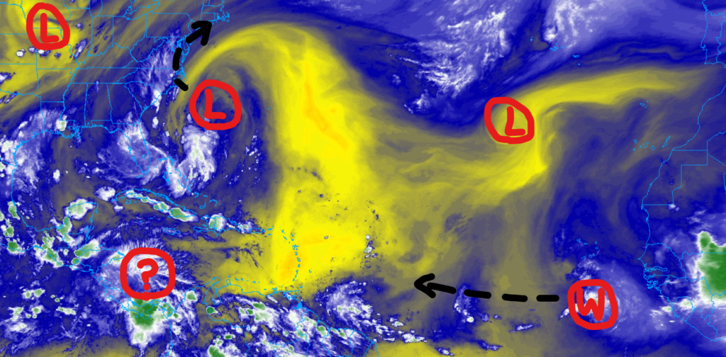
Current Look At the Tropics
Looking at the big picture, we’ve got one area near the coast of the Carolinas, with much of the convection displaced away from the central area of lower pressure.
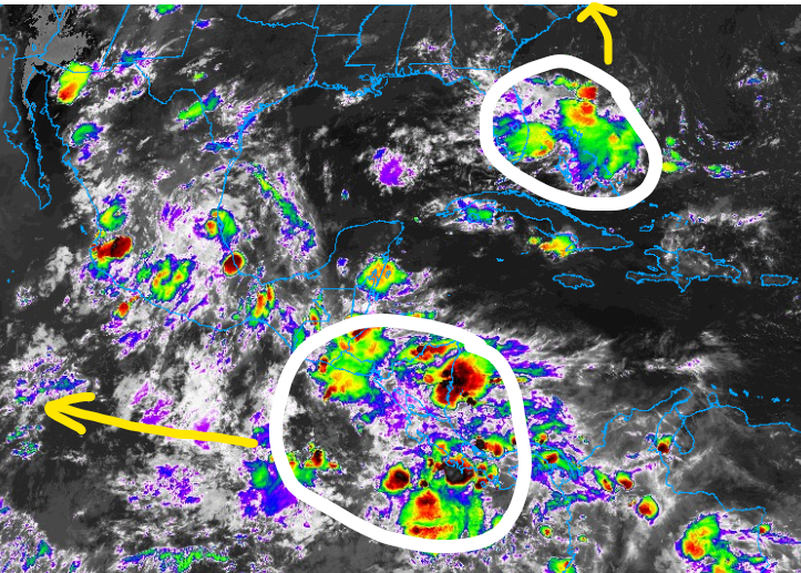
Looking at the imagery of the Caribbean and Gulf on Infrared, you can see the top circle is the area of thunderstorms displaced from that swirl off the Carolina coast. the bottom white circle is the “?” on the map above.
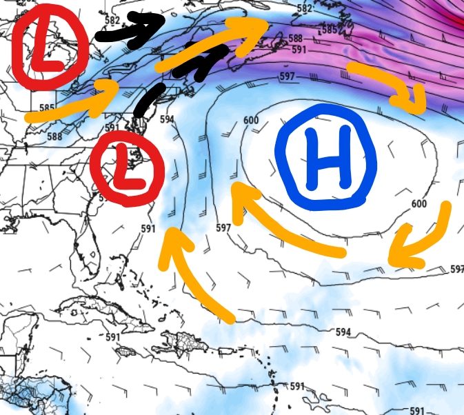
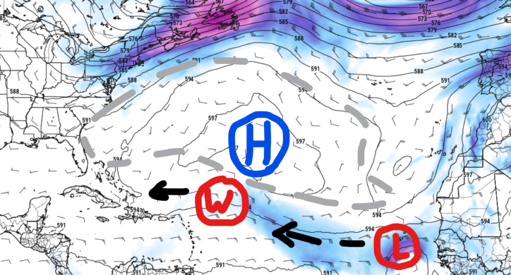
We The NHC is monitoring the area off the coast of the Carolinas for development. But it has noted, in the most recent update, that it has a “near 0” percent chance of development. The puzzle pieces in the atmosphere are not aligned for anything to really happen. There is too much of a southerly and southeasterly flow behind this area of interest. The orange arrows on the map below indicate the “flow” in the atmosphere and the black arrows indicate the direction each “L” will move.
Instead of development, the impacts will likely bring a fair it of rain to the region.
That emans, while the disturbance in the Atlantic could bring some impacts to the U.S. this weekend, but nothing like what Beryl did earlier this week. The main concern with this system is the heavy rain and flash flooding threat because it is very unorganized and slow-moving.
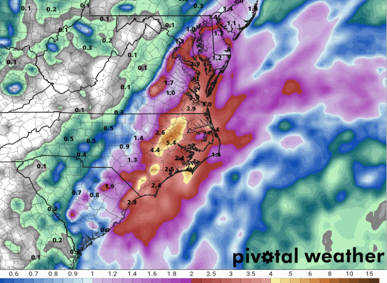
Models are in a bit of a disagreement with rainfall totals this far out, but confidence is increasing that a nice swath of 1-3″ is possible this weekend. This includes coastal areas of South Carolina, North Carolina, and Virginia as localized totals could exceed 4″ if this system overperforms.
Flash flooding could become more of an issue if these totals get bumped up over the next 24-48 hours, so be cautious if you live near a creek, river, or some area that floods easily.
If you are planning on traveling here for the weekend, I’d recommend changing plans 🙁
Beyond that, looking out into the future, we will have two more waves off the coast of Africa try to hold together. The map below is the Euro operational model on Day 7.
It shows one open wave, and a second stout area of low pressure coming off the African coast. Both worth monitoring, but not worth worrying about.
In the Pacific
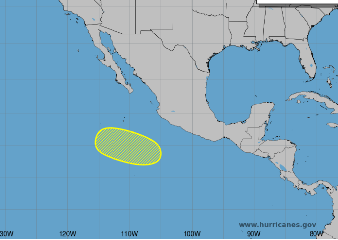
With the disturbance in the eastern Pacific, initial development is unlikely, however, late this weekend into early next week, conditions become more favorable, so a tropical depression or storm could form. This will not impact Mexico or any landmasses over the next week. The next name on the list is Bud.


I used to enjoy watching the weather channel everyday, all day! I just liked to hear them talk and liked the music! I wanted to know what was going on all over the country. I bought a 2nd tv when my husband moved in. He doesn’t like what I watch! Enjoy your job!