Looking at the big picture, we have a few areas to monitor, with no real imminent threat for something to develop.
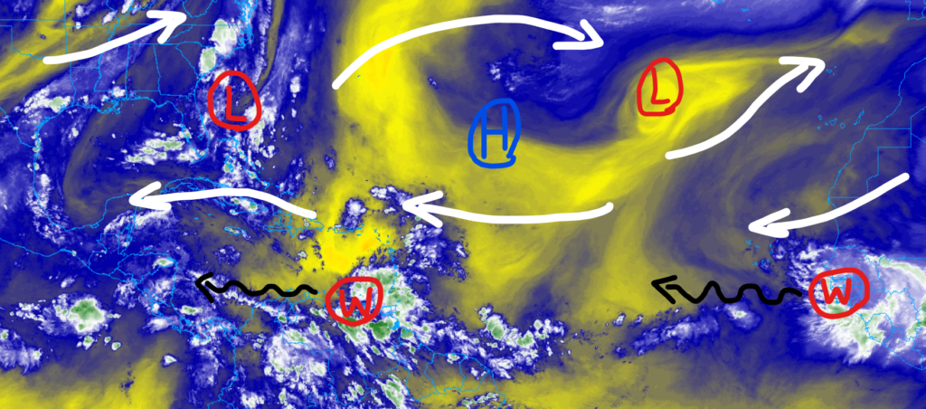
The area of lower pressure off the Georgia coastline doesn’t really appear to be much more than a remnant swirl from the mid-level low that swung north past the Carolinas yesterday. Worth watching, but none of the model guidance currently suggests it will develop much past a cluster of thunderstorms.
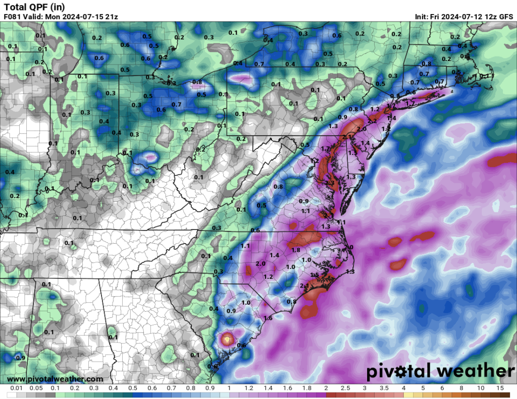
It will spell extra rain for the southeast coastline, but other than that, should dissipate with little fanfare.
ELSEWHERE….
The other two waves – one near the antilles and the other coming off the coast of Africa look more formidable on water vapor imagery than they actually are.
One reason is the Saharan dust that has encompassed mush of the Atlantic. And that is pretty normal for this time of year. You know, aside from the wave that became Beryl, it was a pretty dry June for the Sahara. Looking at June of 2024 compared to the last 10 years, we saw somewhere between 25% and 75% of normal precipitation.
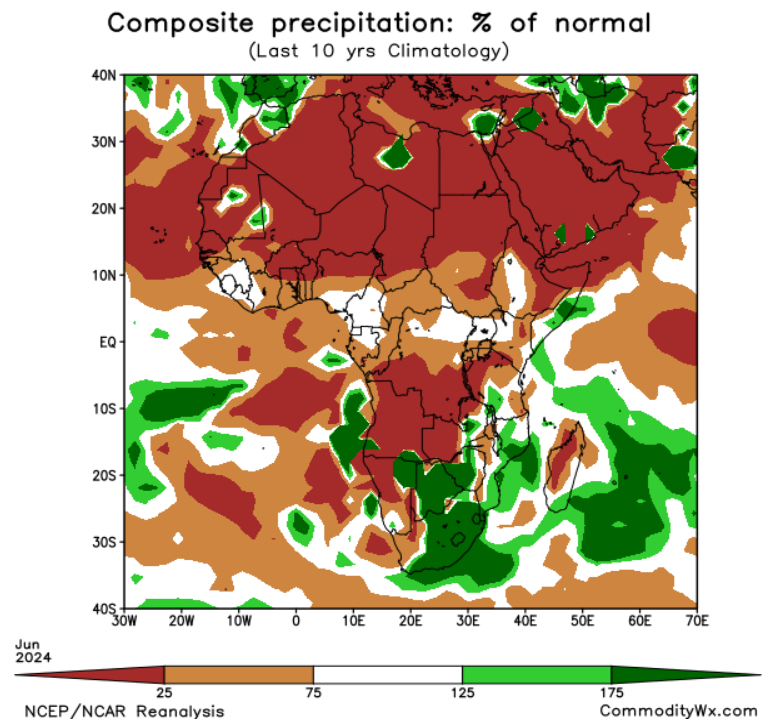
And this is after a very – very! – moist Spring. So, that is helpful. And it is one reason why we have so much dust in the air across the Atlantic.
That dust will help to quell any potential tropical waves from further development. On top of that, we have the MJO in a not-so-favorable place
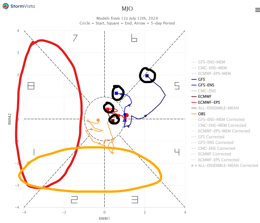
If we were looking for tropical systems to develop for waves coming off the african coast, we would need the MJO to be in either the red of orange circles. And we are currently not. And not even close. That said, there is some suggestion in the research that flipping from the 6/7 area to the 2/3 is possible over the course of a few weeks. So, perhaps things will wake back up in another 14 days.


