Well, things have finally calmed down in the tropics, with no activity being monitored by the NHC. With Beryl gone, there is nothing significant to discuss in the tropics besides a wave off the coast of Africa and the Caribbean. While these waves are the first step to tropical development, they pose no threat for the next week or two. We should get a little break from tropical action, but let’s see what is out in the eastern Atlantic and the Pacific.

WHAT COULD BE NEXT?

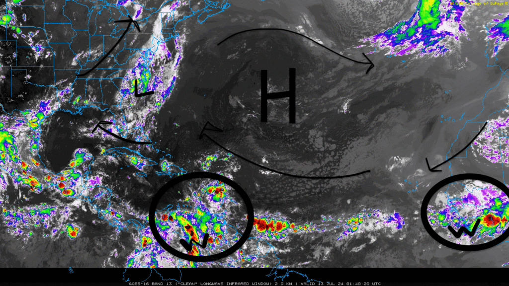
The disturbance we saw off the coast of the Carolinas has lost any tropical potential as it continues to pour rain on the coastline. A large area of high pressure in the middle of the Atlantic is helping to direct wind flow into the Gulf and allow some moisture into the southeast US. With this atmospheric setup, it is unlikely to have any disturbances in the coming days until favorable conditions return.
Looking further south and east, two potential tropical waves do not pose a threat now but are worth looking at, with no other activity occurring. Conditions are not favorable for development now and will most likely remain that way through the weekend.
LOOK AT THE PACIFIC

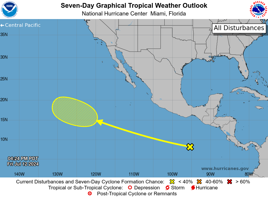
Looking to the eastern Pacific, a tropical wave to the South of Mexico is expected to move to the west/northwest over the next few days. This system is producing disorganized showers/thunderstorms and poses no real threat. If there is any development, it will be slow and will not show progress as the systems moves to the central Pacific basin through next week.

