Happy Friday! Several weather-related topics are going on throughout the country this weekend, including severe weather, extreme heat, and flooding concerns. Heat across the country’s southern half will stick around through the weekend and well into next week, with a large area of high pressure dominating the nation. Other areas will see some rain, and others will see a bunch of rain. Drought concerns are also mentioned as we move through the hot summer. Let’s get into it!
RAINY WEEKEND FOR CAROLINA COAST:
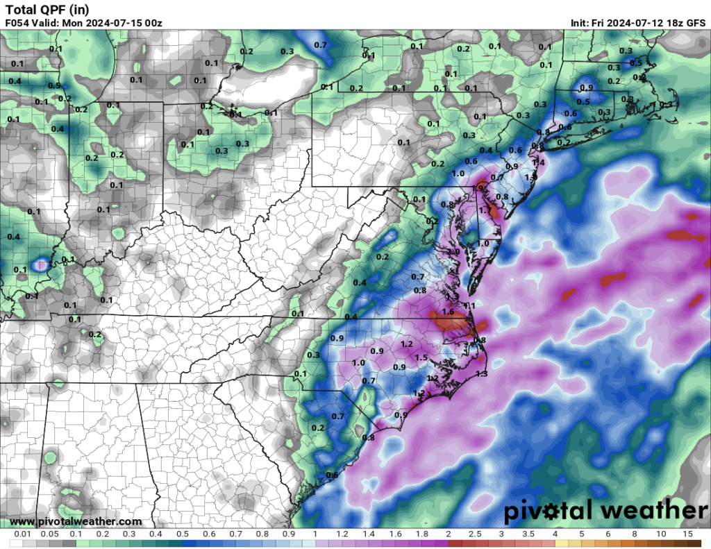
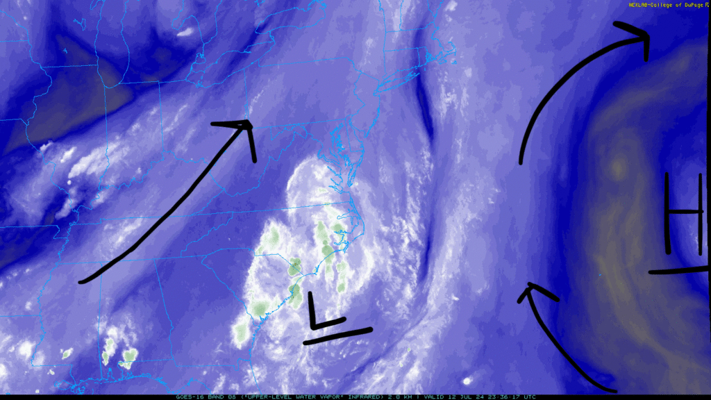
An area of low pressure has positioned itself near the North and South Carolina coastline, producing plenty of disorganized showers/thunderstorms that will keep the area rainy and wet for the weekend. Flash flooding is a concern as heavy rain sweeps the coastline through Sunday.
Areas could see anywhere between a half-inch and 3 inches of rain, depending on how long the system stalls. Flooding will be an issue with this consistent rain, so be cautious if traveling around the area. This system should clear out towards the end of the weekend, so the rain should be gone to start the work week off.
SEVERE WEATHER FOR NORTHERN PLAINS:
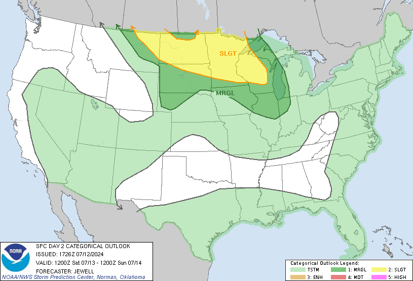
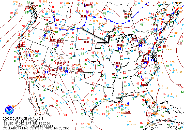
A high-pressure system over the Four Corners region and a broad low-pressure system over southern Canada will create a belt of moderate winds from the northern Rockies to the Great Lakes. This will allow severe weather to enter the plains of the north tomorrow, with the SPC issuing a slight risk (2 out of 5) for the area. The main risk will include multiple clusters of solid or severe thunderstorms that will bring damaging winds and the possibility of hail.
Looking at the timeline of this severe weather event, intense storms are expected from northern Minnesota to Wisconsin, potentially causing solid winds in the morning hours. As temperatures rise in the afternoon, more storms will likely develop, especially along existing weather fronts, focusing on damaging winds and possible hail. Severe weather may continue through the evening, particularly in South Dakota and Nebraska, with strong winds and isolated hail being the main risks.
For the western portion of the slight risk, storms will begin in northeast Montana during evening hours and move into the Dakotas and western Minnesota. These storms might produce hail and strong winds overnight.
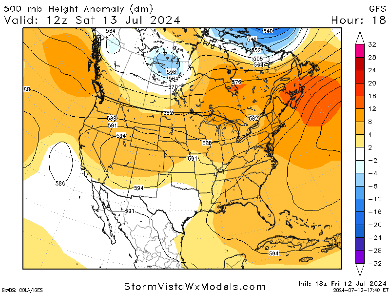
EXTREME HEAT RETURNS TO THE EAST:
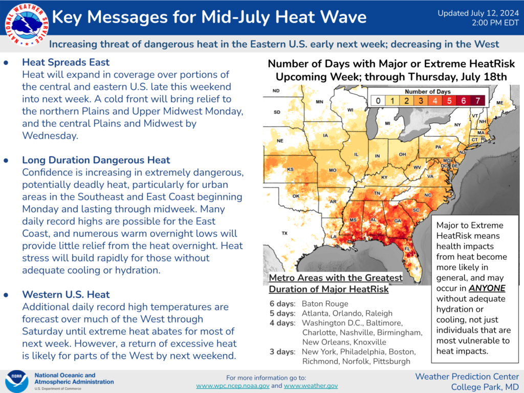

A heat wave is expected to return to the eastern half of the nation this weekend and well into next week. Highs are expected to be in the upper 90s, with some areas hitting the triple digits. Thanks to moisture being pulled inland from the Gulf, heat indices will range around 110F, making the heat even more unbearable.
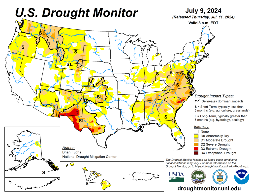
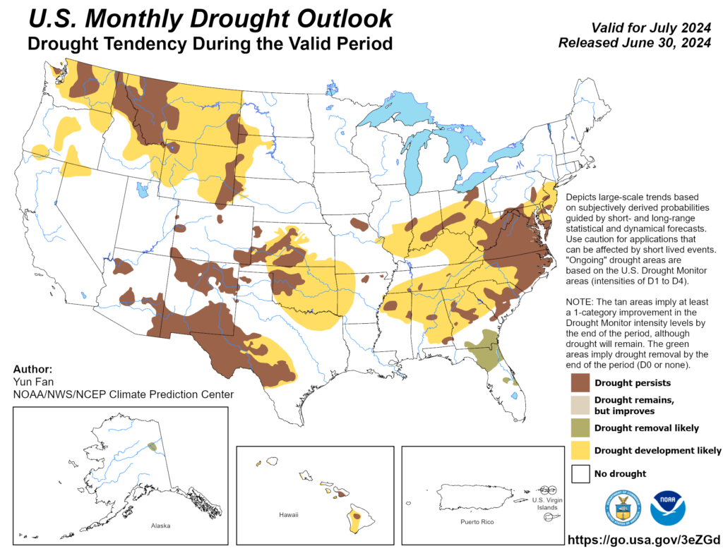
In addition to the extreme heat, certain areas of the US are experiencing drought conditions. The worst parts are in the southwest, with areas in the southeast slowly getting drier with the lack of rain. As we continue into summer, drought conditions will worsen as rain chances decrease. Stay aware and safe during the heat and drought conditions. Stay hydrated and limit work when possible.