Happy Wednesday! We have a range of topics currently affecting the nation to discuss today. Wildfires are causing evacuations out West, mixed with high temperatures, while the eastern half is getting heat with some storms across the region. While there is no chance of severe weather at the moment, there are plenty of storms that could strengthen quickly moving through the southeast. Let’s get into it!
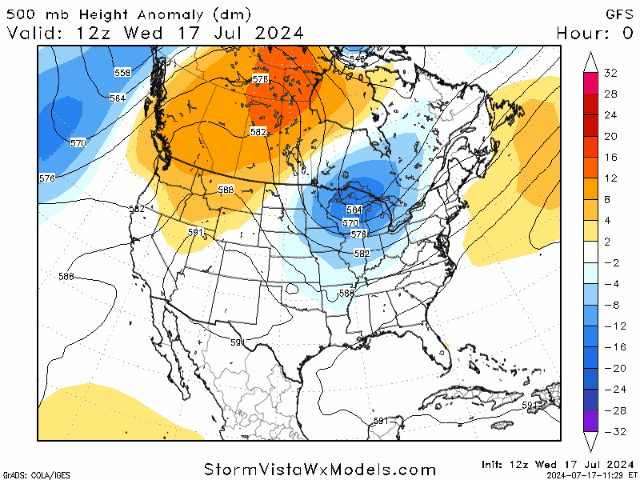
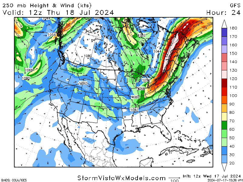
Looking at the upper levels of the atmosphere, a trough is making its way across the eastern half of the US. This is an indicator of the rain seen in the area, along with some slightly cooler temperatures. Comparing the mid-level trough with the jet streak (an upper-level area of fast winds), models of these different variables agree that more shower/storm appearances will occur over the next few days and through the weekend.
However, the conditions out West appear to be drastically different, as a high-pressure ridge is dominating the region. This is allowing for a lack of consistent rain, which is helping to aid the wildfires in the region. Continued high temperatures are also resulting in plenty of heat advisories/warnings in the area.
WILDFIRES OUT WEST:
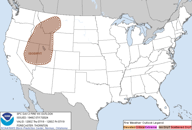

According to the National Interagency Fire Center, 59 large active wildfires are being managed nationwide. The primary states affected include California, Oregon, Washington, Idaho, and Montana. A Red Flag Warning, which means that critical fire weather conditions are either occurring now or will shortly, is in effect for the majority of Washington and in parts of Oregon and Idaho.
Factors potentially affecting the fire conditions include gusty and erratic winds, which are possible with any thunderstorms that develop, and a high-level Haines of 6, which is high. The Haines index is a fire weather index measuring the potential for wildfires to grow into large fires. A ranking of 6 means significantly dry and unstable conditions exist.
As these fires affect the West, we will update you on their movement and what will come next.
EASTERN RAIN CHANCES AND COOLDOWN
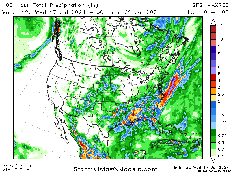
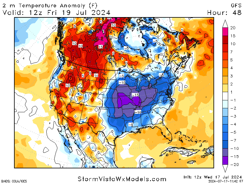
While the western half of the United States is experiencing fires and heat, the eastern half sees the opposite. Rain is expected for most of the area, with the southeast seeing the most, with a potential of 3-4 inches in some areas. Most storms should occur from Thursday through the weekend with a cold front in the area.
Temperatures are also expected to cool down with the incoming cold front, with some spots seeing 15 degrees below usual. Thanks to humidity, sunlight, and other factors, most areas will not experience that drastic a cooldown. Highs should stay below 90 through the weekend. This is a great relief for us as we rarely get a relaxed break like this in the middle of the summer.


