July has certainly gotten off to an interesting start as we’re tracking a category 5 hurricane in the Caribbean Sea with winds of 160 mph! Furthermore, high pressure is currently dominating the southern United States, leading to above average temperatures for states like Texas, Louisiana, Mississippi, and Alabama. Finally, we do have some storm chances for the central U.S. on Wednesday and Thursday.
Latest On Beryl
I figured we’d start with a tropical update since we’re tired of hearing about the heat over and over again.
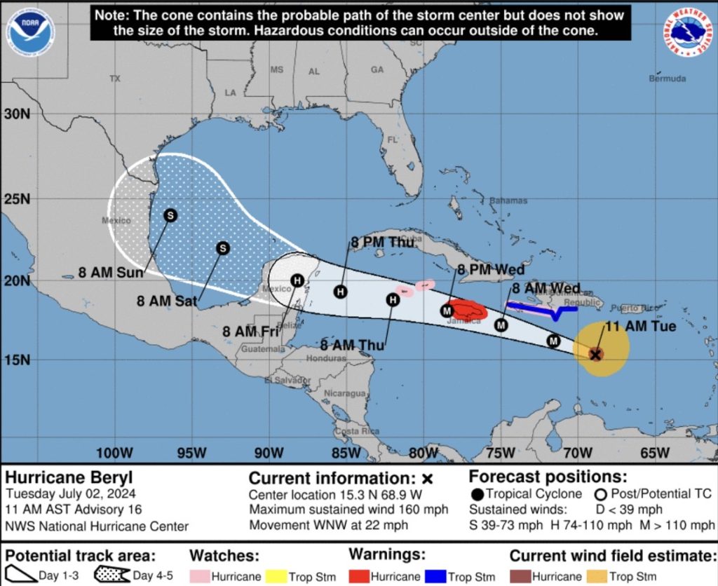
Well, Beryl has been a category 5 hurricane all night now and as of this morning, winds are at 160 mph with a pressure of 938mb. Beryl is the strongest July Atlantic hurricane on record (Previous: Emily in 2005 w/ 160 mph) and is also the earliest category 5 hurricane in the Atlantic basin.
Yesterday, Hurricane Beryl officially made landfall on Carriacou Island (Grenada) as a high end category 4 storm. The system now has continued to track off to the west-northwest and is forecasted to impact Jamaica on Wednesday. The island could very well take a direct hit from a major hurricane, so the National Hurricane Center (NHC) has issued a Hurricane Warning for Jamaica and a Hurricane Watch for the Cayman Islands.
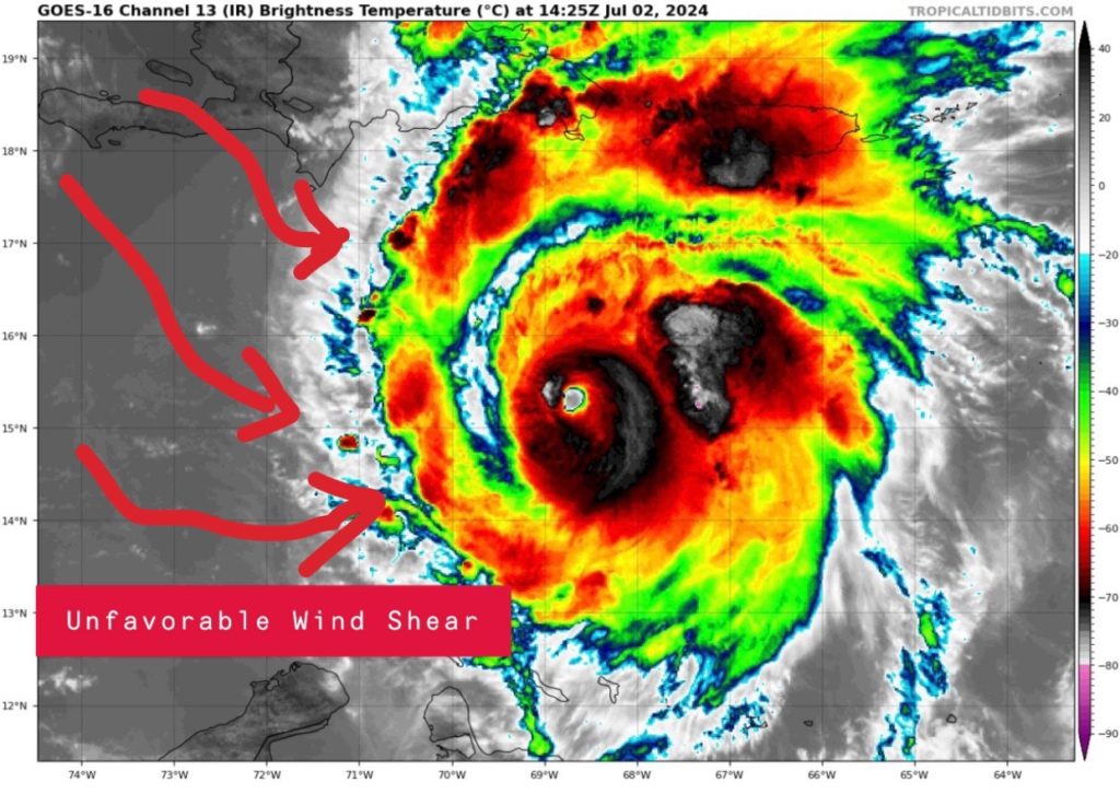
Wind shear off to the west is going to begin to weaken the hurricane starting today, so the intensity will gradually decrease over the next few days. Impacts will still be felt down the line, but the storm has likely peaked in intensity last night.
After that, the system is forecasted to move into the western Caribbean towards the Yucatan. This is where models begin to disagree as we have two possible scenarios:
Option 1: Beryl makes landfall further south of the Yucatan Peninsula which allows it to weaken substantially and leave a narrower window for U.S. impacts.
Option 2: Beryl makes landfall on the northern side of the peninsula which only allows it to weaken a little and has a greater chance to impacts the U.S.
As of now, most of the models take Beryl into the SW Gulf this weekend and have landfall near Mexico or Texas early next week as a strong tropical storm or weak hurricane. It’s still too far out to tell, so continue to check the latest forecast posted here.
Southern U.S. Heat Continues
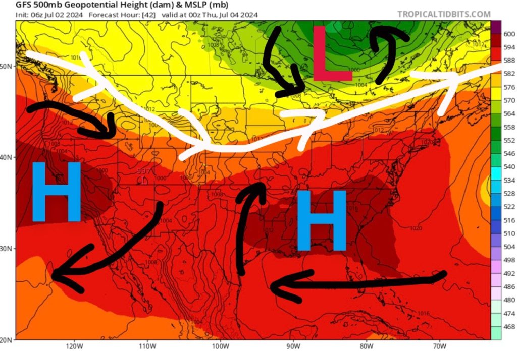
Unfortunately, we’ve been stuck in this weather pattern of high pressure dominating the southern half of the United States, leading to above average temperatures and below average precipitation. High pressure is going to continue to build in across portions of Texas, Louisiana, Mississippi, and Alabama, so the heat isn’t going away for the rest of the week.
High temperatures are forecasted to be in the 90s and maybe some triple digits with heat index values above 110F in some locations. Be sure to drink plenty of water and avoid time outside! The heat will be focused more across the southeast as the area of high pressure shifts east.
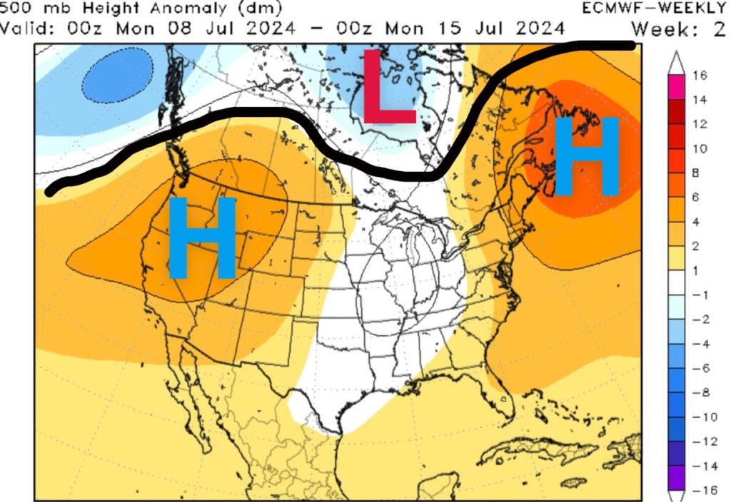
A pattern change next week could help keep temperatures closer to average as the heat will be more dominate across the southwest U.S. and eastern Canada.
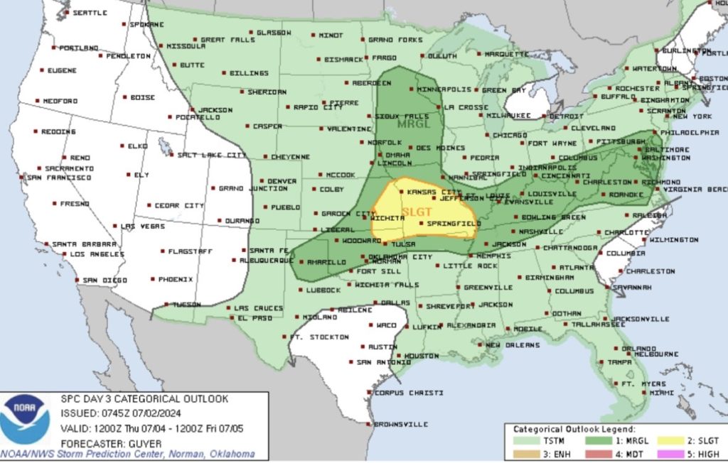
Severe Weather for Wednesday & Thursday
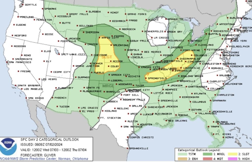
For Wednesday, severe thunderstorms are likely across Midwest/Ohio Valley as well as the central Plains.
Across the Ohio Valley, a shortwave trough is forecasted to move across the Great Lakes, leaving an opportunity for showers and thunderstorms ahead of a cold front from Columbus, OH to Springfield, MO. The main threat would be damaging winds as the Storm Prediction Center has issued a slight risk (Level “2” out of 5) for the region.
In the central and high Plains a mid/upper-level trough is forecasted to move over the northern Rockies, leaving the opportunity for severe weather mid to late Wednesday afternoon. Hail and strong wind gusts are possible though a tornado risk may also exist near the surface trough across the central High Plains. Low-level shear will be more favorable for initial supercells early Wednesday afternoon.


Thanks Nick, I’m from Hattiesburg. We recently got caught in the gulf during last Sunday thunderstorms, so I’m trying to educate myself on weather patterns, etc. I’m enjoying your information. Joey