The Atlantic is still very quiet as we near August. With a couple of tropical waves to discuss, it is just a waiting game to see when any development will occur. Looking at the Pacific, Tropical Storm Bud has formed along with another area of interest to discuss.
QUIET ATLANTIC BASIN…FOR NOW:
The National Hurricane Center is not identifying any areas of interest for development now, but this doesn’t mean nothing is happening. I want to look at three spots showing little potential for being our next topic this season. Please keep in mind that if any development occurs in these areas, it will not happen until late next week, so there is no chance of tropical impact over the next few days and through this weekend.
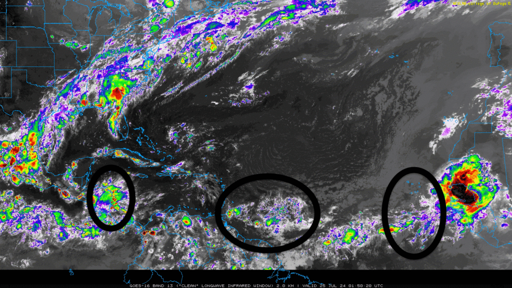
The first area in the western Caribbean Sea is a broad area of low pressure that is currently experiencing high wind shear, which is hindering any further development. It is expected to move into the Gulf of Mexico and is the area with the most promise for development, which should not happen until late next week.
The second area is a tropical wave in the central Atlantic facing dry air and dust from the Saharan desert, limiting any development. As this wave moves westward, environmental conditions are expected to become more favorable for development.
The third area is a tropical wave located off the coast of Africa, which shows signs of potential organization. Warm sea temperatures and moderate amounts of shear allow this system to organize, but development will be gradual and pose no threat to us for a while.
A solid subtropical ridge dominates the Atlantic Basin, helping steer tropical waves more to the west and setting the stage for potential development. While these areas are not “officially on the radar,” I figured it was necessary to point them out to show that things always happen in the ocean, even when we think there is not.
TROPICAL STORM BUD:
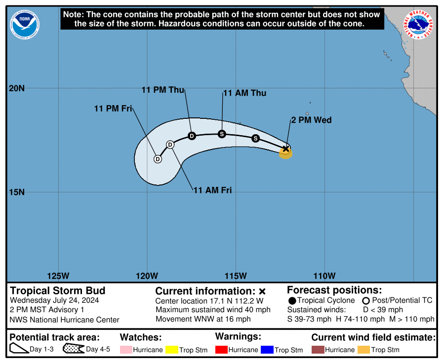
Tropical Storm Bud became official after becoming much more organized in the past 12 hours and developing into a well-defined cyclone. Bud is currently moving west-northwest. A high-pressure system to the north will gradually turn Bud westward the next day. By Friday, as Bud weakens, it will slow down and shift southwest, following the low-level winds.
Bud is in a generally favorable environment with warm sea surface temperatures and moderately moist air. However, it is experiencing some easterly wind shear, which might limit its strengthening. While no significant strength change is expected the next day, slight intensification is possible. After about 36 hours, Bud will move over cooler waters and encounter drier air and stronger wind shear, leading to gradual weakening. The forecast predicts that Bud will become a remnant low on Friday and dissipate by Saturday.
ANOTHE PACIFIC AREA OF INTEREST:
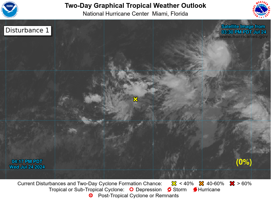
Aside from Tropical Storm Bud, there is another disturbance in the Pacific. A tropical wave more than 1,000 miles southwest of the southern tip of the Baja California Peninsula is causing scattered showers and thunderstorms. However, it’s not likely to develop into a stronger system over the next few days as it moves westward to west-northwestward at 10 to 15 mph across the western part of the ocean.


