Good evening, everyone! We have two areas to talk about with one in the Atlantic and one in the Pacific. As of now, both areas have a low chance of development, however, conditions look slightly more favorable in both the Atlantic and eastern Pacific as we get towards the middle of next week.
Current Look At the Tropics
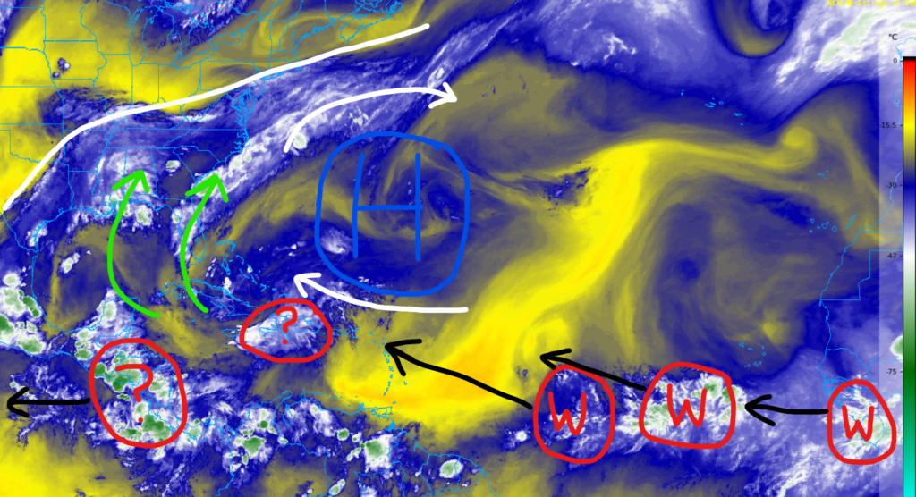
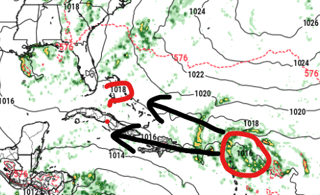
Across the Caribbean and Gulf, there is a weak area of showers and thunderstorms over Hispaniola that should continue to dissipate over the next day or two.
Over the southeast CONUS, strong southwestly flow has continued to pump in Gulf moisture, bringing heavy rain from the Texas coastline to Florida.
Finally, showers and thunderstorms over Central America will slowly move off to the west over the coming days, bringing heavy rain and flash flooding to the region.
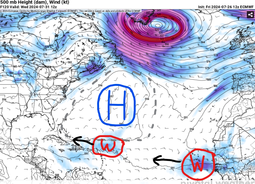
Looking into the future, we have a few potential waves moving west across the open Atlantic, according to the European model by the middle of next week. Both look fairly weak at the moment, but we’ll continue to monitor the latest trends.
Next Named Storm?
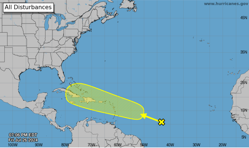
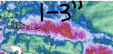
The NHC is monitoring the wave east of the Lesser Antilles for possible development next week. As of this evening, it only has a low (20%) chance of formation as this area tracks off towards the west-northwest. Locations such as the Leeward Islands, Puerto Rico, and Hispaniola should monitor this wave as heavy rain and gusty winds are possible early to mid next week. 1-3″ of rain for the islands could cause flash flooding, especially near the mountains in Puerto Rico and Hispaniola.
The overall track of this area of interest (AOI) will determine if it has the potential to form into a tropical storm or not.
A more southern track would track the circulation directly over the islands and disrupt the structure of the system because of the taller mountains. This would lead to a weaker storm.
A more northern track would avoid most of the islands and keep the circulation over open waters, allowing for a better chance to organize into a named storm. The next name on the list is Debby.
In the Pacific
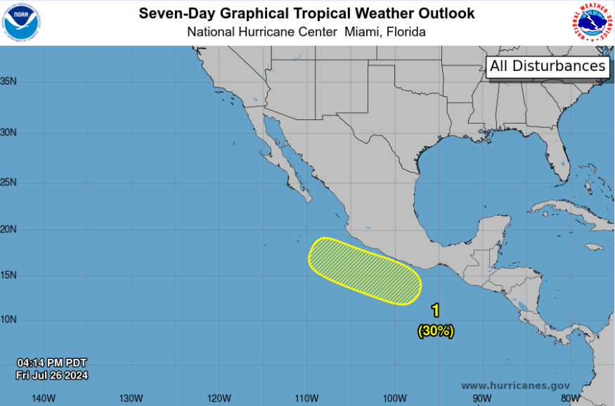
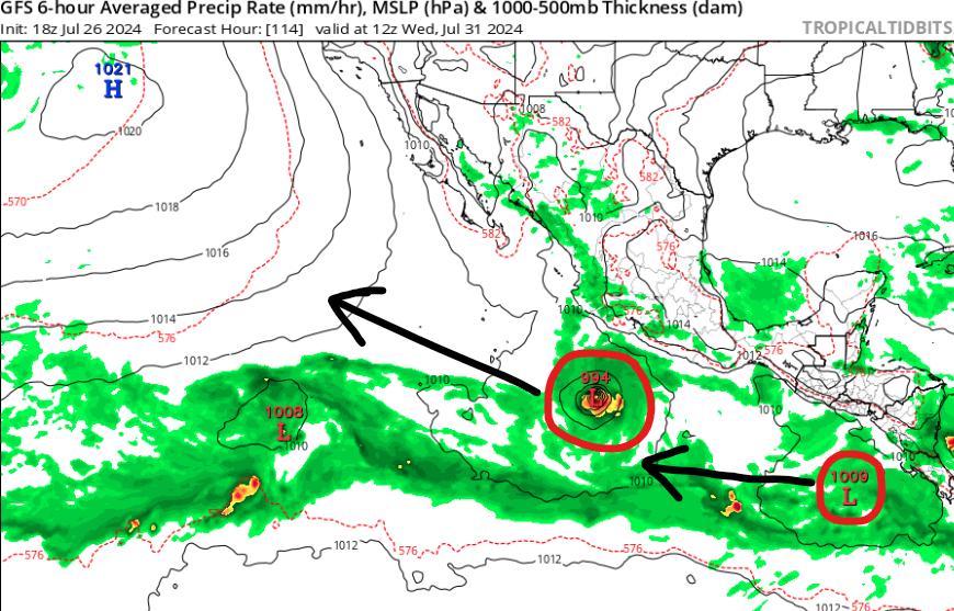
We have a new area of interest across the eastern Pacific as the NHC is giving this a low (30%) chance of development over the next seven days. However, conditions look more favorable in this region as we head into next week, so models are hinting at a tropical storm forming out of this. The next name on the list is Carlotta.
More tropical systems are possible late next week with conditions still favorable for formation across the eastern Pacific. As of now, models keep everything over open waters, but rip currents could be a concern for southern Mexico and Baja next week. If you’re going here for vacation, make sure to stay up to date with the latest forecast in case conditions are too rough to swim.


