Our active summer pattern continues as heat continues across the Southwest and storms hit the saturated Northeast. This pattern is due to the ridge located around the four corners region and the upper low over Hudson Bay that is helping promote troughing across the Eastern US. This common pattern is expected to persist over the next week meaning we should continue to see these impacts for the next several days.

Heating Across the Southwest
Due to the ridge that is present across the region, Heat continues to build with little in relief. The dome of high pressure is working to trap heat near the surface and insulate the ground which is working to reduce the effects of radiative cooling (night time cooling). So when temperatures soar into the upper 90s and low 100s they aren’t able to return to cooler temperatures due to not having anywhere to escape too. Heat indices are also high across the region with values of 105 – 110 being particularly widespread. Finally, winds are expected to be rather breezy across the region which will lead to an elevated fire risk particularly in Nevada and Idaho.

While the heat is oppressive, some relief in the form of monsoon rains can be seen due to the southerly flow being experienced across Arizona and New Mexico. These areas will see isolated showers and thunderstorms which will bring relief to the region. It’s important to remember that not everyone will see relief as not ever location will be impacting by a shower or thunderstorm.

Storms Across New England
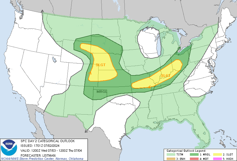
New England continues to be saturated this week as multiple rounds of rain make their way across the region. Today’s rain will accompany a sever risk for damaging winds, isolated tornados, and damaging hail. Additionally, flooding will remain a concern as waterways remain high and soils remain saturated. This rain is working to keep the region cooler then average, but I am sure our friends in New England are hoping for some dry sunny skies here soon.

Extended Outlook
This pattern is fairly common this time and year and is prone to sticking around, and this set up is no exception. For the next week, we can expect largely similar conditions to continue with heat in the Southwest and storms in the Northeast. Some models runs are even hinting at an upper low becoming lodged under the higher which could promote it to amplify and remain in place even longer, but uncertainty still remains. Regardless, until we can move this ridge in our West conditions should remain the same.

Travel Outlook
Have multiple ways to receive weather warnings is advised, especially when your route takes you through these areas where storms are possible. Delays and cancellations due to weather are most likely in the Northeast where storms are expected to be most severe. Elsewhere, travel throughout the rest of the country will be largely unaffected.
Conclusion
Severe thunderstorms will be a concern for several in the Midwest and Eastern US today and tomorrow as a potent disturbance makes its way through the region, bringing the risk for hail, damaging winds, and even tornadoes. Further specific information can be found at the Storm Prediction Center’s website, or on your local news station or local National Weather Service office. Elsewhere, searing heat will continue to bake the western half of the country over the next week and monsoon rains will pour over the Four Corners region. This trend looks to continue over the long-term, as high pressure will remain rooted in the west and any organized storm chances will remain off in the north and eastern US.

