Happy 4th of July-eve everyone! We have plenty to discuss this evening, including monitoring Hurricane Beryl, severe weather threats, and a new weather pattern for the southeast that may slightly lower the above-average temperatures that have been recorded over the past several days. Let’s get into it!
LATEST ON BERYL:
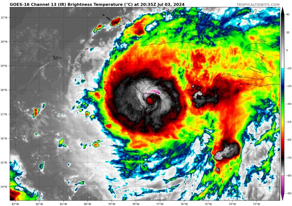
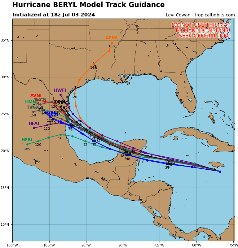
Hurricane Beryl brushed the south end of Jamaica this afternoon. The island is facing devastating winds, heavy rainfall, and life-threatening storm surge as Beryl continues on its path. Looking further up its path, Beryl is expected to weaken from major hurricane status as wind shear from the west is trying to limit any chance of further enhancement. The next area expected for landfall in the Yucatan Peninsula early Friday morning, where Beryl should lose plenty of strength from lack of warm ocean waters for energy.
Once moving back into the Gulf, Beryl may be able to intensify to Cat 1 status before making landfall in Mexico or the southern tip of Texas, but could remain as a very strong tropical storm as well. It all depends on how much Beryl decides to weaken affect hitting Yucatan. Majority of the models are in agreement on this final landfall location, but it is still early to know for sure. We will continue to keep you updated.
4TH OF JULY SPC OUTLOOK:
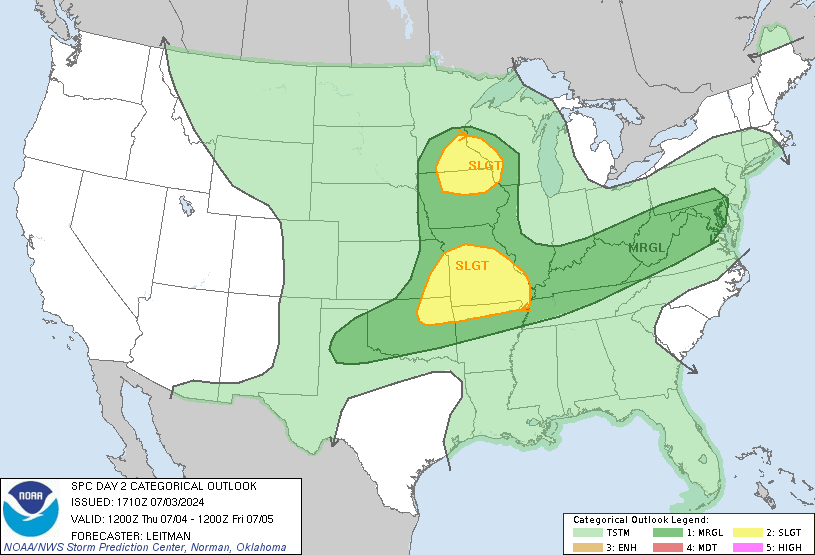
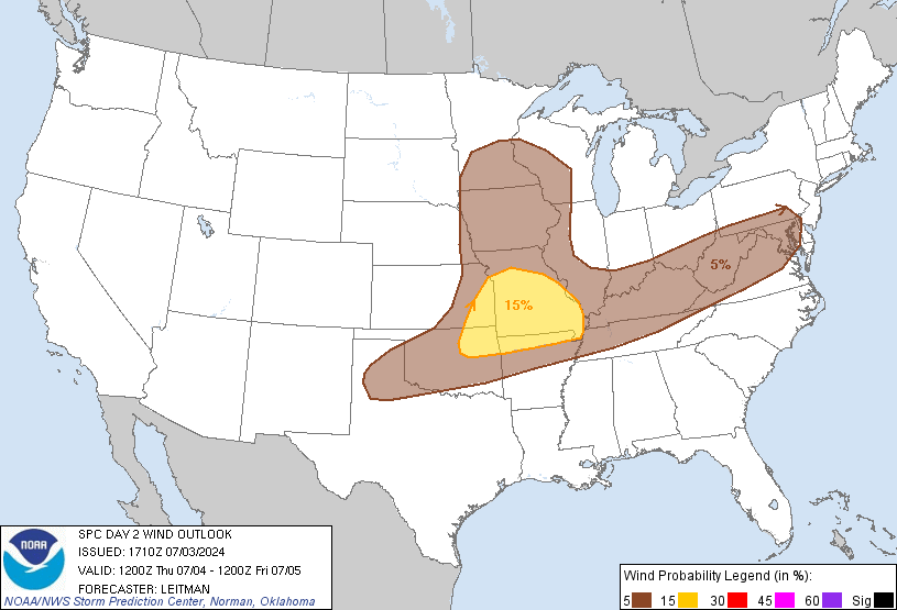
Unfortunately for some, there is a chance of sever weather that may cause a change in your 4th of July plans. A slight risk (2 out of 5) for severe weather has been issued for Missouri and some of the surrounding states, and a little to the north in the Iowa/Minnesota/Wisconsin corner. There is an additional marginal risk (1 out of 5) surrounding the slight risk and stretching all the way to the east coast
For the Missouri area, a weak weather system will move east across the area in the afternoon and early evening. A cold front will stretch from western Minnesota to eastern Nebraska by midday. The moist air ahead of this front, along with warming temperatures, will help create conditions for thunderstorms in the afternoon. These storms could become organized and might include a few severe thunderstorms with hail up to 1.75 inches in diameter and strong wind gusts
For the Lower Mississippi Valley, thunderstorms from Wednesday night might continue into Thursday morning. Despite weak wind shear and limited heating due to clouds and rain, the very moist air will allow for pockets of stronger heating, leading to thunderstorms with strong gusts of wind. As the cold front moves into northern Oklahoma and northwest Missouri by the afternoon, more thunderstorms are expected over Missouri and Oklahoma. These storms could become organized, bringing strong to damaging wind gusts and possibly hail. There could also be isolated strong thunderstorms in parts of western and central Oklahoma and the Texas Panhandle.
NEW WEATHER PATTERN OVER THE WEEKEND:
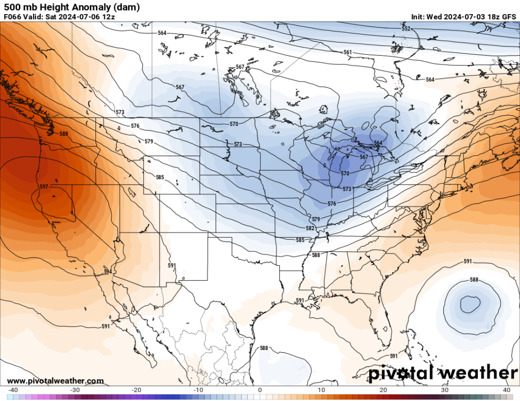
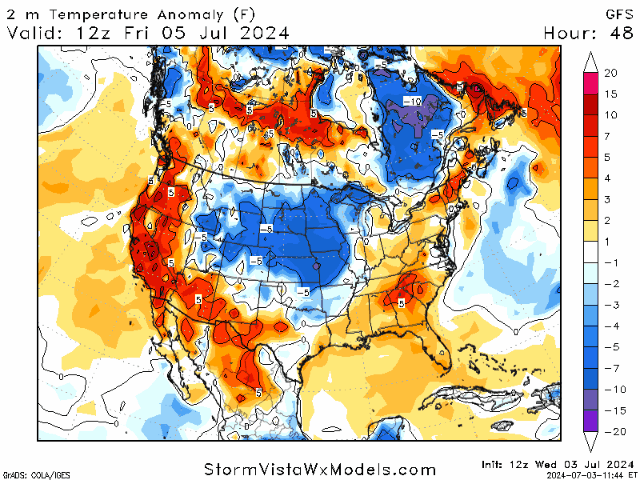
There is a high chance that we will finally get a new weather pattern down in the southeast this weekend as the high-pressure ridge that has been dominating the region finally starts to shift eastward, allowing a trough to push its way into the area. This trough is expected to bring in a cold front that will dip down into Mississippi before stalling out into a stationary front.
Some good news to go along with this trough is the potential for a cool down in areas that have been getting hammered by extreme heat like Mississippi, Alabama, Louisiana, etc. Areas in the central Great Plains will continue to experience some heat relief thanks to this new weather pattern.
No matter what plans you have for the 4th, please be aware of the heat/rain and take precautions as you celebrate. Have a safe and happy 4th of July!


