The Atlantic seems to be trying to ramp back up with a promising tropical wave near the Leeward Islands /Puerto Rico that has made some big shifts since they first “officially” started monitoring it. Looking to the Pacific, Tropical Storm Carlotta has been named along with two other ares of interest. Let’s get into it!
ATLANTIC BASIN:
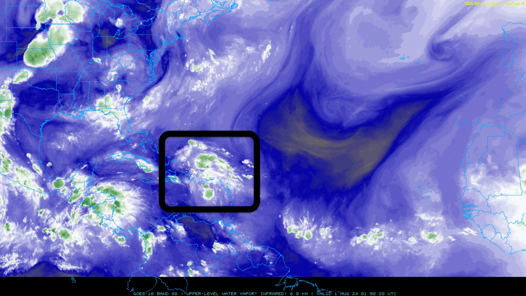
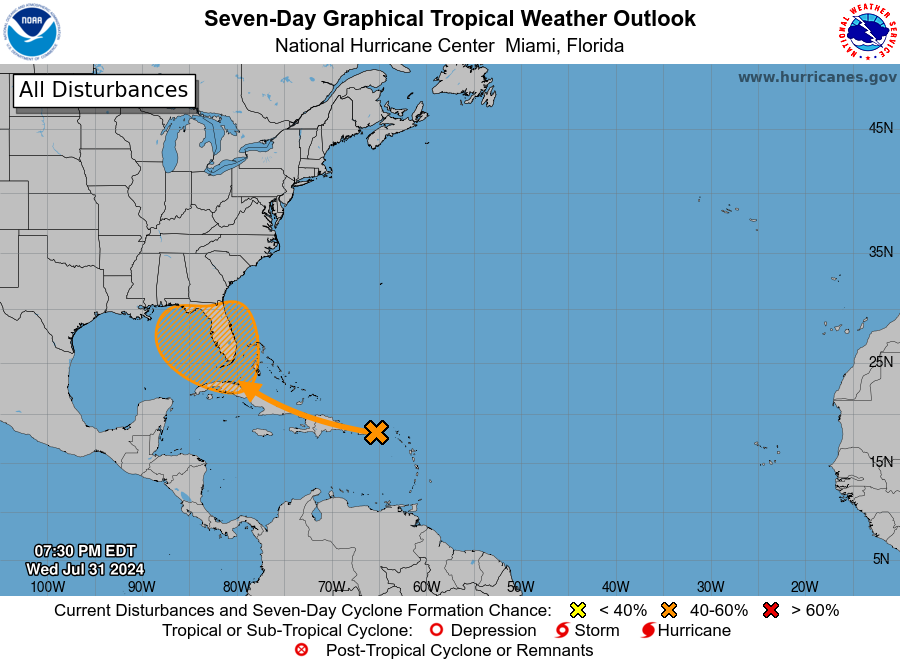
The tropical wave is currently producing showers and thunderstorms that are scattered and not well-organized at this time. As this system moves west-northwest over the next few days, it is not expected to develop into a stronger storm over the Greater Antilles.
Conditions are expected to become more favorable for development after it passes the Greater Antilles. There is a chance it could form into a tropical depression this weekend or early next week as it moves over the eastern Gulf of Mexico or the far southwestern Atlantic, which includes areas near Florida. People in the Greater Antilles, the Bahamas, and Florida should monitor this system’s progress and stay updated for any changes or developments.
In the most recent NHC cycle, the system showed a westward shift into the Gulf of Mexico under certain conditions. Land interaction would likely keep the wave weak. The system will still be fragile and organized if the low tracks from Cuba to Florida. If the low tracks are more east or westward, the intensity could increase.
The most important thing to do is to keep an eye out for the trends. With the gradual development expected in this tropical wave, take steps to ensure your safety as US impact seems to be likely with this system. The strength and more accurate impact region will be determined as the wave moves closer.
PACIFIC BASIN:
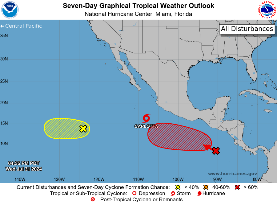
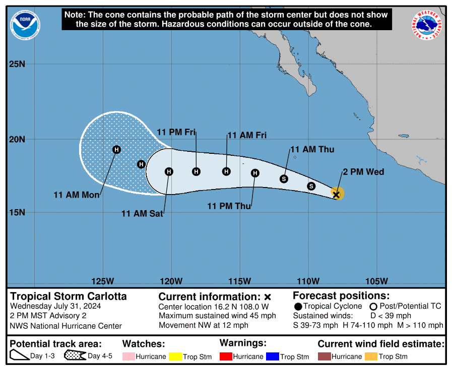
The Pacific basin picked up the slack with three different areas of inspection. The first one is Tropical Storm Carlotta. Carlotta is expected to become a hurricane by Thursday night. While there is no chance for land impact right now, there is nothing much to discuss besides the pathway more profound into the Pacific.
The other two areas include a system with an 80% chance of development and a low with a 20% chance. The 80% area is causing some scattered rain and thunderstorms. This system is expected to develop into a tropical depression by the weekend. It will move westward and offshore from Mexico at about 10 to 15 mph. The second area is not expected to do much, with a 20% chance of further development as it moves further out into the Pacific.


