Happy Wednesday! The country is quite busy with several different weather events affecting different regions. The Southeast is experiencing another heat wave, with areas reaching record-breaking temperatures. The Midwest is dealing with more severe weather threats, and the western U.S. is facing a combination of extreme heat, ongoing wildfires, and severe drought. Let’s get into the details!
SOUTHEASTERN HEAT WAVE:
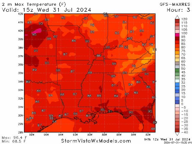
A severe heat wave affects the Southeast U.S., resulting in dangerously high temperatures and high humidity levels. This heat wave is expected to persist for several days.
A high-pressure system is centered over the Southeast, leading to clear skies and intense sunlight. This system also causes subsidence (sinking air), which inhibits cloud formation and promotes warming. Light winds are failing to provide relief, allowing temperatures to rise significantly. Daily highs will range from the upper 90s to the mid 100s, with some areas reaching up to 110°F. High humidity levels are making the air feel hotter than the actual temperature. The “experienced” temperatures, which combine the heat, humidity, sun, and wind, are expected to range from 105-110°F and even higher in some areas.
With heat to this degree, it is essential to prioritize safety. Stay hydrated by drinking plenty of water, Avoid outdoor activities during the hottest parts of the day (midday and afternoon), and take plenty of breaks if working outside is mandatory. Prolonged exposure to these temperatures can lead to heat exhaustion or heat stroke, so please be aware of the signs of heat-related illnesses and take immediate action if symptoms appear.
This heat wave is expected to continue for several days. Cooler temperatures may arrive later in the week as a cold front moves in, but the exact timing and impact are still uncertain.
SEVERE WEATHER IN THE MIDWEST:
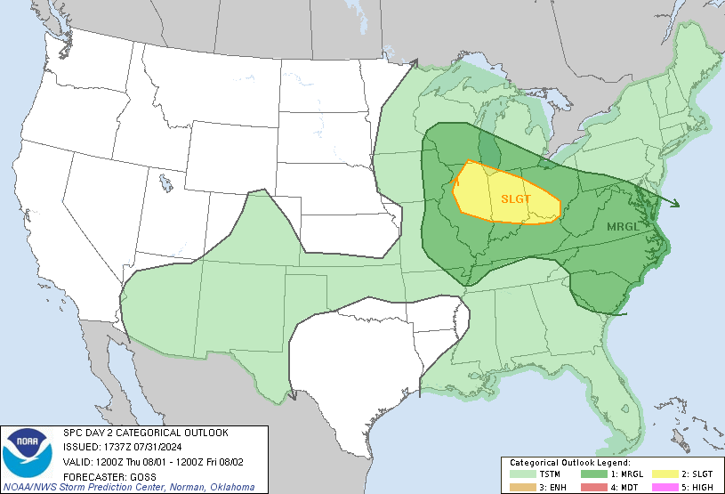
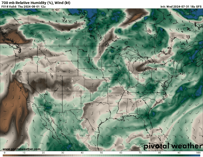
A weather system is moving from the central and southern U.S. towards the Upper Midwest and will shift slightly southeast as it moves across the Upper Great Lakes and Ohio Valley by Thursday and Friday morning. On the ground, this system will create a weak low-pressure area moving Southeast across the Ohio Valley, causing widespread showers and thunderstorms, some of which may be severe. A slight risk (2 of 5) for severe weather has been issued for the Midwest/Ohio Valley, while a marginal risk (1 of 5) extends to the Carolinas.
For the Midwest/Ohio Vally region, thunderstorms are expected in Illinois early Thursday and may continue throughout the day as they move Southeast. These storms might weaken as the day passes, but new storms will likely form in the afternoon. With moderate wind speeds in the mid-levels of the atmosphere, these storms could become organized and move eastward across the Ohio Valley in the evening. There’s a risk of large hail and damaging wind gusts, but the exact severity is uncertain due to the effects of the morning storms. More detailed forecasts will be provided as the situation becomes more evident.
For the Mid-Atlantic/Carolinas region, scattered thunderstorms are expected to develop in the afternoon as the area heats up and becomes more humid. While the wind at lower levels will be weak, and no significant weather system is pushing these storms, mid-level winds will support a few intense storms capable of producing damaging winds and hail.
WESTERN HEAT, FIRES, AND DROUGHTS:

The western U.S. is experiencing a mix of weather conditions, with a notable focus on wildfire activity and heat. The region is experiencing high temperatures, with many areas forecasted to reach above 100°F. For instance, places like Phoenix, Arizona, and Las Vegas, Nevada, are seeing temperatures soar well into the triple digits. This extreme heat is exacerbating drought conditions and increasing the fire risk.
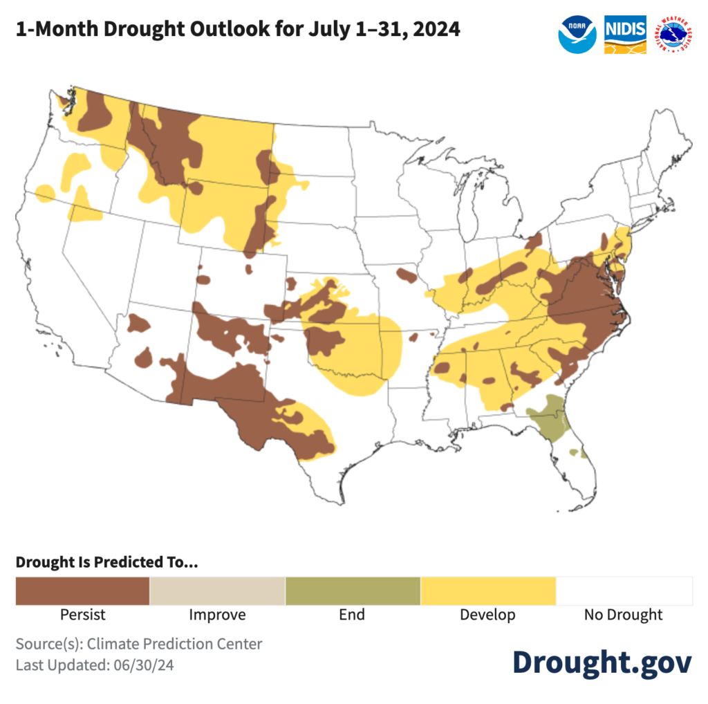
There are 95 large active wildfires across the country, with many concentrated in the western U.S. These fires have burned over 2 million acres. Oregon, Washington, Nevada, southern Idaho, Utah, and California are the most affected areas. Efforts to contain these fires are ongoing, but extreme fire behavior and dry conditions pose significant challenges. Along with wildfires, drought conditions persist in much of the region. The lack of precipitation and high temperatures lead to dry fuels, which contribute to the spread of wildfires. These two factors go hand-in-hand with each other.
Like in the East, the West is expected to remain hot and mostly dry. Some areas may see isolated thunderstorms, but these are not likely to bring significant relief from the heat or drought.


