Hurricane Ernesto continues to get closer to Bermuda as the latest observations have it at 90 mph with a pressure of 969 mb. Impacts on the island will be the worst tonight into tomorrow as Ernesto passes overhead. Besides that, we are watching three areas of interest in the Eastern Pacific that have a low, medium, and high chance of development next week. Finally, we’ll touch on what’s to come in the Atlantic for the rest of the month.
Current Look At the Tropics
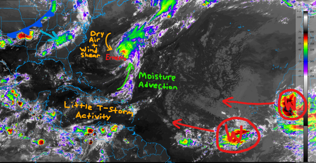
Across the Caribbean and Gulf, convection is limited tonight with little thunderstorm activity. Hurricane Ernesto’s outflow is causing some wind shear across the northern Caribbean and in the Gulf, a cold front is forecasted to move through this weekend.
A shortwave trough associated with the front will help keep Ernesto out to sea once it moves over Bermuda tonight.
Finally, we have two new waves near the coast of Africa which are forecasted to move west over the next few days.
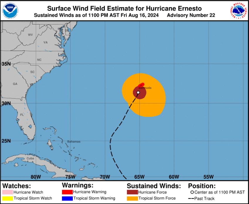
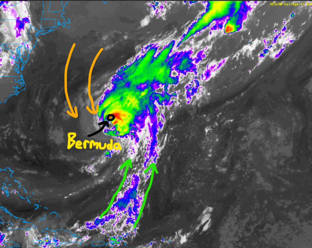
The latest with Hurricane Ernesto shows how large of a system it is with tropical storm force winds extending out a couple hundred miles away from the center. Hurricane-force winds (>= 74 mph) are likely for the entire island of Bermuda tonight into tomorrow as a hurricane warning is in effect.
Currently, the system is slowly weakening due to some dry air and wind shear on the west side of the storm. Also, sea surface temperatures aren’t as warm in this part of the Atlantic, so Ernesto will continue to weaken over the next couple of days.
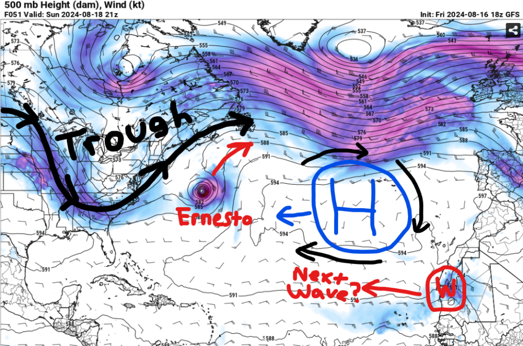
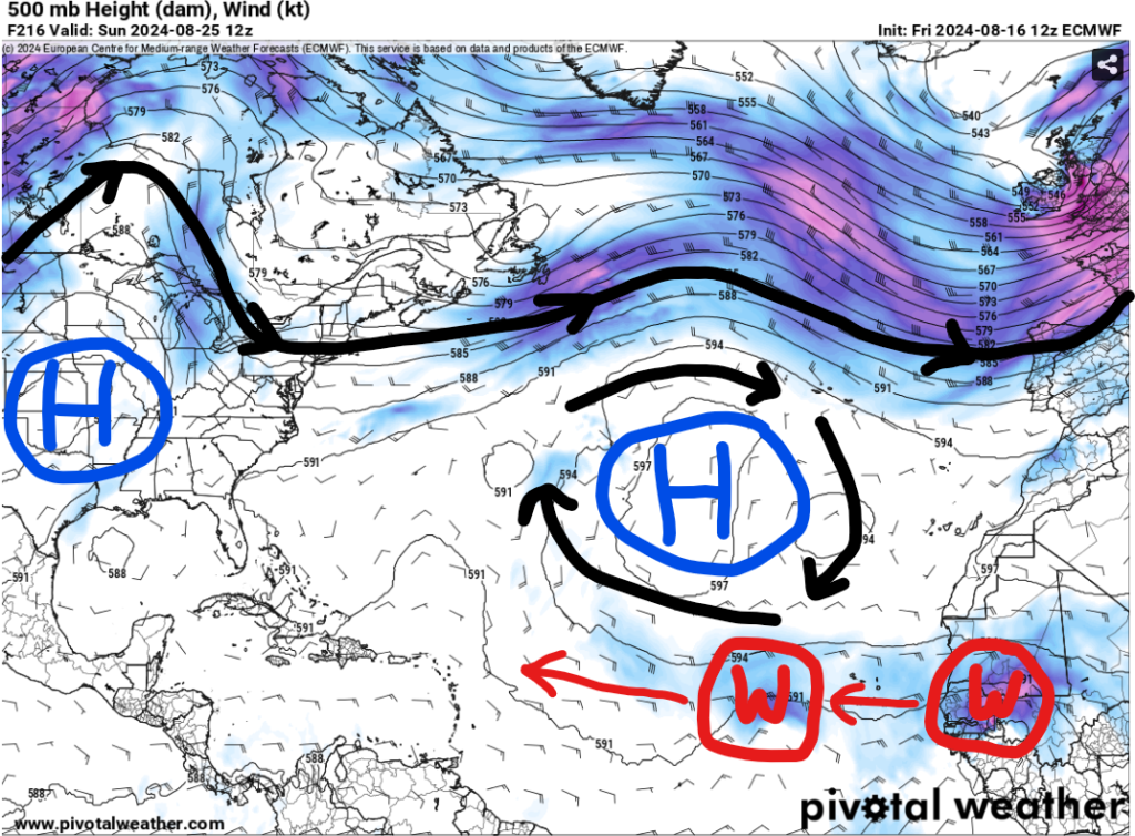
Late this weekend, Ernesto will continue to accelerate off to the north-northeast as it gets picked up by that trough over the east coast. Other than that, high pressure over the Atlantic will likely strengthen as we get towards next week, so any waves that do develop will move off to the west.
Some models do hint at a wave coming off the coast of Africa by the start of next week, however, dry air in the Atlantic could limit development with that, so don’t be surprised if we don’t have a new named storm for a least a week.
Model Guidance
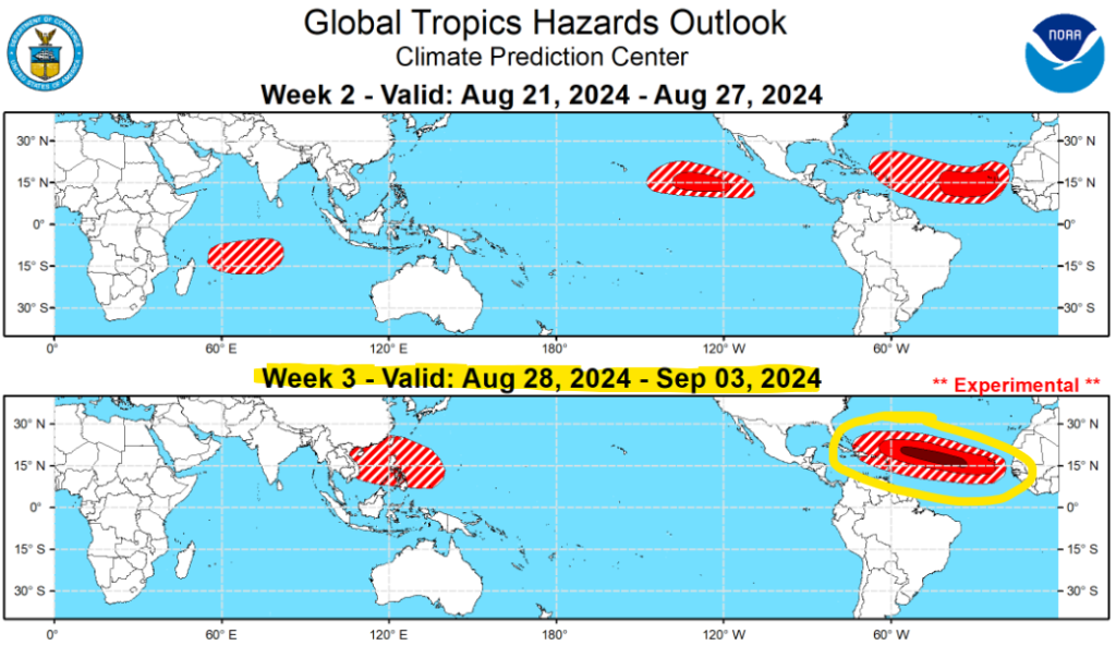
Even if things are quiet next week, the Climate Prediction Center does like the last week of August for some sort of development. This would likely be one of those waves off of Africa moving into the open Atlantic, so I’d recommend paying closer attention to the forecasts as we get towards September.
Any U.S. impacts with anything will heavily depend on the Bermuda high. A stronger high pressure could steer a storm further west, but a weaker high would open up the opportunity for a “fish storm”. Regardless, we have plenty of time to watch things, so continue to check back with the latest forecast.
In the Pacific
In the Pacific, we have three areas to look at.
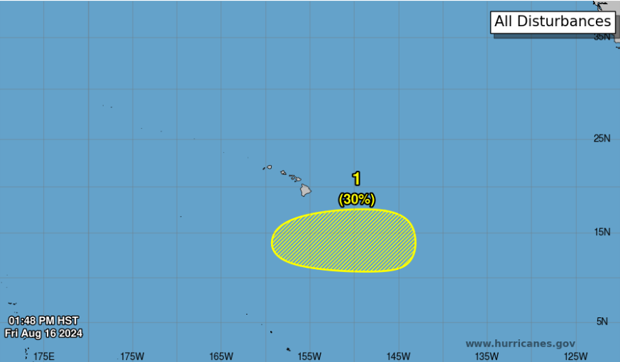
First, a disorganized area of showers and thunderstorms currently sits south of Hawaii with a small window open for development. The National Hurricane Center gives it a low (30%) chance of formation over the next few days. This could bring increased cloud cover and possibly a rain shower to the southern islands, so if you’re on vacation in Hawaii I’d recommend checking the NHC this weekend for any minor changes.
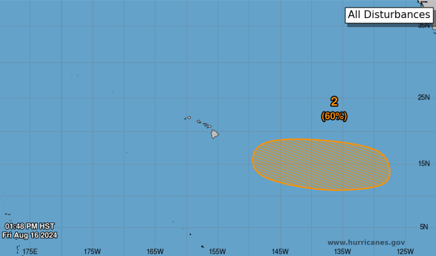
Second, another area of showers and thunderstorms is a couple hundred miles east of Hawaii. The NHC gives this a medium (60%) chance of formation over the next seven days. Similarly, if there were impacts from this later next week, it would be for the southernmost islands with some increased cloud cover and rain showers.
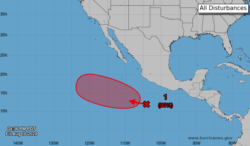
Finally, a more defined area of showers and thunderstorms is currently a couple hundred miles south of the southern Mexcian coastline. The NHC gives this a high (80%) chance of development over the next few days as it moves off to the west-northwest. The next name of the list is Gilma.


