Good Friday evening, everyone! I hope you all had an amazing workweek. Heading into next week, a large troughing pattern will move in for the eastern half of the country, allowing some of us to get a break from this summertime heat. Unfortunately, this is not the case out West as ridging will dominate and continue to bring above-average temperatures. Overall, this pattern across the U.S. typically limits precipitation, so don’t be surprised if your area stays dry for at least a couple of days in a row.
Weekend Setup
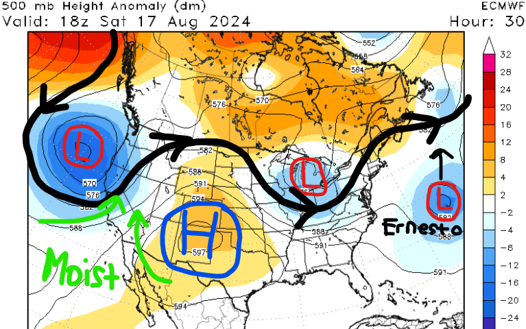
For this weekend, a shortwave trough will continue to move through the eastern CONUS, bringing showers and thunderstorms to many. Further west, ridging is going to continue to get stronger, resulting in a hot pattern for millions next week. Finally, Hurricane Ernesto is forecasted to make landfall in Bermuda tomorrow, so conditions will begin to deteriorate this evening.
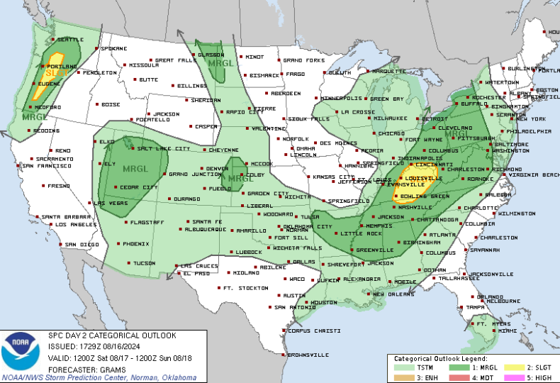
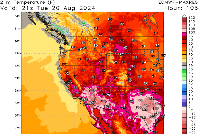
For Saturday, a mid to upper-level shortwave trough is forecasted to move into the Pacific Northwest. Out ahead of it, warm moist air from the south should allow for thunderstorms to develop during the afternoon hours. Damaging winds and hail are the main concerns with these storms across Washington and Oregon. A slight risk (Level “2” out of 5) has been issued for this area.
Across the Ohio Valley, severe thunderstorms are also possible Saturday afternoon and evening due to a weak cold front drifting southward. Similar to the severe weather setup out west, a slight risk (Level “2” out of 5) has been issued for this area with damaging winds and hail being the main hazards.
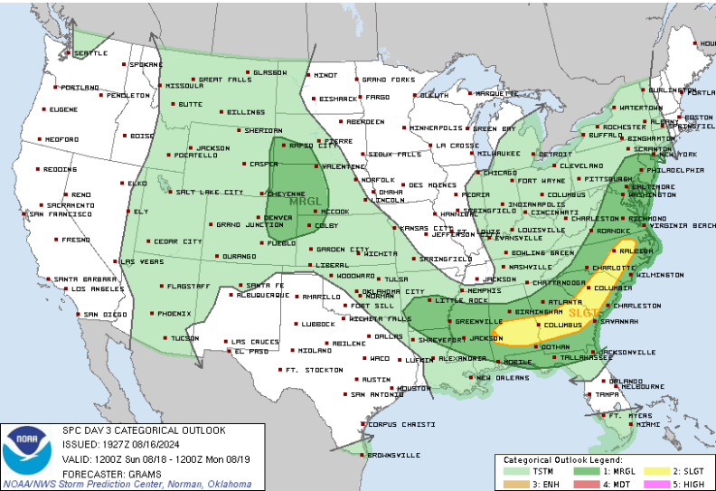
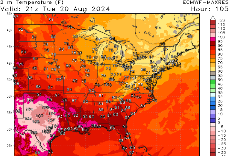
For Sunday, a slight risk (Level “2” out of 5) has been introduced for much of the Southeast, stretching from Alabama to North Carolina. The weak cold front from Saturday will continue to slowly move southward, allowing for another chance of storms out ahead of it.
Next Week’s Pattern Change
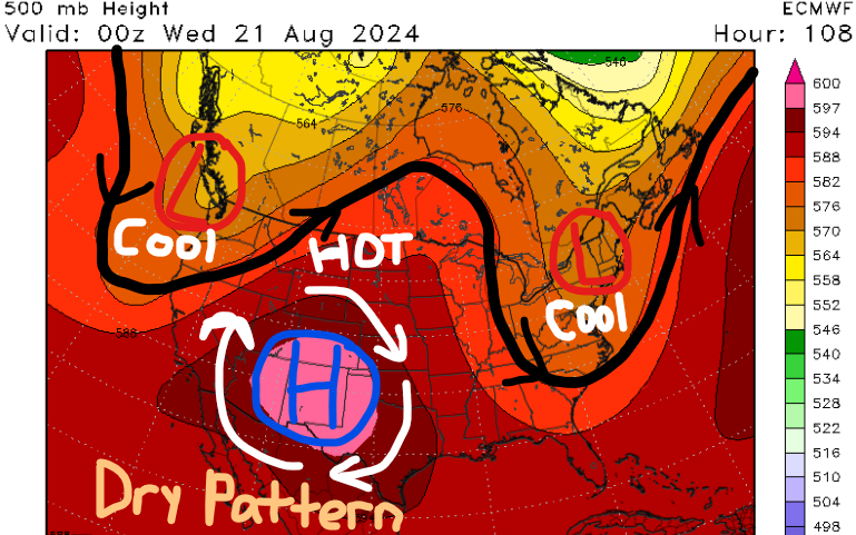
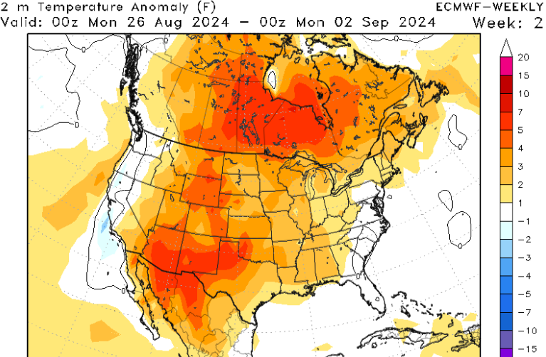
Heading into next week, a big pattern change is coming to the eastern half of the country as a large mid to upper-level trough digs in, bringing cooler temperatures and lower humidity values. Across the western U.S., a large area of high pressure is forecasted to settle in, allowing for hot and dry conditions for an extended period.
Afternoon high temperatures out West will get into the 90s and triple digits for many due to the ridging pattern. This will also keep precipitation chances fairly low as the best locations to see rainfall next week will be Arizona, Utah, and Colorado due to the monsoon. Above-average temperatures and below-average precipitation should continue for this region over the next seven to ten days.
Across the eastern CONUS, millions will be greeted with an early hint of fall-like weather as afternoon highs will only be in the 60s and 70s for the Upper Midwest and Northeast. Furthermore, dew points will be a lot lower, so it won’t feel as humid outside. Next week is a great time to make outdoor plans! Unfortunately, the farmost southern states aren’t going to experience much of a cool down as the trough isn’t THAT intense.
Pattern Going Into September
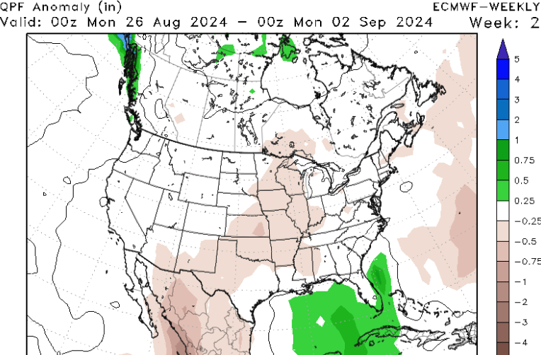
For the rest of August, this pattern will begin to weaken slowly, however, above-average temperatures will continue to be the story out West. When it comes to precipitation, most of the country should be near or slightly below the typical average for this time of the year. The best chance for above-average rainfall will be near the southeast coastline.


