Tropical Storm Debby continues to make its way up the East Coast, bringing plenty of rain and flood chances to the entire region. As we continue to monitor Debby and what it will do next, the area of interest identified in the eastern Caribbean has fizzled out and lost any chance for further development. However, the Pacific basin remains quite active with several named storms. Let’s get into it!
TROPICAL STORM DEBBY:
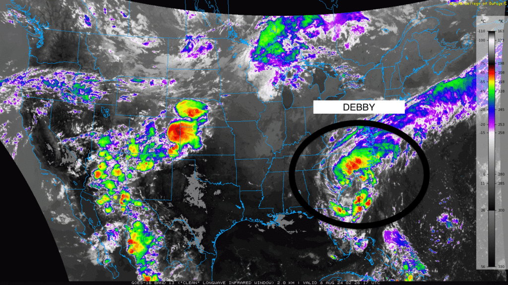
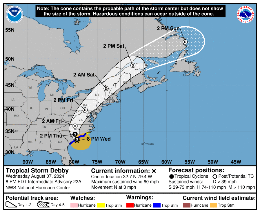
Tropical Storm Debby continues to impact the East Coast with significant flooding, particularly in the Carolinas. According to the latest National Hurricane Center (NHC) advisories, Debby is currently positioned near the South Carolina coast, moving northward. Over the next few days, the storm is expected to bring heavy rainfall, with some areas likely receiving up to 8 inches of rain, which could lead to life-threatening flash flooding and river flooding.
The storm’s intensity is projected to remain steady, with sustained winds of around 45 mph, and it is not expected to strengthen significantly. However, the main threat remains the heavy rainfall and associated flooding. The storm’s slow movement exacerbates this risk, as prolonged periods of heavy rain can saturate the ground and lead to more severe flooding.
As Debby advances, its influence will extend towards the northeastern United States, including the New England region. Residents in these areas should brace for increased rainfall, strong winds, and rough seas, with coastal areas facing the possibility of higher-than-normal tides and beach erosion. Rainfall could accumulate 3-5 inches in some regions, leading to localized flooding, especially in low-lying areas with inadequate drainage.
BUSY EASTERN PACIFIC BASIN:
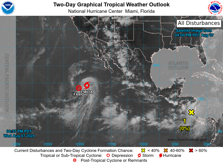
The Pacific has been quite active recently, with plenty of named storms as we continue through August. We have ongoing Tropical Storm Emilia, projected to strengthen over the next few days due to favorable conditions such as warm sea surface temperatures and low wind shear. It could reach hurricane strength in the near future. As Emilia progresses, it may approach the southwestern coast of Mexico, potentially bringing heavy rainfall, strong winds, and rough seas to the region. Coastal and maritime interests in this area should stay updated with the latest forecasts and be prepared for possible impacts.
We also have Post-Tropical Storm Fabio, which has weakened significantly due to unfavorable conditions. Only a weak swirl of clouds remains, and Fabio no longer qualifies as a tropical cyclone. As a result, Fabio will no longer be monitored. According to satellite estimates, the storm’s strength has decreased to about 35 mph. Fabio is expected to weaken and will likely merge with Tropical Storm Emilia by Thursday.
In addition to the two previously mentioned systems, a tropical wave is currently moving over Central America and is expected to emerge into the far eastern portion of the East Pacific sometime on Thursday. Environmental conditions appear generally favorable for the system’s slow development thereafter as it moves west-northwestward at 15 to 20 mph.


