Happy Labor Day Weekend folks! For those of you living closer to the coast, there was plenty of rain across much of the area the past couple of days keeping things cool but soggy. We’ll get a slight break from the rain on Labor Day, but it’s going to be fairly wet to start off September! It’ll be a little different than the past couple of years with the heat usually taking precedence.
Labor Day Weekend
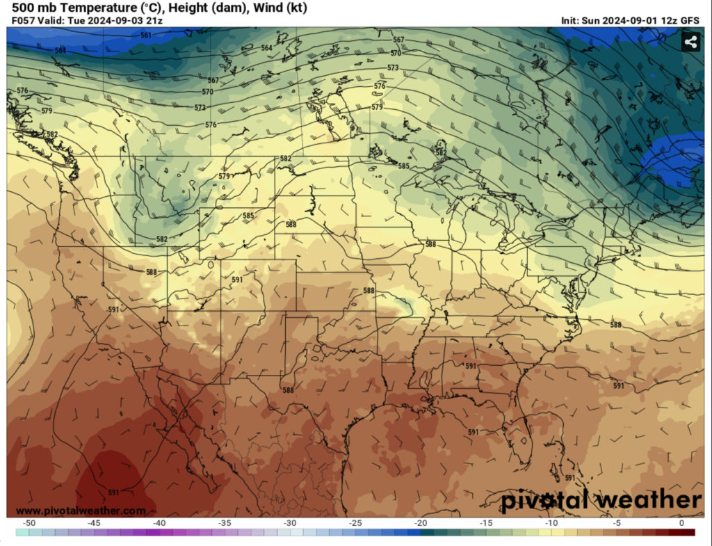
The disturbance out in the Gulf will slowly move west towards Texas. This afternoon will have a few more showers and thunderstorms coming from the coast and parts of southern Louisiana. A few could make it inland by the evening, but we’ll begin to dry out overnight. Lows will be in the low 70s with winds calming overnight. Due to this, we’ll also have some patchy fog in the morning.
Monday will be our hot and humid type of Labor Day. It’s a good day to take yourself and/or the kids to the pool or somewhere similar as the temperatures will climb into the low to mid 90s. There will be a few afternoon thunderstorms possible with some developing from the coast and moving inland. Overnight, the wind will shift towards the east and lows will be in the low to mid 70s.
The Rest of the Week
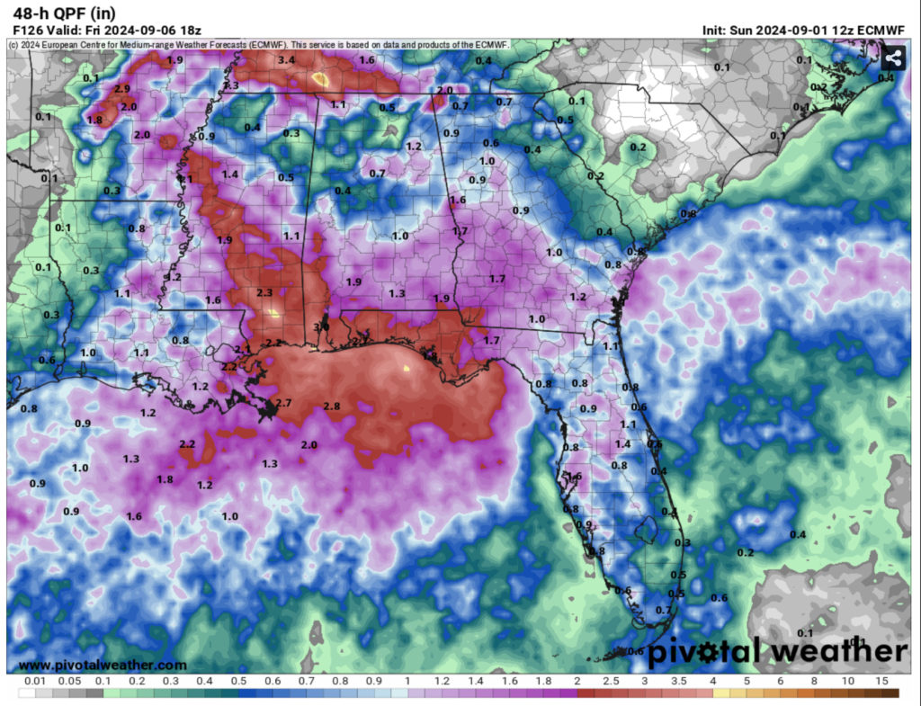
As you’re going back into the work week, we’ll have plenty of rain that’s rolling in for the next few days. A weak upper-level front will be moving through the Ohio River valley along with a stalling surface front that’s moving further south towards the Gulf. Along with this, some southerly flow from a mid-level Atlantic ridge will provide enough moisture to up rain chances quite a bit.
Starting Tuesday, we’ll have rain showers develop from the South and move up from the coast across the central Gulf States. This will likely develop in the afternoon and keep raining into the evening hours. Temperatures will reach the 90s during the day and quickly dip for areas the get the rain. Overnight the low will be in the 70s with winds from the East.
Wednesday is when we get our larger shot for rain as the warm front encourages more moisture flow into the South. We’ll have areas that may see up to an inch of rain, but otherwise, it’s going to be a rainy day for many across much of Southern LA/MS/AL. This will continue into the overnight hours before we do it all again on Thursday. Temperatures will be in the mid 80s and lows will reach the low 70s.
Thursday will have a higher chance for thunderstorm development and some heavy rain. This will be throughout most of the day, so be sure to have your umbrella with you. This will continue on into the night, so be prepared if you’re going to be driving the wet and rainy roads. Temperatures will reach the low to mid 80s during the day and only reach the low 70s at night.
//Courtesy: Pivotal Weather
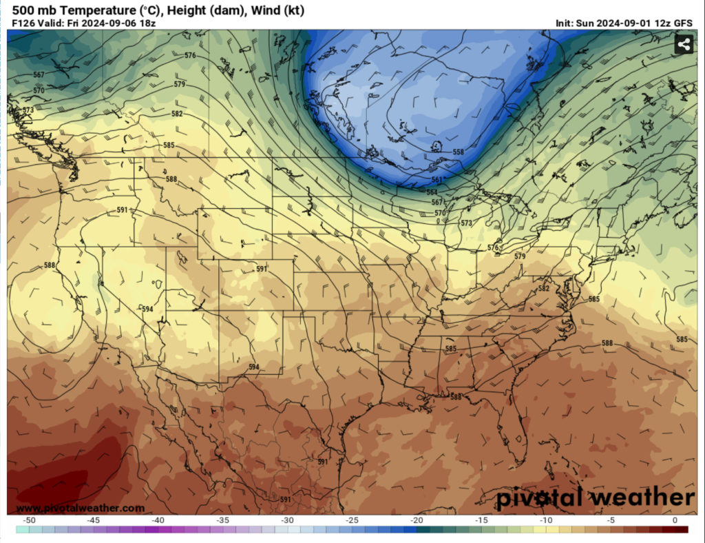
Friday will also be wet especially in the morning. A few showers and thunderstorms will linger into the afternoon before they head east. Overall it’ll be a soggy day as the front moves out with temperatures in the mid 80s. Overnight, the temperature will dip into the upper 60s to around 70 which is a good indicator of the weather coming up during the weekend.
Overall, there looks to be 1-3” rain possible with some areas even reaching up to 4” over
The Weekend
The weekend looks to be much drier when the ridge moves in from the north. A good indicator is the lower than average temperatures for the next several days afterwards. Temperatures will drop to the upper 80s with the heat index staying close to the high and eventually warming up into the 90s later on. Overall, it’ll be a nice change from the sweltering heat we had during the latter part of the summer. I’ll call this our “False Fall” as the Mississippi weather indicator likes to call it.
This week will be a big change from the summer we had and we’ll see some better weather on the other side of it. Be sure to bring an umbrella for the main part of the week and enjoy your Labor Day!
Regional Day-to-Day Forecast
This Afternoon – A 30 percent chance of showers in the afternoon. Mostly sunny, with a high in the upper 80s. Heat index values as high as 98. East southeast wind around 5 mph.
Tonight – A 30 percent chance of showers before sunset. Mostly clear, with a low in the lower 70s. Calm wind.
Labor Day – A slight chance of showers and thunderstorms in the afternoon. Patchy fog before 8am. Otherwise, sunny, with a high in the mid 90s. Heat index values as high as 104. Northeast wind around 5 mph. Chance of precipitation is 20%.
Monday Night – Partly cloudy, with a low in the low 70s. North northeast wind around 5 mph becoming calm.
Tuesday – Showers likely and possibly a thunderstorm in the afternoon. Partly sunny, with a high in the low to mid 90s. East wind around 5 mph. Chance of precipitation is 60%. New rainfall amounts of less than a tenth of an inch, except higher amounts possible in thunderstorms.
Tuesday Night – Scattered showers and thunderstorms. Mostly cloudy, with a low in the low 70s. East wind around 5 mph. Chance of precipitation is 50%. New precipitation amounts between a quarter and half of an inch possible.
Wednesday – Scattered showers, then showers and possibly a thunderstorm after 1pm. High in the mid 80s. East wind 5 to 10 mph. Chance of precipitation is 80%.
Wednesday Night – Showers likely and possibly a thunderstorm. Mostly cloudy, with a low around 72. East wind around 5 mph. Chance of precipitation is 60%.
Thursday – Scattered showers and thunderstorms, then showers and possibly a thunderstorm in the afternoon. High in the low to mid 80s. East wind around 5 mph. Chance of precipitation is 80%.
Thursday Night – Scattered showers and thunderstorms. Mostly cloudy, with a low in the low 70s. Chance of precipitation is 50%.
Friday – Showers and thunderstorms likely. Partly sunny, with a high in the mid 80s. Chance of precipitation is 60%.
Friday Night – Scattered showers and thunderstorms. Partly cloudy, with a low in the upper 60s. Chance of precipitation is 30%.
Saturday – Scattered showers and thunderstorms. Mostly sunny, with a high in the upper 80s. Chance of precipitation is 30%.


