The latest from the NHC shows that Hurricane Francine is now on land and will start to morph in the coming hours. It will change from a Hurricane to a flooding-producer and tornado-producer.

The forecast shows Francine will continue to move north through the night. I tend to think it will skirt a bit more to the east before pivoting and moving north.
The timeline on the arrival of Tropical Storm-force wind is shown in the graphic below on the left and the percent-chance you see Hurricane-force winds is below and on the right. Notice the Hurricane-force winds are confined mainly to the immediate coastline.
Below is the county-by-county breakdown. The storm is still strengthening, there is a chance this forecast will change. So please take this for now, but check back for an update.
Please note that all times shown begin on Wednesday and – if needed – move into Thursday morning.
QUICK NOTES
As we talked about last night and earlier today, the dry air – and a little shear – are going to do a number on this thing now that it has moved onshore. The dry air is pushing in from the west and despite the plume of moisture on the east side of the storm, eventually this thing will be cut – nearly – in half with only the northern side with any meaningful rainfall and the east side featuring a tornado risk.
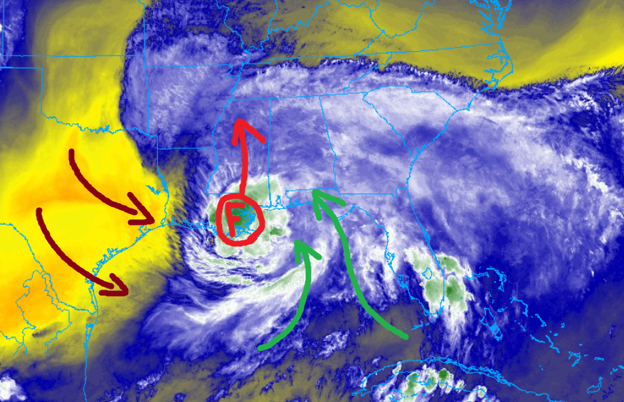
So if you live south of – roughly – Highway 84 the forecast has actually shifted slightly slower, again. That said, some spots will still have plenty of wind and a tornado threat to deal with. For folks north of HWY 84 the forecast has slowed and your wind has also slowed because it looks like this thing may get eaten up a bit quicker.
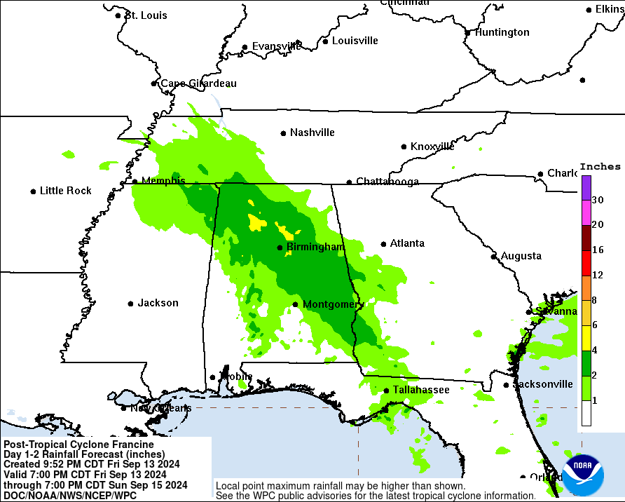
The good news is the erosion of the back half of the storm as it moves ashore means that the rainfall totals have been reduced for many spots.
I know this may feel like a stressful situation, but I promise you that if you take the right steps, have a plan in place, and execute that plan, you’ll make it through the storm with far less stress.
Along I-20
Rankin County:
Now — 1a – As things get started, a few isolated storms are possible. Sustained wind between 15 and 30mph. A few may be severe. The main concerns are brief heavy rain, some lightning, gusty wind, small hail. Rainfall totals up to 1 inch possible.
1a — 8a – Sustained wind between 25 and 40 mph. There is a chance for showers and storms. The main concerns are the rainbands swinging through with heavy rain, wind gusts up to 50mph, and a few tornadoes (up to EF1 in strength). Rainfall totals are estimated to be around 2-4 inches.
8a — 12p – All Clear! Though, there is a chance for some lingering brief heavy rain, some lightning, gusty wind, small hail. Rainfall totals up to 1 inch possible.
How it will impact you:
— Roads may be briefly impassable due to short-term flash flooding
— Trees may be knocked down, and scattered power outages are likely
— A Tornado Watch is possible
Best to be where you want to be by 11p
Scott County:
Now — 1a – As things get started, a few isolated storms are possible. Sustained wind between 15 and 30mph. A few may be severe. The main concerns are brief heavy rain, some lightning, gusty wind, small hail. Rainfall totals up to 1 inch possible.
1a — 8a – Sustained wind between 25 and 40 mph. There is a chance for showers and storms. The main concerns are the rainbands swinging through with heavy rain, wind gusts up to 50mph, and a few tornadoes (up to EF1 in strength). Rainfall totals are estimated to be around 2-4 inches.
8a — 12p – All Clear! Though, there is a chance for some lingering brief heavy rain, some lightning, gusty wind, small hail. Rainfall totals up to 1 inch possible.
How it will impact you:
— Roads may be briefly impassable due to short-term flash flooding
— Trees may be knocked down, and scattered power outages are likely
— A Tornado Watch is possible
Best to be where you want to be by 11p
Newton County:
Now — 1a – As things get started, a few isolated storms are possible. Sustained wind between 15 and 30mph. A few may be severe. The main concerns are brief heavy rain, some lightning, gusty wind, small hail. Rainfall totals up to 1 inch possible.
1a — 8a – Sustained wind between 25 and 40 mph. There is a chance for showers and storms. The main concerns are the rainbands swinging through with heavy rain, wind gusts up to 50mph, and a few tornadoes (up to EF1 in strength). Rainfall totals are estimated to be around 2-4 inches.
8a — 12p – All Clear! Though, there is a chance for some lingering brief heavy rain, some lightning, gusty wind, small hail. Rainfall totals up to 1 inch possible.
How it will impact you:
— Roads may be briefly impassable due to short-term flash flooding
— Trees may be knocked down, and scattered power outages are likely
— A Tornado Watch is possible
Best to be where you want to be by 11p
Lauderdale County:
Now — 1a – As things get started, a few isolated storms are possible. Sustained wind between 15 and 30mph. A few may be severe. The main concerns are brief heavy rain, some lightning, gusty wind, small hail. Rainfall totals up to 1 inch possible.
1a — 8a – Sustained wind between 25 and 35 mph. There is a chance for showers and storms. The main concerns are the rainbands swinging through with heavy rain, wind gusts up to 45mph, and a few tornadoes (up to EF1 in strength). Rainfall totals are estimated to be around 2-4 inches.
8a — 12p – All Clear! Though, there is a chance for some lingering brief heavy rain, some lightning, gusty wind, small hail. Rainfall totals up to 1 inch possible.
How it will impact you:
— Roads may be briefly impassable due to short-term flash flooding
— Trees may be knocked down, and scattered power outages are likely
— A Tornado Watch is possible
Best to be where you want to be by 11p
Near I-20
Copiah County:
Now — 1a – As things get started, a few isolated storms are possible. Sustained wind between 15 and 30mph. A few may be severe. The main concerns are brief heavy rain, some lightning, gusty wind, small hail. Rainfall totals up to 1 inch possible.
1a — 8a – Sustained wind between 25 and 45 mph. There is a chance for showers and storms. The main concerns are the rainbands swinging through with heavy rain, wind gusts up to 55mph, and a few tornadoes (up to EF1 in strength). Rainfall totals are estimated to be around 2-4 inches.
8a — 12p – All Clear! Though, there is a chance for some lingering brief heavy rain, some lightning, gusty wind, small hail. Rainfall totals up to 1 inch possible.
How it will impact you:
— Roads may be briefly impassable due to short-term flash flooding
— Trees may be knocked down, and scattered power outages are likely
— A Tornado Watch is possible
Best to be where you want to be by 11p
Simpson County:
Now — 1a – As things get started, a few isolated storms are possible. Sustained wind between 15 and 30mph. A few may be severe. The main concerns are brief heavy rain, some lightning, gusty wind, small hail. Rainfall totals up to 1 inch possible.
1a — 8a – Sustained wind between 25 and 45 mph. There is a chance for showers and storms. The main concerns are the rainbands swinging through with heavy rain, wind gusts up to 55mph, and a few tornadoes (up to EF1 in strength). Rainfall totals are estimated to be around 2-4 inches.
8a — 12p – All Clear! Though, there is a chance for some lingering brief heavy rain, some lightning, gusty wind, small hail. Rainfall totals up to 1 inch possible.
How it will impact you:
— Roads may be briefly impassable due to short-term flash flooding
— Trees may be knocked down, and scattered power outages are likely
— A Tornado Watch is possible
Best to be where you want to be by 11p
Smith County:
Now — 1a – As things get started, a few isolated storms are possible. Sustained wind between 15 and 30mph. A few may be severe. The main concerns are brief heavy rain, some lightning, gusty wind, small hail. Rainfall totals up to 1 inch possible.
1a — 8a – Sustained wind between 25 and 45 mph. There is a chance for showers and storms. The main concerns are the rainbands swinging through with heavy rain, wind gusts up to 55mph, and a few tornadoes (up to EF1 in strength). Rainfall totals are estimated to be around 2-4 inches.
8a — 12p – All Clear! Though, there is a chance for some lingering brief heavy rain, some lightning, gusty wind, small hail. Rainfall totals up to 1 inch possible.
How it will impact you:
— Roads may be briefly impassable due to short-term flash flooding
— Trees may be knocked down, and scattered power outages are likely
— A Tornado Watch is possible
Best to be where you want to be by 11p
Jasper County:
Now — 1a – As things get started, a few isolated storms are possible. Sustained wind between 15 and 30mph. A few may be severe. The main concerns are brief heavy rain, some lightning, gusty wind, small hail. Rainfall totals up to 1 inch possible.
1a — 8a – Sustained wind between 25 and 45 mph. There is a chance for showers and storms. The main concerns are the rainbands swinging through with heavy rain, wind gusts up to 55mph, and a few tornadoes (up to EF1 in strength). Rainfall totals are estimated to be around 2-4 inches.
8a — 12p – All Clear! Though, there is a chance for some lingering brief heavy rain, some lightning, gusty wind, small hail. Rainfall totals up to 1 inch possible.
How it will impact you:
— Roads may be briefly impassable due to short-term flash flooding
— Trees may be knocked down, and scattered power outages are likely
— A Tornado Watch is possible
Best to be where you want to be by 11p
Clarke County:
Now — 1a – As things get started, a few isolated storms are possible. Sustained wind between 15 and 30mph. A few may be severe. The main concerns are brief heavy rain, some lightning, gusty wind, small hail. Rainfall totals up to 1 inch possible.
1a — 8a – Sustained wind between 25 and 40 mph. There is a chance for showers and storms. The main concerns are the rainbands swinging through with heavy rain, wind gusts up to 50mph, and a few tornadoes (up to EF1 in strength). Rainfall totals are estimated to be around 2-4 inches.
8a — 12p – All Clear! Though, there is a chance for some lingering brief heavy rain, some lightning, gusty wind, small hail. Rainfall totals up to 1 inch possible.
How it will impact you:
— Roads may be briefly impassable due to short-term flash flooding
— Trees may be knocked down, and scattered power outages are likely
— A Tornado Watch is possible
Best to be where you want to be by 11p
HWY 84 Corridor
Lincoln County:
Now — 12a – As things get started, a few isolated storms are possible. Sustained wind between 15 and 30mph. A few may be severe. The main concerns are brief heavy rain, some lightning, gusty wind, small hail. Rainfall totals up to 1 inch possible.
12a — 8a – Sustained wind between 25 and 40 mph. There is a chance for showers and storms. The main concerns are the rainbands swinging through with heavy rain, wind gusts up to 50mph, and a few tornadoes (up to EF1 in strength). Rainfall totals are estimated to be around 2-4 inches.
8a — 12p – All Clear! Though, there is a chance for some lingering brief heavy rain, some lightning, gusty wind, small hail. Rainfall totals up to 1 inch possible.
How it will impact you:
— Roads may be briefly impassable due to short-term flash flooding
— Roads may be impassable due to downed trees
— Numerous power outages are likely, have battery backup if needed
— A Tornado Watch is possible
Best to be where you want to be by 11p
Lawrence County:
Now — 12a – As things get started, a few isolated storms are possible. Sustained wind between 15 and 30mph. A few may be severe. The main concerns are brief heavy rain, some lightning, gusty wind, small hail. Rainfall totals up to 1 inch possible.
12a — 8a – Sustained wind between 25 and 45 mph. There is a chance for showers and storms. The main concerns are the rainbands swinging through with heavy rain, wind gusts up to 55mph, and a few tornadoes (up to EF1 in strength). Rainfall totals are estimated to be around 2-4 inches.
8a — 12p – All Clear! Though, there is a chance for some lingering brief heavy rain, some lightning, gusty wind, small hail. Rainfall totals up to 1 inch possible.
How it will impact you:
— Roads may be briefly impassable due to short-term flash flooding
— Roads may be impassable due to downed trees
— Numerous power outages are likely, have battery backup if needed
— A Tornado Watch is possible
Best to be where you want to be by 11p
Jeff Davis County:
Now — 12a – As things get started, a few isolated storms are possible. Sustained wind between 15 and 30mph. A few may be severe. The main concerns are brief heavy rain, some lightning, gusty wind, small hail. Rainfall totals up to 1 inch possible.
12a — 8a – Sustained wind between 25 and 45 mph. There is a chance for showers and storms. The main concerns are the rainbands swinging through with heavy rain, wind gusts up to 60mph, and a few tornadoes (up to EF1 in strength). Rainfall totals are estimated to be around 2-4 inches.
8a — 12p – All Clear! Though, there is a chance for some lingering brief heavy rain, some lightning, gusty wind, small hail. Rainfall totals up to 1 inch possible.
How it will impact you:
— Roads may be briefly impassable due to short-term flash flooding
— Roads may be impassable due to downed trees
— Numerous power outages are likely, have battery backup if needed
— A Tornado Watch is possible
Best to be where you want to be by 11p
Covington County:
Now — 12a – As things get started, a few isolated storms are possible. Sustained wind between 15 and 30mph. A few may be severe. The main concerns are brief heavy rain, some lightning, gusty wind, small hail. Rainfall totals up to 1 inch possible.
12a — 8a – Sustained wind between 25 and 45 mph. There is a chance for showers and storms. The main concerns are the rainbands swinging through with heavy rain, wind gusts up to 55mph, and a few tornadoes (up to EF2 in strength). Rainfall totals are estimated to be around 3-5 inches.
8a — 12p – All Clear! Though, there is a chance for some lingering brief heavy rain, some lightning, gusty wind, small hail. Rainfall totals up to 1 inch possible.
How it will impact you:
— Roads may be briefly impassable due to short-term flash flooding
— Roads may be impassable due to downed trees
— Numerous power outages are likely, have battery backup if needed
— A Tornado Watch is possible
Best to be where you want to be by 11p
Jones County:
Now — 12a – As things get started, a few isolated storms are possible. Sustained wind between 15 and 30mph. A few may be severe. The main concerns are brief heavy rain, some lightning, gusty wind, small hail. Rainfall totals up to 1 inch possible.
12a — 8a – Sustained wind between 25 and 45 mph. There is a chance for showers and storms. The main concerns are the rainbands swinging through with heavy rain, wind gusts up to 60mph, and a few tornadoes (up to EF2 in strength). Rainfall totals are estimated to be around 3-5 inches.
8a — 12p – All Clear! Though, there is a chance for some lingering brief heavy rain, some lightning, gusty wind, small hail. Rainfall totals up to 1 inch possible.
How it will impact you:
— Roads may be briefly impassable due to short-term flash flooding
— Roads may be impassable due to downed trees
— Numerous power outages are likely, have battery backup if needed
— A Tornado Watch is possible
Best to be where you want to be by 11p
Wayne County:
Now — 12a – As things get started, a few isolated storms are possible. Sustained wind between 15 and 30mph. A few may be severe. The main concerns are brief heavy rain, some lightning, gusty wind, small hail. Rainfall totals up to 1 inch possible.
12a — 8a – Sustained wind between 25 and 45 mph. There is a chance for showers and storms. The main concerns are the rainbands swinging through with heavy rain, wind gusts up to 60mph, and a few tornadoes (up to EF1 in strength). Rainfall totals are estimated to be around 2-4 inches.
8a — 12p – All Clear! Though, there is a chance for some lingering brief heavy rain, some lightning, gusty wind, small hail. Rainfall totals up to 1 inch possible.
How it will impact you:
— Roads may be briefly impassable due to short-term flash flooding
— Roads may be impassable due to downed trees
— Numerous power outages are likely, have battery backup if needed
— A Tornado Watch is possible
Best to be where you want to be by 11p
HWY 98 Corridor
Pike County:
Now — 11p – As things get started, a few isolated storms are possible. Sustained wind between 20 and 35mph. A few may be severe. The main concerns are brief heavy rain, some lightning, gusty wind, small hail. Rainfall totals up to 1 inch possible.
11p — 6a – Sustained wind between 25 and 50 mph. There is a chance for showers and storms. The main concerns are the rainbands swinging through with heavy rain, wind gusts up to 65mph, and a few tornadoes (up to EF2 in strength). Rainfall totals are estimated to be around 4-6 inches.
6a — 10a – All Clear! Though, there is a chance for some lingering brief heavy rain, some lightning, gusty wind, small hail. Rainfall totals up to 1 inch possible.
How it will impact you:
— Roads may be briefly impassable due to short-term flash flooding
— Wind will knock over and blow around anything not tied down or anchored
— Roads may be impassable due to downed trees
— Numerous, multiple-hour, power outages are likely, have battery backup
— A Tornado Watch is likely
Best to be where you want to be by 9p
Walthall County:
Now — 11p – As things get started, a few isolated storms are possible. Sustained wind between 20 and 35mph. A few may be severe. The main concerns are brief heavy rain, some lightning, gusty wind, small hail. Rainfall totals up to 1 inch possible.
11p — 6a – Sustained wind between 30 and 50 mph. There is a chance for showers and storms. The main concerns are the rainbands swinging through with heavy rain, wind gusts up to 65mph, and a few tornadoes (up to EF2 in strength). Rainfall totals are estimated to be around 4-6 inches.
6a — 10a – All Clear! Though, there is a chance for some lingering brief heavy rain, some lightning, gusty wind, small hail. Rainfall totals up to 1 inch possible.
How it will impact you:
— Roads may be briefly impassable due to short-term flash flooding
— Wind will knock over and blow around anything not tied down or anchored
— Roads may be impassable due to downed trees
— Numerous, multiple-hour, power outages are likely, have battery backup
— A Tornado Watch is likely
Best to be where you want to be by 9p
Marion County:
Now — 11p – As things get started, a few isolated storms are possible. Sustained wind between 20 and 35mph. A few may be severe. The main concerns are brief heavy rain, some lightning, gusty wind, small hail. Rainfall totals up to 1 inch possible.
11p — 6a – Sustained wind between 35 and 55 mph. There is a chance for showers and storms. The main concerns are the rainbands swinging through with heavy rain, wind gusts up to 65mph, and a few tornadoes (up to EF2 in strength). Rainfall totals are estimated to be around 4-6 inches.
6a — 10a – All Clear! Though, there is a chance for some lingering brief heavy rain, some lightning, gusty wind, small hail. Rainfall totals up to 1 inch possible.
How it will impact you:
— Roads may be briefly impassable due to short-term flash flooding
— Wind will knock over and blow around anything not tied down or anchored
— Roads may be impassable due to downed trees
— Numerous, multiple-hour, power outages are likely, have battery backup
— A Tornado Watch is likely
Best to be where you want to be by 9p
Lamar County:
Now — 11p – As things get started, a few isolated storms are possible. Sustained wind between 20 and 35mph. A few may be severe. The main concerns are brief heavy rain, some lightning, gusty wind, small hail. Rainfall totals up to 1 inch possible.
11p — 6a – Sustained wind between 30 and 50 mph. There is a chance for showers and storms. The main concerns are the rainbands swinging through with heavy rain, wind gusts up to 65mph, and a few tornadoes (up to EF2 in strength). Rainfall totals are estimated to be around 4-6 inches.
6a — 10a – All Clear! Though, there is a chance for some lingering brief heavy rain, some lightning, gusty wind, small hail. Rainfall totals up to 1 inch possible.
How it will impact you:
— Roads may be briefly impassable due to short-term flash flooding
— Wind will knock over and blow around anything not tied down or anchored
— Roads may be impassable due to downed trees
— Numerous, multiple-hour, power outages are likely, have battery backup
— A Tornado Watch is likely
Best to be where you want to be by 9p
Forrest County:
Now — 11p – As things get started, a few isolated storms are possible. Sustained wind between 20 and 35mph. A few may be severe. The main concerns are brief heavy rain, some lightning, gusty wind, small hail. Rainfall totals up to 1 inch possible.
11p — 6a – Sustained wind between 35 and 50 mph. There is a chance for showers and storms. The main concerns are the rainbands swinging through with heavy rain, wind gusts up to 70mph, and a few tornadoes (up to EF2 in strength). Rainfall totals are estimated to be around 4-6 inches.
6a — 10a – All Clear! Though, there is a chance for some lingering brief heavy rain, some lightning, gusty wind, small hail. Rainfall totals up to 1 inch possible.
How it will impact you:
— Roads may be briefly impassable due to short-term flash flooding
— Wind will knock over and blow around anything not tied down or anchored
— Roads may be impassable due to downed trees
— Numerous, multiple-hour, power outages are likely, have battery backup
— A Tornado Watch is likely
Best to be where you want to be by 9p
Perry County:
Now — 11p – As things get started, a few isolated storms are possible. Sustained wind between 20 and 35mph. A few may be severe. The main concerns are brief heavy rain, some lightning, gusty wind, small hail. Rainfall totals up to 1 inch possible.
11p — 6a – Sustained wind between 35 and 50 mph. There is a chance for showers and storms. The main concerns are the rainbands swinging through with heavy rain, wind gusts up to 70mph, and a few tornadoes (up to EF2 in strength). Rainfall totals are estimated to be around 4-6 inches.
6a — 10a – All Clear! Though, there is a chance for some lingering brief heavy rain, some lightning, gusty wind, small hail. Rainfall totals up to 1 inch possible.
How it will impact you:
— Roads may be briefly impassable due to short-term flash flooding
— Wind will knock over and blow around anything not tied down or anchored
— Roads may be impassable due to downed trees
— Numerous, multiple-hour, power outages are likely, have battery backup
— A Tornado Watch is likely
Best to be where you want to be by 9p
Greene County:
Now — 11p – As things get started, a few isolated storms are possible. Sustained wind between 20 and 35mph. A few may be severe. The main concerns are brief heavy rain, some lightning, gusty wind, small hail. Rainfall totals up to 1 inch possible.
11p — 6a – Sustained wind between 30 and 45 mph. There is a chance for showers and storms. The main concerns are the rainbands swinging through with heavy rain, wind gusts up to 65mph, and a few tornadoes (up to EF2 in strength). Rainfall totals are estimated to be around 3-5 inches.
6a — 10a – All Clear! Though, there is a chance for some lingering brief heavy rain, some lightning, gusty wind, small hail. Rainfall totals up to 1 inch possible.
How it will impact you:
— Roads may be briefly impassable due to short-term flash flooding
— Wind will knock over and blow around anything not tied down or anchored
— Roads may be impassable due to downed trees
— Numerous, multiple-hour, power outages are likely, have battery backup
— A Tornado Watch is likely
Best to be where you want to be by 9p
HWY 26 Corridor
Pearl River County:
Now — 10p – As things get started, a few isolated storms are possible. Sustained wind between 20 and 40mph. A few may be severe. The main concerns are brief heavy rain, some lightning, gusty wind, small hail. Rainfall totals up to 1 inch possible.
10p — 4a – Sustained wind between 35 and 55 mph. There is a chance for showers and storms. The main concerns are the rainbands swinging through with heavy rain, wind gusts up to 75mph, and a few tornadoes (up to EF2 in strength). Rainfall totals are estimated to be around 3-5 inches.
4a — 8a – All Clear! Though, there is a chance for some lingering brief heavy rain, some lightning, gusty wind, small hail. Rainfall totals up to 1 inch possible.
How it will impact you:
— Roads may be briefly impassable due to short-term flash flooding
— Wind will knock over and blow around anything not tied down or anchored
— Roads may be impassable due to downed trees
— Numerous, multiple-hour, power outages are likely, have battery backup
— A Tornado Watch is likely
Best to be where you want to be by now
Stone County:
Now — 10p – As things get started, a few isolated storms are possible. Sustained wind between 20 and 40mph. A few may be severe. The main concerns are brief heavy rain, some lightning, gusty wind, small hail. Rainfall totals up to 1 inch possible.
10p — 4a – Sustained wind between 35 and 50 mph. There is a chance for showers and storms. The main concerns are the rainbands swinging through with heavy rain, wind gusts up to 70mph, and a few tornadoes (up to EF2 in strength). Rainfall totals are estimated to be around 3-5 inches.
4a — 8a – All Clear! Though, there is a chance for some lingering brief heavy rain, some lightning, gusty wind, small hail. Rainfall totals up to 1 inch possible.
How it will impact you:
— Roads may be briefly impassable due to short-term flash flooding
— Wind will knock over and blow around anything not tied down or anchored
— Roads may be impassable due to downed trees
— Numerous, multiple-hour, power outages are likely, have battery backup
— A Tornado Watch is likely
Best to be where you want to be by now
George County:
Now — 11p – As things get started, a few isolated storms are possible. Sustained wind between 20 and 40mph. A few may be severe. The main concerns are brief heavy rain, some lightning, gusty wind, small hail. Rainfall totals up to 1 inch possible.
11p — 6a – Sustained wind between 35 and 50 mph. There is a chance for showers and storms. The main concerns are the rainbands swinging through with heavy rain, wind gusts up to 65mph, and a few tornadoes (up to EF2 in strength). Rainfall totals are estimated to be around 3-5 inches.
6a — 10a – All Clear! Though, there is a chance for some lingering brief heavy rain, some lightning, gusty wind, small hail. Rainfall totals up to 1 inch possible.
How it will impact you:
— Roads may be briefly impassable due to short-term flash flooding
— Wind will knock over and blow around anything not tied down or anchored
— Roads may be impassable due to downed trees
— Numerous, multiple-hour, power outages are likely, have battery backup
— A Tornado Watch is likely
Best to be where you want to be by now
MISSISSIPPI COAST
Hancock County:
Now — 6a – Sustained wind between 35 and 55 mph. There is a chance for showers and storms. The main concerns are the rainbands swinging through with heavy rain, wind gusts up to 75mph, and a few tornadoes (up to EF2 in strength). Rainfall totals are estimated to be around 3-6 inches.
6a — 10a – All Clear! Though, there is a chance for some lingering brief heavy rain, some lightning, gusty wind, small hail. Rainfall totals up to 1 inch possible.
How it will impact you:
— Roads may be briefly impassable due to short-term flash flooding
— Wind will knock over and blow around anything not tied down or anchored
— Roads may be impassable due to downed trees
— Numerous, multiple-hour, power outages are likely, have battery backup
— A Tornado Watch is likely
–Peak Storm Surge of 4-6ft
Best to be where you want to be by now
Harrison County:
Now — 6a – Sustained wind between 35 and 50 mph. There is a chance for showers and storms. The main concerns are the rainbands swinging through with heavy rain, wind gusts up to 70mph, and a few tornadoes (up to EF2 in strength). Rainfall totals are estimated to be around 3-6 inches.
6a — 10a – All Clear! Though, there is a chance for some lingering brief heavy rain, some lightning, gusty wind, small hail. Rainfall totals up to 1 inch possible.
How it will impact you:
— Roads may be briefly impassable due to short-term flash flooding
— Wind will knock over and blow around anything not tied down or anchored
— Roads may be impassable due to downed trees
— Numerous, multiple-hour, power outages are likely, have battery backup
— A Tornado Watch is likely
–Peak Storm Surge of 4-6ft
Best to be where you want to be by now
Jackson County:
Now — 6a – Sustained wind between 30 and 45 mph. There is a chance for showers and storms. The main concerns are the rainbands swinging through with heavy rain, wind gusts up to 65mph, and a few tornadoes (up to EF2 in strength). Rainfall totals are estimated to be around 3-5 inches.
6a — 10a – All Clear! Though, there is a chance for some lingering brief heavy rain, some lightning, gusty wind, small hail. Rainfall totals up to 1 inch possible.
How it will impact you:
— Roads may be briefly impassable due to short-term flash flooding
— Wind will knock over and blow around anything not tied down or anchored
— Roads may be impassable due to downed trees
— Numerous, multiple-hour, power outages are likely, have battery backup
— A Tornado Watch is likely
–Peak Storm Surge of 3-5ft
Best to be where you want to be by now
LOUISIANA PARISHES
St. Helena Parish:
Now — 10p – As things get started, a few isolated storms are possible. Sustained wind between 20 and 40mph. A few may be severe. The main concerns are brief heavy rain, some lightning, gusty wind, small hail. Rainfall totals up to 1 inch possible.
10p — 4a – Sustained wind between 35 and 55 mph. There is a chance for showers and storms. The main concerns are the rainbands swinging through with heavy rain, wind gusts up to 75mph, and a few tornadoes (up to EF2 in strength). Rainfall totals are estimated to be around 3-5 inches.
4a — 8a – All Clear! Though, there is a chance for some lingering brief heavy rain, some lightning, gusty wind, small hail. Rainfall totals up to 1 inch possible.
How it will impact you:
— Roads may be briefly impassable due to short-term flash flooding
— Wind will knock over and blow around anything not tied down or anchored
— Roads may be impassable due to downed trees
— Numerous, multiple-hour, power outages are likely, have battery backup
— A Tornado Watch is likely
Best to be where you want to be by now
Tangipahoa Parish:
Now — 9p – As things get started, a few isolated storms are possible. Sustained wind between 20 and 40mph. A few may be severe. The main concerns are brief heavy rain, some lightning, gusty wind, small hail. Rainfall totals up to 1 inch possible.
9p — 4a – Sustained wind between 35 and 60 mph. There is a chance for showers and storms. The main concerns are the rainbands swinging through with heavy rain, wind gusts up to 80mph, and a few tornadoes (up to EF2 in strength). Rainfall totals are estimated to be around 3-5 inches.
4a — 8a – All Clear! Though, there is a chance for some lingering brief heavy rain, some lightning, gusty wind, small hail. Rainfall totals up to 1 inch possible.
How it will impact you:
— Roads may be briefly impassable due to short-term flash flooding
— Wind will knock over and blow around anything not tied down or anchored
— Roads may be impassable due to downed trees
— Numerous, multiple-hour, power outages are likely, have battery backup
— A Tornado Watch is likely
Best to be where you want to be by now
Washington Parish:
Now — 9p – As things get started, a few isolated storms are possible. Sustained wind between 20 and 40mph. A few may be severe. The main concerns are brief heavy rain, some lightning, gusty wind, small hail. Rainfall totals up to 1 inch possible.
9p — 4a – Sustained wind between 35 and 60 mph. There is a chance for showers and storms. The main concerns are the rainbands swinging through with heavy rain, wind gusts up to 80mph, and a few tornadoes (up to EF2 in strength). Rainfall totals are estimated to be around 3-5 inches.
4a — 8a – All Clear! Though, there is a chance for some lingering brief heavy rain, some lightning, gusty wind, small hail. Rainfall totals up to 1 inch possible.
How it will impact you:
— Roads may be briefly impassable due to short-term flash flooding
— Wind will knock over and blow around anything not tied down or anchored
— Roads may be impassable due to downed trees
— Numerous, multiple-hour, power outages are likely, have battery backup
— A Tornado Watch is likely
Best to be where you want to be by now
Livingston Parish:
Now — 4a – Sustained wind between 35 and 60 mph. There is a chance for showers and storms. The main concerns are the rainbands swinging through with heavy rain, wind gusts up to 80mph, and a few tornadoes (up to EF2 in strength). Rainfall totals are estimated to be around 3-5 inches.
4a — 8a – All Clear! Though, there is a chance for some lingering brief heavy rain, some lightning, gusty wind, small hail. Rainfall totals up to 1 inch possible.
How it will impact you:
— Roads may be briefly impassable due to short-term flash flooding
— Wind will knock over and blow around anything not tied down or anchored
— Roads may be impassable due to downed trees
— Numerous, multiple-hour, power outages are likely, have battery backup
— A Tornado Watch is likely
Best to be where you want to be by now
St. Tammany Parish:
Now — 4a – Sustained wind between 35 and 60 mph. There is a chance for showers and storms. The main concerns are the rainbands swinging through with heavy rain, wind gusts up to 80mph, and a few tornadoes (up to EF2 in strength). Rainfall totals are estimated to be around 3-5 inches.
4a — 8a – All Clear! Though, there is a chance for some lingering brief heavy rain, some lightning, gusty wind, small hail. Rainfall totals up to 1 inch possible.
How it will impact you:
— Roads may be briefly impassable due to short-term flash flooding
— Wind will knock over and blow around anything not tied down or anchored
— Roads may be impassable due to downed trees
— Numerous, multiple-hour, power outages are likely, have battery backup
— A Tornado Watch is likely
Best to be where you want to be by now
Orleans Parish:
Now — 4a – Sustained wind between 35 and 60 mph. There is a chance for showers and storms. The main concerns are the rainbands swinging through with heavy rain, wind gusts up to 80mph, and a few tornadoes (up to EF2 in strength). Rainfall totals are estimated to be around 3-5 inches.
4a — 8a – All Clear! Though, there is a chance for some lingering brief heavy rain, some lightning, gusty wind, small hail. Rainfall totals up to 1 inch possible.
How it will impact you:
— Roads may be briefly impassable due to short-term flash flooding
— Wind will knock over and blow around anything not tied down or anchored
— Roads may be impassable due to downed trees
— Numerous, multiple-hour, power outages are likely, have battery backup
— A Tornado Watch is likely
Best to be where you want to be by now
ALABAMA COUNTIES
Sumter County:
Now — 11p – As things get started, a few isolated storms are possible. Sustained wind between 20 and 35mph. A few may be severe. The main concerns are brief heavy rain, some lightning, gusty wind, small hail. Rainfall totals up to 1 inch possible.
11p — 6a – Sustained wind between 30 and 45 mph. There is a chance for showers and storms. The main concerns are the rainbands swinging through with heavy rain, wind gusts up to 65mph, and a few tornadoes (up to EF2 in strength). Rainfall totals are estimated to be around 3-5 inches.
6a — 10a – All Clear! Though, there is a chance for some lingering brief heavy rain, some lightning, gusty wind, small hail. Rainfall totals up to 1 inch possible.
How it will impact you:
— Roads may be briefly impassable due to short-term flash flooding
— Wind will knock over and blow around anything not tied down or anchored
— Roads may be impassable due to downed trees
— Numerous, multiple-hour, power outages are likely, have battery backup
— A Tornado Watch is likely
Best to be where you want to be by 9p
Choctaw County:
Now — 11p – As things get started, a few isolated storms are possible. Sustained wind between 20 and 35mph. A few may be severe. The main concerns are brief heavy rain, some lightning, gusty wind, small hail. Rainfall totals up to 1 inch possible.
11p — 6a – Sustained wind between 30 and 45 mph. There is a chance for showers and storms. The main concerns are the rainbands swinging through with heavy rain, wind gusts up to 65mph, and a few tornadoes (up to EF2 in strength). Rainfall totals are estimated to be around 3-5 inches.
6a — 10a – All Clear! Though, there is a chance for some lingering brief heavy rain, some lightning, gusty wind, small hail. Rainfall totals up to 1 inch possible.
How it will impact you:
— Roads may be briefly impassable due to short-term flash flooding
— Wind will knock over and blow around anything not tied down or anchored
— Roads may be impassable due to downed trees
— Numerous, multiple-hour, power outages are likely, have battery backup
— A Tornado Watch is likely
Best to be where you want to be by 9p
Washington County:
Now — 11p – As things get started, a few isolated storms are possible. Sustained wind between 20 and 35mph. A few may be severe. The main concerns are brief heavy rain, some lightning, gusty wind, small hail. Rainfall totals up to 1 inch possible.
11p — 6a – Sustained wind between 30 and 45 mph. There is a chance for showers and storms. The main concerns are the rainbands swinging through with heavy rain, wind gusts up to 65mph, and a few tornadoes (up to EF2 in strength). Rainfall totals are estimated to be around 3-5 inches.
6a — 10a – All Clear! Though, there is a chance for some lingering brief heavy rain, some lightning, gusty wind, small hail. Rainfall totals up to 1 inch possible.
How it will impact you:
— Roads may be briefly impassable due to short-term flash flooding
— Wind will knock over and blow around anything not tied down or anchored
— Roads may be impassable due to downed trees
— Numerous, multiple-hour, power outages are likely, have battery backup
— A Tornado Watch is likely
Best to be where you want to be by 9p
Mobile County:
Now — 10p – As things get started, a few isolated storms are possible. Sustained wind between 20 and 35mph. A few may be severe. The main concerns are brief heavy rain, some lightning, gusty wind, small hail. Rainfall totals up to 1 inch possible.
10p — 6a – Sustained wind between 30 and 45 mph. There is a chance for showers and storms. The main concerns are the rainbands swinging through with heavy rain, wind gusts up to 65mph, and a few tornadoes (up to EF2 in strength). Rainfall totals are estimated to be around 3-5 inches.
6a — 10a – All Clear! Though, there is a chance for some lingering brief heavy rain, some lightning, gusty wind, small hail. Rainfall totals up to 1 inch possible.
How it will impact you:
— Roads may be briefly impassable due to short-term flash flooding
— Wind will knock over and blow around anything not tied down or anchored
— Roads may be impassable due to downed trees
— Numerous, multiple-hour, power outages are likely, have battery backup
— A Tornado Watch is likely
Best to be where you want to be by 9p
MISC REQUESTED COUNTIES
Neshoba County, MS:
Now — 1a – As things get started, a few isolated storms are possible. Sustained wind between 15 and 30mph. A few may be severe. The main concerns are brief heavy rain, some lightning, gusty wind, small hail. Rainfall totals up to 1 inch possible.
1a — 8a – Sustained wind between 25 and 40 mph. There is a chance for showers and storms. The main concerns are the rainbands swinging through with heavy rain, wind gusts up to 50mph, and a few tornadoes (up to EF1 in strength). Rainfall totals are estimated to be around 2-4 inches.
8a — 12p – All Clear! Though, there is a chance for some lingering brief heavy rain, some lightning, gusty wind, small hail. Rainfall totals up to 1 inch possible.
How it will impact you:
— Roads may be briefly impassable due to short-term flash flooding
— Trees may be knocked down, and scattered power outages are likely
— A Tornado Watch is possible
Best to be where you want to be by 11p
Franklin County, MS:
Now — 11p – As things get started, a few isolated storms are possible. Sustained wind between 20 and 35mph. A few may be severe. The main concerns are brief heavy rain, some lightning, gusty wind, small hail. Rainfall totals up to 1 inch possible.
11p — 6a – Sustained wind between 25 and 50 mph. There is a chance for showers and storms. The main concerns are the rainbands swinging through with heavy rain, wind gusts up to 65mph, and a few tornadoes (up to EF2 in strength). Rainfall totals are estimated to be around 4-6 inches.
6a — 10a – All Clear! Though, there is a chance for some lingering brief heavy rain, some lightning, gusty wind, small hail. Rainfall totals up to 1 inch possible.
How it will impact you:
— Roads may be briefly impassable due to short-term flash flooding
— Wind will knock over and blow around anything not tied down or anchored
— Roads may be impassable due to downed trees
— Numerous, multiple-hour, power outages are likely, have battery backup
— A Tornado Watch is likely
Best to be where you want to be by 9p
Hinds County:
Now — 1a – As things get started, a few isolated storms are possible. Sustained wind between 15 and 30mph. A few may be severe. The main concerns are brief heavy rain, some lightning, gusty wind, small hail. Rainfall totals up to 1 inch possible.
1a — 8a – Sustained wind between 25 and 40 mph. There is a chance for showers and storms. The main concerns are the rainbands swinging through with heavy rain, wind gusts up to 50mph, and a few tornadoes (up to EF1 in strength). Rainfall totals are estimated to be around 2-4 inches.
8a — 12p – All Clear! Though, there is a chance for some lingering brief heavy rain, some lightning, gusty wind, small hail. Rainfall totals up to 1 inch possible.
How it will impact you:
— Roads may be briefly impassable due to short-term flash flooding
— Trees may be knocked down, and scattered power outages are likely
— A Tornado Watch is possible
Best to be where you want to be by 11p
St. Charles Parish:
Now — 4a – Sustained wind between 35 and 60 mph. There is a chance for showers and storms. The main concerns are the rainbands swinging through with heavy rain, wind gusts up to 80mph, and a few tornadoes (up to EF2 in strength). Rainfall totals are estimated to be around 3-5 inches.
4a — 8a – All Clear! Though, there is a chance for some lingering brief heavy rain, some lightning, gusty wind, small hail. Rainfall totals up to 1 inch possible.
How it will impact you:
— Roads may be briefly impassable due to short-term flash flooding
— Wind will knock over and blow around anything not tied down or anchored
— Roads may be impassable due to downed trees
— Numerous, multiple-hour, power outages are likely, have battery backup
— A Tornado Watch is likely
Best to be where you want to be by now


